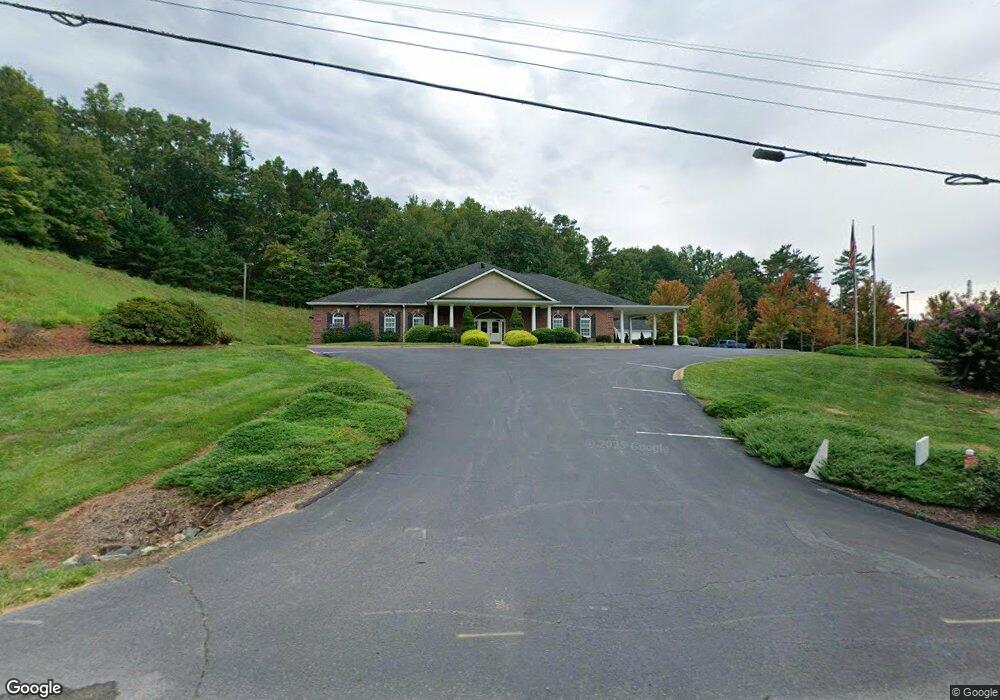
7626 Nc Highway 213 Mars Hill, NC 28754
Estimated Value: $2,275,789
--
Bed
--
Bath
1,421
Sq Ft
$1,602/Sq Ft
Est. Value
About This Home
This home is located at 7626 Nc Highway 213, Mars Hill, NC 28754 and is currently estimated at $2,275,789, approximately $1,601 per square foot. 7626 Nc Highway 213 is a home with nearby schools including Madison Middle School.
Ownership History
Date
Name
Owned For
Owner Type
Purchase Details
Closed on
Jul 25, 2014
Sold by
Blue Ridge Funeral Service Llc
Bought by
T & K Capps Family Llc
Current Estimated Value
Home Financials for this Owner
Home Financials are based on the most recent Mortgage that was taken out on this home.
Original Mortgage
$800,000
Outstanding Balance
$610,046
Interest Rate
4.19%
Mortgage Type
Commercial
Estimated Equity
$1,665,743
Create a Home Valuation Report for This Property
The Home Valuation Report is an in-depth analysis detailing your home's value as well as a comparison with similar homes in the area
Home Values in the Area
Average Home Value in this Area
Purchase History
| Date | Buyer | Sale Price | Title Company |
|---|---|---|---|
| T & K Capps Family Llc | $950,000 | None Available |
Source: Public Records
Mortgage History
| Date | Status | Borrower | Loan Amount |
|---|---|---|---|
| Open | T & K Capps Family Llc | $800,000 |
Source: Public Records
Tax History Compared to Growth
Tax History
| Year | Tax Paid | Tax Assessment Tax Assessment Total Assessment is a certain percentage of the fair market value that is determined by local assessors to be the total taxable value of land and additions on the property. | Land | Improvement |
|---|---|---|---|---|
| 2024 | $6,950 | $1,384,344 | $368,016 | $1,016,328 |
| 2023 | $5,402 | $915,514 | $254,266 | $661,248 |
| 2022 | $5,402 | $915,514 | $254,266 | $661,248 |
| 2021 | $5,402 | $915,514 | $254,266 | $661,248 |
| 2020 | $5,609 | $915,514 | $254,266 | $661,248 |
| 2019 | $4,804 | $718,250 | $121,611 | $596,639 |
| 2018 | $4,381 | $0 | $0 | $0 |
| 2017 | $4,381 | $0 | $0 | $0 |
| 2016 | $4,381 | $0 | $0 | $0 |
| 2015 | -- | $0 | $0 | $0 |
| 2014 | -- | $718,250 | $121,611 | $596,639 |
| 2013 | -- | $718,250 | $121,611 | $596,639 |
Source: Public Records
Map
Nearby Homes
- 60 Gins Ln Unit 9 & 10
- 60 Gins Ln Unit lot 11
- 9999 Gabriel's Creek Rd Unit 42
- 9999 Gabriel's Creek Rd Unit 41
- 9999 Gabriel's Creek Rd Unit 40
- 9999 Gabriel's Creek Rd
- ### Gabriel's Creek Rd
- 132 Bailey Mountain Rd
- 297 Bethany Dr
- 522 Bailey Mountain Rd
- 560 Bailey Mountain Rd
- 1603 Bull Creek Rd
- Lot 15 Mountain Gait Dr
- 1091 Kelly Hunter Rd
- 96 Chestnut Ln Unit 96
- 21 Ponder St
- 29 Ponder St
- 121 Ponder St
- 360 Turkey Branch Rd
- 1159 Bone Camp Rd
- 7041 Nc Highway 213
- 634 Stone Cottage Rd
- 7631 Nc Highway 213
- 7643 Nc Highway 213
- 0000 Snook's Path Unit Lot 3
- 0000 Snook's Path Unit 11 & 10
- 0000 Snook's Path Unit 12
- 0000 Snook's Path Unit 5
- 0000 Snook's Path Unit 12, 11 & 10
- 161 Snooks Path
- 525 Stone Cottage Rd
- 7730 Nc Highway 213
- 7536 Nc Highway 213
- 157 Snooks Path
- 164 Snooks Path
- 7394 Nc Highway 213
- 189 Leisure Ridge Dr
- 7396 Nc Highway 213
- 121 Snooks Path
- 200 Leisure Ridge Dr