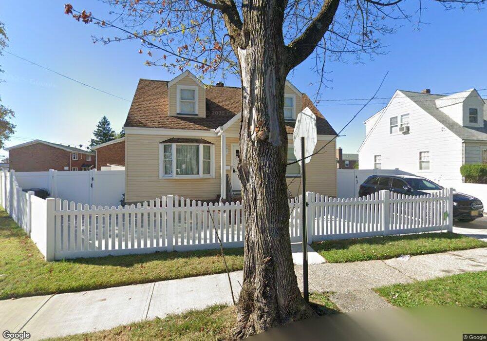
763 Donald Ave Perth Amboy, NJ 08861
Amboy Avenue NeighborhoodEstimated Value: $460,609 - $550,000
--
Bed
--
Bath
1,381
Sq Ft
$361/Sq Ft
Est. Value
About This Home
This home is located at 763 Donald Ave, Perth Amboy, NJ 08861 and is currently estimated at $498,402, approximately $360 per square foot. 763 Donald Ave is a home located in Middlesex County with nearby schools including Perth Amboy High School, Academy for Urban Leadership Charter School, and Assumption Catholic School.
Ownership History
Date
Name
Owned For
Owner Type
Purchase Details
Closed on
Dec 23, 2020
Sold by
Roth Richard Joshua
Bought by
Jimenez Edgar
Current Estimated Value
Home Financials for this Owner
Home Financials are based on the most recent Mortgage that was taken out on this home.
Original Mortgage
$286,900
Outstanding Balance
$254,884
Interest Rate
2.71%
Mortgage Type
New Conventional
Estimated Equity
$243,518
Purchase Details
Closed on
Oct 14, 2020
Sold by
Roth Lillian E and Roth Albert R
Bought by
Roth Richard Joshua
Create a Home Valuation Report for This Property
The Home Valuation Report is an in-depth analysis detailing your home's value as well as a comparison with similar homes in the area
Home Values in the Area
Average Home Value in this Area
Purchase History
| Date | Buyer | Sale Price | Title Company |
|---|---|---|---|
| Jimenez Edgar | $315,000 | Stewart Title | |
| Roth Richard Joshua | -- | Scott Title Services |
Source: Public Records
Mortgage History
| Date | Status | Borrower | Loan Amount |
|---|---|---|---|
| Open | Jimenez Edgar | $286,900 |
Source: Public Records
Tax History Compared to Growth
Tax History
| Year | Tax Paid | Tax Assessment Tax Assessment Total Assessment is a certain percentage of the fair market value that is determined by local assessors to be the total taxable value of land and additions on the property. | Land | Improvement |
|---|---|---|---|---|
| 2025 | $8,683 | $287,800 | $136,800 | $151,000 |
| 2024 | $8,666 | $287,800 | $136,800 | $151,000 |
| 2023 | $8,666 | $287,800 | $136,800 | $151,000 |
| 2022 | $8,562 | $287,800 | $136,800 | $151,000 |
| 2021 | $8,574 | $287,800 | $136,800 | $151,000 |
| 2020 | $4,726 | $167,100 | $136,800 | $30,300 |
| 2019 | $4,995 | $167,100 | $136,800 | $30,300 |
| 2018 | $7,104 | $248,200 | $136,800 | $111,400 |
| 2017 | $7,089 | $248,200 | $136,800 | $111,400 |
| 2016 | $7,148 | $248,200 | $136,800 | $111,400 |
| 2015 | $6,948 | $248,200 | $136,800 | $111,400 |
| 2014 | $6,992 | $248,200 | $136,800 | $111,400 |
Source: Public Records
Map
Nearby Homes
- 765 Donald Ave
- 767 Donald Ave
- 758 Convery Blvd
- 760 Convery Blvd
- 771 Donald Ave
- 752 Convery Blvd Unit 1A
- 773 Donald Ave
- 758 Donald Ave
- 546 Krockmally Ave
- 748 Convery Blvd
- 748 Convery Blvd Unit 4B
- 754 Donald Ave
- 756 Donald Ave
- 775 Donald Ave
- 542 Krockmally Ave
- 542 Krochmally Ave
- 770 Convery Blvd
- 745 Donald Ave
- 763 Mary St
- 549 Harding Ave