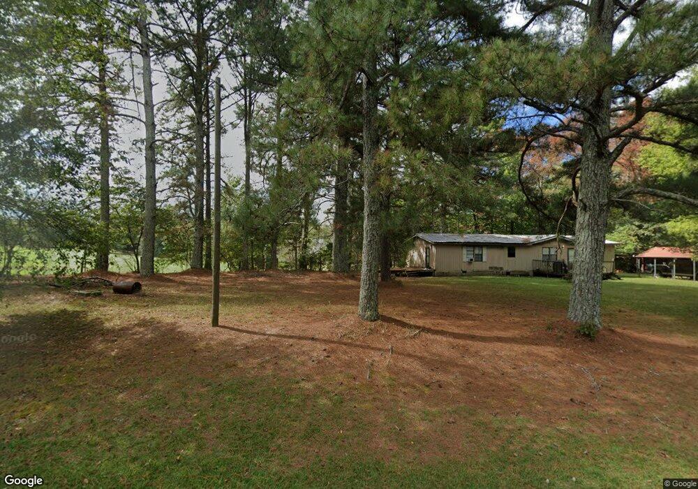
763 Lovvorn Farm Rd Carrollton, GA 30117
Estimated Value: $399,000 - $508,582
3
Beds
3
Baths
3,136
Sq Ft
$145/Sq Ft
Est. Value
About This Home
This home is located at 763 Lovvorn Farm Rd, Carrollton, GA 30117 and is currently estimated at $453,646, approximately $144 per square foot. 763 Lovvorn Farm Rd is a home located in Carroll County with nearby schools including Mt. Zion Elementary School, Mt. Zion Middle School, and Mt. Zion High School.
Ownership History
Date
Name
Owned For
Owner Type
Purchase Details
Closed on
Jul 14, 2004
Sold by
Mcewen Homer and Mcewen Linda
Bought by
Kenerly Charles S and Kenerly Suzann M
Current Estimated Value
Purchase Details
Closed on
Oct 23, 2003
Sold by
Entrekin W W The Estate Of
Bought by
Mcewen Homer and Mcewen Linda
Purchase Details
Closed on
May 14, 2003
Sold by
Mcewen Homer and Mcewen Linda
Bought by
Kenerly Kathryn S
Create a Home Valuation Report for This Property
The Home Valuation Report is an in-depth analysis detailing your home's value as well as a comparison with similar homes in the area
Home Values in the Area
Average Home Value in this Area
Purchase History
| Date | Buyer | Sale Price | Title Company |
|---|---|---|---|
| Kenerly Charles S | -- | -- | |
| Mcewen Homer | -- | -- | |
| Kenerly Kathryn S | -- | -- |
Source: Public Records
Tax History Compared to Growth
Tax History
| Year | Tax Paid | Tax Assessment Tax Assessment Total Assessment is a certain percentage of the fair market value that is determined by local assessors to be the total taxable value of land and additions on the property. | Land | Improvement |
|---|---|---|---|---|
| 2024 | $3,992 | $214,664 | $22,123 | $192,541 |
| 2023 | $3,992 | $205,791 | $23,409 | $182,382 |
| 2022 | $3,441 | $162,040 | $15,606 | $146,434 |
| 2021 | $3,083 | $137,505 | $12,485 | $125,020 |
| 2020 | $2,801 | $121,684 | $11,350 | $110,334 |
| 2019 | $2,649 | $112,174 | $11,350 | $100,824 |
| 2018 | $2,394 | $96,136 | $3,252 | $92,884 |
| 2017 | $2,401 | $96,136 | $3,252 | $92,884 |
| 2016 | $2,402 | $96,136 | $3,252 | $92,884 |
| 2015 | $2,490 | $93,044 | $9,696 | $83,348 |
| 2014 | $2,501 | $93,044 | $9,696 | $83,348 |
Source: Public Records
Map
Nearby Homes
- 1800 Mandeville Rd
- 406 Holly Springs Rd
- 14 Cole Lake Rd
- Plan 1709 at Saddle Ridge
- Plan 3119 at Saddle Ridge
- Plan 1902 at Saddle Ridge
- Plan 2131 at Saddle Ridge
- Plan 2307 at Saddle Ridge
- Plan 2604 at Saddle Ridge
- 177 Garnett Point Dr
- 4748 Us Highway 27
- 405 Adler Point
- 539 Saddle Chase Dr
- 1401 Alabama Ave
- 112 Summit Ln
- 0000 Hog Liver Rd
- 48 Covered Bridge Rd
- 112 Turkey Creek Trail
- 00 Hog Liver Rd Unit 346
- 0 Hog Liver Rd Unit 148331
- 755 Lovvorn Farm Rd
- 36 Taylor Cir
- 40 Taylor Cir
- 760 Lovvorn Farm Rd
- 0 Lovvorn Rd
- 00 Lovvorn Rd
- 000 Lovvorn Rd
- 0 Lovvorn Rd Unit 147606
- 0 Lovvorn Rd Unit 10352320
- 0 Lovvorn Rd Unit 7341362
- 0 Lovvorn Rd Unit 7013097
- 0 Lovvorn Rd Unit 8822640
- 0 Lovvorn Rd Unit 8739513
- 0 Lovvorn Rd Unit 8680488
- 0 Lovvorn Rd Unit 8552041
- 0 Lovvorn Rd Unit 8478911
- 0 Lovvorn Rd Unit 8435171
- 0 Lovvorn Rd Unit 8263572
- 0 Lovvorn Rd Unit 8073389
- 0 Lovvorn Rd Unit 8486263