Estimated Value: $903,000 - $1,168,000
Studio
--
Bath
2,580
Sq Ft
$390/Sq Ft
Est. Value
About This Home
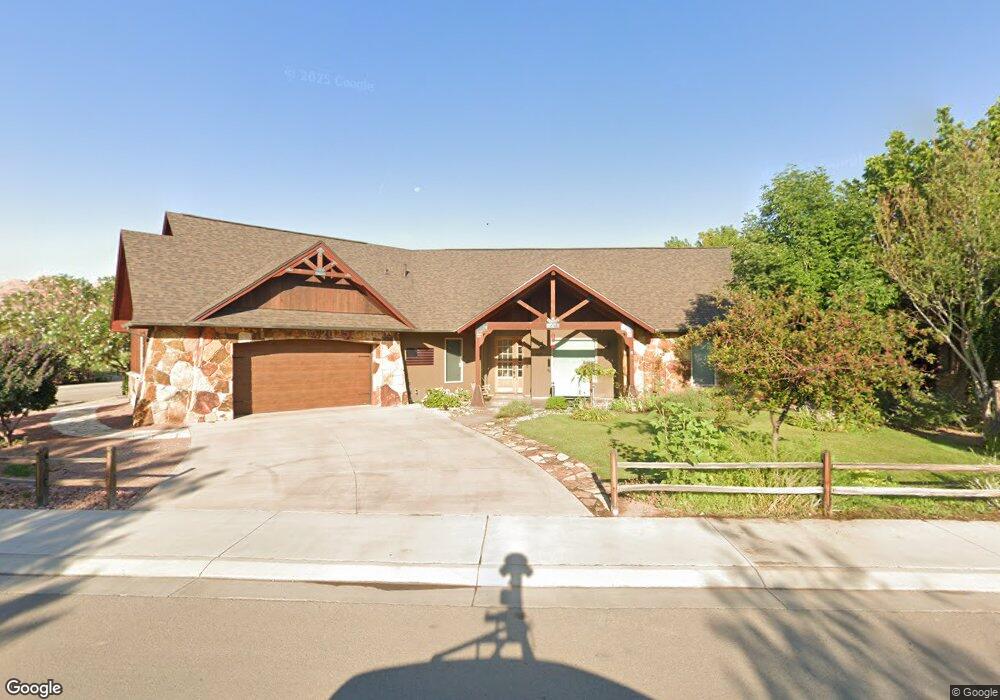
This home is located at 763 Palisade Dr, Moab, UT 84532 and is currently estimated at $1,006,379, approximately $390 per square foot. 763 Palisade Dr is a home with nearby schools including Helen M. Knight School, Grand County Middle School, and Grand County High School.
Ownership History
Date
Name
Owned For
Owner Type
Purchase Details
Closed on
Jun 21, 2013
Sold by
Byrd Dennis E and Byrd Patricia B
Bought by
Preserve Of Moab Utah Llc A Utah Limited
Current Estimated Value
Purchase Details
Closed on
Nov 16, 2012
Sold by
Preserve Of Moab Utah Llc
Bought by
Ben Byrd Construction Llc
Purchase Details
Closed on
Oct 23, 2012
Sold by
Byrd Dennis E and Byrd Patricia B
Bought by
Preserve Of Moab Utah Llc
Create a Home Valuation Report for This Property
The Home Valuation Report is an in-depth analysis detailing your home's value as well as a comparison with similar homes in the area
Home Values in the Area
Average Home Value in this Area
Purchase History
| Date | Buyer | Sale Price | Title Company |
|---|---|---|---|
| Preserve Of Moab Utah Llc A Utah Limited | -- | Na | |
| Ben Byrd Construction Llc | -- | -- | |
| Preserve Of Moab Utah Llc | -- | -- | |
| Byrd Becky | -- | -- |
Source: Public Records
Tax History
| Year | Tax Paid | Tax Assessment Tax Assessment Total Assessment is a certain percentage of the fair market value that is determined by local assessors to be the total taxable value of land and additions on the property. | Land | Improvement |
|---|---|---|---|---|
| 2025 | $5,563 | $959,683 | $150,000 | $809,683 |
| 2024 | $5,563 | $959,683 | $150,000 | $809,683 |
| 2023 | $5,742 | $959,683 | $150,000 | $809,683 |
| 2022 | $4,831 | $730,083 | $75,000 | $655,083 |
| 2021 | $2,494 | $417,817 | $75,000 | $342,817 |
| 2020 | $2,587 | $417,817 | $75,000 | $342,817 |
| 2019 | $2,442 | $417,817 | $75,000 | $342,817 |
| 2018 | $2,420 | $417,817 | $75,000 | $342,817 |
| 2017 | $2,507 | $0 | $0 | $0 |
| 2016 | $2,481 | $0 | $0 | $0 |
| 2015 | $2,188 | $0 | $0 | $0 |
| 2014 | $1,710 | $0 | $0 | $0 |
| 2013 | $466 | $45,000 | $0 | $0 |
Source: Public Records
Map
Nearby Homes
- 827 Palisade Dr
- 527 Palisade Dr
- 491 Marcus Ct
- 592 W Hale Ave
- 400 N 500 W Unit 280
- 615 W 470 N
- 429 N 600 W
- 278 Hobbs St
- 420 N 600 W
- 656 W 400 N
- 911 N Main St
- 284 W Mcgill Ave
- 1004 N Highway 191 Unit A
- 276 N Opal Ave
- 247 W 400 N Unit 1
- 279 Park Rd
- 709 Bartlett Cir
- 452 N Main St
- 1371 N Highway 191
- 24 W 200 N
- 775 Palisade Dr Unit 30-B
- 634 Byrd
- 667 Byrd Ave
- 663 Byrd Ave
- 663 Byrd Ave Unit 32B
- 797 Palisade Dr Unit 29
- 780 Palisade Dr Unit 43
- 780 Palisade Dr
- 780 Palisade Dr Unit 43
- 624 Byrd Ave Unit 45
- 624 Byrd Ave
- 627 Byrd Ave
- 794 Palisade Dr Unit 42AB
- 794 Palisade Dr
- 794 Palisade Dr Unit 42
- 811 Palisade Dr
- 798 Palisade Dr
- 798 Palisade Dr Unit 42-A
- 606 Byrd Ave
- 812 Palisade Dr Unit 41