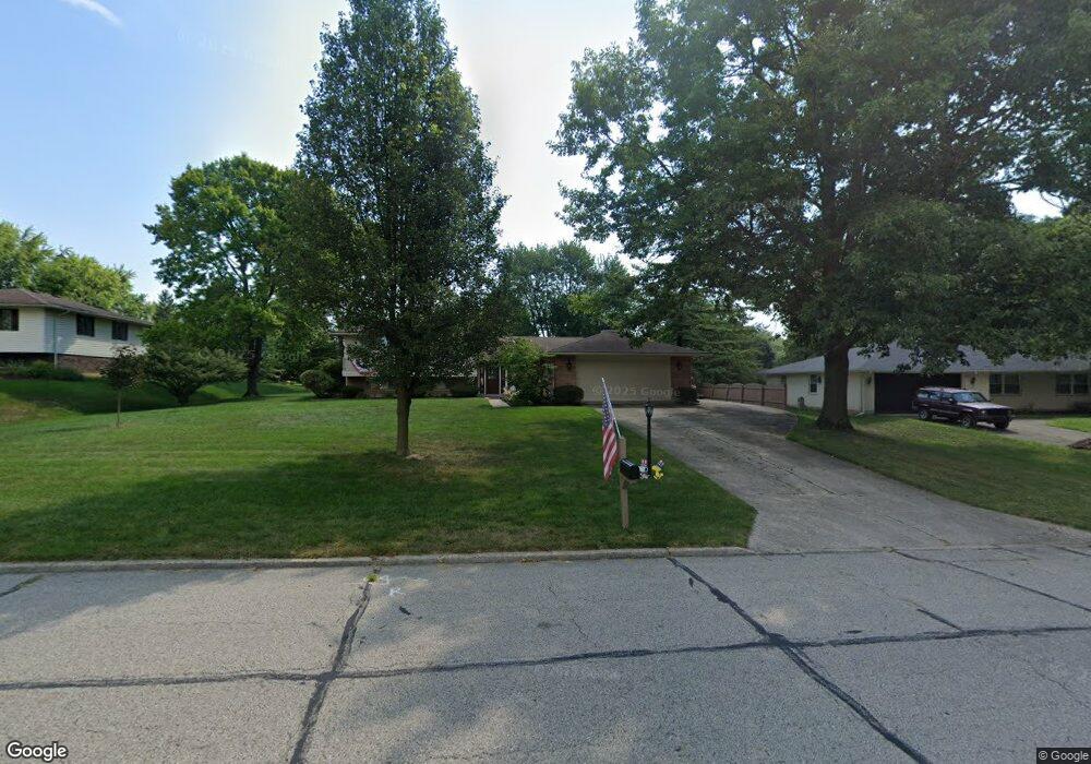
7630 Bigger Rd Dayton, OH 45459
Estimated Value: $366,000 - $401,000
3
Beds
3
Baths
2,859
Sq Ft
$134/Sq Ft
Est. Value
About This Home
This home is located at 7630 Bigger Rd, Dayton, OH 45459 and is currently estimated at $384,117, approximately $134 per square foot. 7630 Bigger Rd is a home located in Montgomery County with nearby schools including Primary Village North, Stingley Elementary School, and Tower Heights Middle School.
Ownership History
Date
Name
Owned For
Owner Type
Purchase Details
Closed on
Nov 19, 2021
Sold by
Davis Steve S and Davis Leta R
Bought by
Super Jeffrey and Brunner Shannon Marie
Current Estimated Value
Home Financials for this Owner
Home Financials are based on the most recent Mortgage that was taken out on this home.
Original Mortgage
$248,800
Outstanding Balance
$227,951
Interest Rate
2.98%
Mortgage Type
New Conventional
Estimated Equity
$156,166
Create a Home Valuation Report for This Property
The Home Valuation Report is an in-depth analysis detailing your home's value as well as a comparison with similar homes in the area
Home Values in the Area
Average Home Value in this Area
Purchase History
| Date | Buyer | Sale Price | Title Company |
|---|---|---|---|
| Super Jeffrey | $311,000 | Landmark Ttl Agcy South Inc |
Source: Public Records
Mortgage History
| Date | Status | Borrower | Loan Amount |
|---|---|---|---|
| Open | Super Jeffrey | $248,800 |
Source: Public Records
Tax History Compared to Growth
Tax History
| Year | Tax Paid | Tax Assessment Tax Assessment Total Assessment is a certain percentage of the fair market value that is determined by local assessors to be the total taxable value of land and additions on the property. | Land | Improvement |
|---|---|---|---|---|
| 2024 | $6,479 | $111,640 | $21,740 | $89,900 |
| 2023 | $6,479 | $111,640 | $21,740 | $89,900 |
| 2022 | $5,917 | $80,850 | $15,750 | $65,100 |
| 2021 | $5,933 | $80,850 | $15,750 | $65,100 |
| 2020 | $5,925 | $80,850 | $15,750 | $65,100 |
| 2019 | $5,830 | $71,000 | $15,750 | $55,250 |
| 2018 | $5,167 | $71,000 | $15,750 | $55,250 |
| 2017 | $5,107 | $71,000 | $15,750 | $55,250 |
| 2016 | $4,931 | $64,690 | $15,750 | $48,940 |
| 2015 | $4,880 | $64,690 | $15,750 | $48,940 |
| 2014 | $4,880 | $64,690 | $15,750 | $48,940 |
| 2012 | -- | $61,650 | $17,500 | $44,150 |
Source: Public Records
Map
Nearby Homes
- 1563 Langdon Dr
- 1620 Ambridge Rd
- 7308 Tamarind Trail
- 7395 Cades Cove Unit 174174
- 7640 Cloverbrook Park Dr
- 2349 Donamere Cir Unit 5C
- 7201 Brookmeadow Dr Unit 11A
- 1235 Chevington Ct Unit 1515
- 7124 Fallen Oak Trace Unit 420
- 7215 Whitetail Trail Unit 108108
- 7129 Fallen Oak Trace Unit 839
- 1501 Lake Pointe Way Unit 8
- 1511 Lake Pointe Way
- 1511 Lake Pointe Way Unit 2
- 7128 Hartcrest Ln Unit 130130
- 7128 Hartcrest Ln Unit 130
- 1310 Hollow Run Unit 3
- 6765 Montpellier Blvd
- 7111 Fallen Oak Trace Unit 1050
- 2540 Early Spring Ct
- 7620 Bigger Rd
- 7640 Bigger Rd
- 7635 Rolling Oak Dr
- 7610 Bigger Rd
- 7650 Bigger Rd
- 7625 Rolling Oak Dr
- 7645 Rolling Oak Dr
- 7665 Bigger Rd
- 7615 Rolling Oak Dr
- 7675 Bigger Rd
- 7655 Rolling Oak Dr
- 7670 Bigger Rd
- 7655 Bigger Rd
- 7645 Bigger Rd
- 1550 Mapleton Dr
- 1500 Mapleton Dr
- 7665 Rolling Oak Dr
- 7605 Rolling Oak Dr
- 7680 Bigger Rd
- 1485 Ambridge Rd