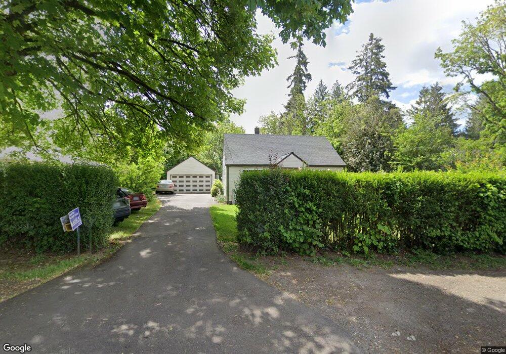
7630 SW Cedarcrest St Portland, OR 97223
Estimated Value: $441,000 - $484,000
3
Beds
1
Bath
1,116
Sq Ft
$420/Sq Ft
Est. Value
About This Home
This home is located at 7630 SW Cedarcrest St, Portland, OR 97223 and is currently estimated at $468,830, approximately $420 per square foot. 7630 SW Cedarcrest St is a home located in Washington County with nearby schools including Metzger Elementary School, Thomas R. Fowler Middle School, and Tigard High School.
Ownership History
Date
Name
Owned For
Owner Type
Purchase Details
Closed on
Jul 25, 2005
Sold by
Davis George W
Bought by
Digregorio Leah D and Faris Brooks J
Current Estimated Value
Home Financials for this Owner
Home Financials are based on the most recent Mortgage that was taken out on this home.
Original Mortgage
$173,200
Outstanding Balance
$88,141
Interest Rate
5.37%
Mortgage Type
Fannie Mae Freddie Mac
Estimated Equity
$380,689
Create a Home Valuation Report for This Property
The Home Valuation Report is an in-depth analysis detailing your home's value as well as a comparison with similar homes in the area
Home Values in the Area
Average Home Value in this Area
Purchase History
| Date | Buyer | Sale Price | Title Company |
|---|---|---|---|
| Digregorio Leah D | $216,500 | Transnation Title Agency Or |
Source: Public Records
Mortgage History
| Date | Status | Borrower | Loan Amount |
|---|---|---|---|
| Open | Digregorio Leah D | $173,200 |
Source: Public Records
Tax History Compared to Growth
Tax History
| Year | Tax Paid | Tax Assessment Tax Assessment Total Assessment is a certain percentage of the fair market value that is determined by local assessors to be the total taxable value of land and additions on the property. | Land | Improvement |
|---|---|---|---|---|
| 2026 | $2,898 | $185,610 | -- | -- |
| 2025 | $2,898 | $180,210 | -- | -- |
| 2024 | $2,800 | $174,970 | -- | -- |
| 2023 | $2,800 | $169,880 | $0 | $0 |
| 2022 | $2,684 | $169,880 | $0 | $0 |
| 2021 | $2,622 | $160,140 | $0 | $0 |
| 2020 | $2,544 | $155,480 | $0 | $0 |
| 2019 | $2,491 | $150,960 | $0 | $0 |
| 2018 | $2,378 | $146,570 | $0 | $0 |
| 2017 | $2,291 | $142,310 | $0 | $0 |
| 2016 | $2,180 | $138,170 | $0 | $0 |
| 2015 | $2,098 | $134,150 | $0 | $0 |
| 2014 | $2,033 | $130,250 | $0 | $0 |
Source: Public Records
Map
Nearby Homes
- 7480 SW Taylors Ferry Rd
- 7849 SW Birch St
- 7830 SW Hemlock St
- 8925 SW 80th Ave
- 7080 SW Taylors Ferry Rd
- 9335 SW 69th Ave
- 10022 SW 72nd Ave
- 10125 SW 72nd Ave
- 7402 SW Locust St
- 9825 SW Ventura Ct
- 6985 SW Florence Ln
- 7375 SW Ashdale Dr
- 10200 SW 70th Ave
- 6551 SW Taylors Ferry Rd
- 6512 SW Taylors Ferry Rd
- 10010 SW Hall Blvd Unit 5
- 7705 SW Alden St
- 10534 SW 80th Ave
- 6405 SW Radcliffe St
- 7333 SW Pine St
- 7640 SW Cedarcrest St
- 7620 SW Cedarcrest St
- 7606 SW Cedarcrest St
- 7650 SW Cedarcrest St
- 7625 SW Cedarcrest St
- 7619 SW Chestnut St
- 7621 SW Chestnut St
- 7617 SW Cedarcrest St
- 7645 SW Cedarcrest St
- 7655 SW Chestnut St
- 7670 SW Cedarcrest St
- 9400 SW 77th Ave
- 7615 SW Chestnut St
- 7655 SW Cedarcrest St
- 9430 SW 77th Ave
- 7548 SW Cedarcrest St
- 9279 SW 75th Ave
- 7514 SW Cedarcrest St
- 7566 SW Cedarcrest St
- 9288 SW 77th Ave