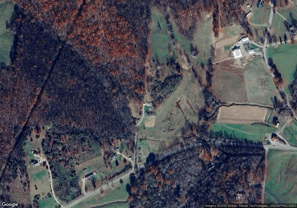
7631 State Route 279 Oak Hill, OH 45656
Estimated Value: $72,763 - $315,000
2
Beds
1
Bath
1,120
Sq Ft
$142/Sq Ft
Est. Value
About This Home
This home is located at 7631 State Route 279, Oak Hill, OH 45656 and is currently estimated at $158,941, approximately $141 per square foot. 7631 State Route 279 is a home located in Jackson County with nearby schools including Oak Hill Elementary School and Oak Hill Middle/High School.
Ownership History
Date
Name
Owned For
Owner Type
Purchase Details
Closed on
Jul 29, 2025
Sold by
Orourke Paul
Bought by
Orourke Lisbeth A and Hook Jack
Current Estimated Value
Purchase Details
Closed on
Oct 15, 2021
Sold by
Yoder Raymond and Yoder Barbara
Bought by
Orourke Lisbeth A and Orourke Paul
Home Financials for this Owner
Home Financials are based on the most recent Mortgage that was taken out on this home.
Original Mortgage
$70,000
Interest Rate
2.1%
Mortgage Type
Purchase Money Mortgage
Purchase Details
Closed on
Nov 18, 2019
Sold by
Saylor Properties Llc
Bought by
Yoder Raymond
Purchase Details
Closed on
May 30, 2018
Sold by
Saylor Anthony and Saylor Cheryl
Bought by
Saylor Properties Llc
Purchase Details
Closed on
Feb 19, 2015
Sold by
Adkins Jerry and Adkins Carma
Bought by
Saylor Anthony A and Saylor Cheryl F
Create a Home Valuation Report for This Property
The Home Valuation Report is an in-depth analysis detailing your home's value as well as a comparison with similar homes in the area
Home Values in the Area
Average Home Value in this Area
Purchase History
| Date | Buyer | Sale Price | Title Company |
|---|---|---|---|
| Orourke Lisbeth A | -- | None Listed On Document | |
| Orourke Lisbeth A | -- | None Listed On Document | |
| Orourke Lisbeth A | $110,000 | Hocking Valley Title Agency | |
| Yoder Raymond | $60,000 | None Available | |
| Saylor Properties Llc | -- | None Available | |
| Saylor Anthony A | $8,000 | None Available |
Source: Public Records
Mortgage History
| Date | Status | Borrower | Loan Amount |
|---|---|---|---|
| Previous Owner | Orourke Lisbeth A | $70,000 |
Source: Public Records
Tax History Compared to Growth
Tax History
| Year | Tax Paid | Tax Assessment Tax Assessment Total Assessment is a certain percentage of the fair market value that is determined by local assessors to be the total taxable value of land and additions on the property. | Land | Improvement |
|---|---|---|---|---|
| 2024 | $208 | $6,390 | $5,600 | $790 |
| 2023 | $208 | $6,390 | $5,600 | $790 |
| 2022 | $338 | $8,330 | $4,520 | $3,810 |
| 2021 | $291 | $8,330 | $4,520 | $3,810 |
| 2020 | $293 | $8,330 | $4,520 | $3,810 |
| 2019 | $289 | $7,940 | $4,310 | $3,630 |
| 2018 | $280 | $7,940 | $4,310 | $3,630 |
| 2017 | $268 | $7,940 | $4,310 | $3,630 |
| 2016 | $279 | $8,220 | $5,080 | $3,140 |
| 2015 | $282 | $8,220 | $5,080 | $3,140 |
| 2013 | $277 | $8,070 | $5,080 | $2,990 |
| 2012 | $282 | $8,070 | $5,080 | $2,990 |
Source: Public Records
Map
Nearby Homes
- 10355 Ohio 279
- 509 Homer Lewis Rd
- 2080 Cozy Glenn Rd
- 321 W Main St
- 275 Horton Sisters Rd
- 349 S Park Ave
- 1150 Courtney McCoy
- 2006 Ohio 279
- 703 E Main St
- 251 Wastier Cherrington Rd
- 1337 Ohio 140
- 413 Gallipolis Rd
- 413 Gallipolis Rd Unit (Clearview Pond)
- 1 Riegel Ridge Rd
- Tbd Roscoe Rd
- 0 Roscoe Rd
- 0 Roscoe Rd
- 3325 Camba Rd
- 13916 State Route 279
- 49 Twp Rd 2974
- 7633 State Route 279
- 7802 State Route 279
- 235 Dan T Davis Rd
- 55 Wood Hill Rd
- 7469 State Route 279
- 57 Wood Hill Rd
- 150 Comer Cemetery Rd
- 75 Wood Hill Rd
- 75 Woodhill Rd
- 75 Woodhill Dr
- 103 Wood Hill Rd
- 103 Woodhill Rd
- 133 Wood Hill Rd
- 94 Wood Hill Rd
- 21 Wood Hill Rd
- 236 Dan T Davis Rd
- 502 Dan T Davis Rd
- 152 Wood Hill Rd
- 22 Wood Hill Rd
- 340 Comer Cemetery Rd
