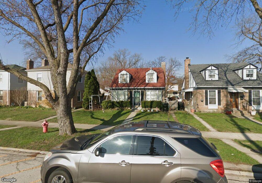
764 Gardner Rd Westchester, IL 60154
Estimated Value: $286,000 - $311,000
3
Beds
1
Bath
1,245
Sq Ft
$236/Sq Ft
Est. Value
About This Home
This home is located at 764 Gardner Rd, Westchester, IL 60154 and is currently estimated at $293,746, approximately $235 per square foot. 764 Gardner Rd is a home located in Cook County with nearby schools including Westchester Primary School, Westchester Intermediate School, and Westchester Middle School.
Ownership History
Date
Name
Owned For
Owner Type
Purchase Details
Closed on
Jun 30, 2008
Sold by
Jasso Francisco and Jasso Maria
Bought by
Jasso Francisco
Current Estimated Value
Purchase Details
Closed on
Aug 5, 1996
Sold by
Flanigan Carey John H and Flanigan Carey Brigid T
Bought by
Jasso Francisco and Jasso Maria
Home Financials for this Owner
Home Financials are based on the most recent Mortgage that was taken out on this home.
Original Mortgage
$111,145
Outstanding Balance
$8,856
Interest Rate
8.3%
Mortgage Type
FHA
Estimated Equity
$284,890
Create a Home Valuation Report for This Property
The Home Valuation Report is an in-depth analysis detailing your home's value as well as a comparison with similar homes in the area
Home Values in the Area
Average Home Value in this Area
Purchase History
| Date | Buyer | Sale Price | Title Company |
|---|---|---|---|
| Jasso Francisco | -- | None Available | |
| Jasso Francisco | $112,000 | -- |
Source: Public Records
Mortgage History
| Date | Status | Borrower | Loan Amount |
|---|---|---|---|
| Open | Jasso Francisco | $111,145 |
Source: Public Records
Tax History Compared to Growth
Tax History
| Year | Tax Paid | Tax Assessment Tax Assessment Total Assessment is a certain percentage of the fair market value that is determined by local assessors to be the total taxable value of land and additions on the property. | Land | Improvement |
|---|---|---|---|---|
| 2024 | $3,945 | $21,000 | $3,075 | $17,925 |
| 2023 | $2,852 | $21,000 | $3,075 | $17,925 |
| 2022 | $2,852 | $17,012 | $2,706 | $14,306 |
| 2021 | $2,688 | $17,012 | $2,706 | $14,306 |
| 2020 | $2,446 | $17,012 | $2,706 | $14,306 |
| 2019 | $2,454 | $15,545 | $2,460 | $13,085 |
| 2018 | $3,376 | $15,545 | $2,460 | $13,085 |
| 2017 | $3,989 | $17,963 | $2,460 | $15,503 |
| 2016 | $2,550 | $11,240 | $2,214 | $9,026 |
| 2015 | $2,974 | $12,953 | $2,214 | $10,739 |
| 2014 | $3,514 | $15,063 | $2,214 | $12,849 |
| 2013 | $3,553 | $16,764 | $2,214 | $14,550 |
Source: Public Records
Map
Nearby Homes
- 750 Bristol Ave
- 923 Manchester Ave
- 805 Norfolk Ave
- 814 Norfolk Ave
- 626 Manchester Ave
- 920 Suffolk Ave
- 1108 31st Ave
- 1102 31st Ave
- 2003 S 24th Ave
- 1119 Newcastle Ave
- 1034 31st Ave
- 1910 S 22nd Ave
- 1016 Hull Ave
- 1022 Eastern Ave
- 10072 Drury Ln
- 1909 S 22nd Ave
- 1023 Rice Ave
- 1035 Bohland Ave
- 723 Balmoral Ave
- 3401 Jackson St