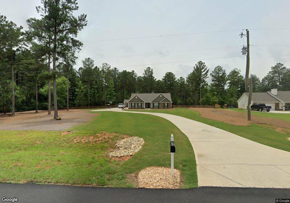
764 Michael Rd Monroe, GA 30656
Estimated Value: $370,000 - $460,000
Studio
--
Bath
2,392
Sq Ft
$173/Sq Ft
Est. Value
About This Home
This home is located at 764 Michael Rd, Monroe, GA 30656 and is currently estimated at $413,679, approximately $172 per square foot. 764 Michael Rd is a home with nearby schools including Monroe Elementary School, Carver Middle School, and Monroe Area High School.
Ownership History
Date
Name
Owned For
Owner Type
Purchase Details
Closed on
Aug 13, 2021
Sold by
Ivey Dylan
Bought by
Ivey Dylan and Ivey Marlana
Current Estimated Value
Home Financials for this Owner
Home Financials are based on the most recent Mortgage that was taken out on this home.
Original Mortgage
$245,471
Outstanding Balance
$221,404
Interest Rate
2.8%
Mortgage Type
FHA
Estimated Equity
$192,275
Purchase Details
Closed on
Sep 17, 2020
Sold by
Smith Leonard Samuel
Bought by
Br Homes Llc
Purchase Details
Closed on
May 22, 2020
Sold by
Southern Storage Inc
Bought by
Smith Leonard Samuel
Purchase Details
Closed on
Mar 30, 2017
Sold by
Stanley Linda C
Bought by
Southern Storage Inc
Create a Home Valuation Report for This Property
The Home Valuation Report is an in-depth analysis detailing your home's value as well as a comparison with similar homes in the area
Home Values in the Area
Average Home Value in this Area
Purchase History
| Date | Buyer | Sale Price | Title Company |
|---|---|---|---|
| Ivey Dylan | -- | -- | |
| Ivey Dylan | $250,000 | -- | |
| Br Homes Llc | $498,480 | -- | |
| Smith Leonard Samuel | -- | -- | |
| Southern Storage Inc | $270,841 | -- |
Source: Public Records
Mortgage History
| Date | Status | Borrower | Loan Amount |
|---|---|---|---|
| Open | Ivey Dylan | $245,471 |
Source: Public Records
Tax History
| Year | Tax Paid | Tax Assessment Tax Assessment Total Assessment is a certain percentage of the fair market value that is determined by local assessors to be the total taxable value of land and additions on the property. | Land | Improvement |
|---|---|---|---|---|
| 2025 | $3,810 | $139,440 | $31,160 | $108,280 |
| 2024 | $3,643 | $135,280 | $31,160 | $104,120 |
| 2023 | $3,582 | $125,200 | $26,080 | $99,120 |
| 2022 | $3,079 | $114,320 | $23,240 | $91,080 |
| 2021 | $581 | $17,840 | $17,840 | $0 |
| 2020 | $2,443 | $73,120 | $73,120 | $0 |
| 2019 | $2,250 | $64,960 | $64,960 | $0 |
| 2018 | $2,172 | $64,960 | $64,960 | $0 |
| 2017 | $2,016 | $58,520 | $58,520 | $0 |
| 2016 | $363 | $48,400 | $48,400 | $0 |
| 2015 | $359 | $48,400 | $48,400 | $0 |
| 2014 | -- | $43,960 | $0 | $0 |
Source: Public Records
Map
Nearby Homes
- 1537 Lakeland Dr
- 1186 Emmas Path
- 1159 Locklin Rd
- 1393 Michael Rd NW
- 3846 Mt Enon Church Rd
- 2891 Ike Stone Rd
- 970 John W Breedlove Rd
- 950 John W Breedlove Rd NW
- 440 Mount Vernon Rd NW
- 2955 Hearn Rd NW
- 1299 McLeod Estates Dr
- 1650 Locklin Cemetery Rd
- 1650 & 1620 Locklin Cemetery Rd
- 1790 Michael Rd NW
- 1849 Bradley Gin Rd
- 403 Springtime Way
- 275 Springtime Way
- 305 Springtime Way
- 1811 Michael Rd
- 327 Springtime Way
- 819 Michael Rd NW
- 782 Michael Rd
- 829 Michael Rd
- 0 Michael Rd NW Unit 7580803
- 0 Michael Rd NW Unit 7580113
- 0 Michael Rd NW Unit 10 8053284
- 0 Michael Rd NW Unit 9 8053278
- 0 Michael Rd NW
- 0 Michael Rd NW Unit 20094538
- 0 Michael Rd NW Unit 979072
- 0 Michael Rd NW Unit 5640645
- 0 Michael Rd NW Unit 6824685
- 0 Michael Rd NW Unit 8908785
- 0 Michael Rd NW Unit 8834008
- 0 Michael Rd NW Unit 1 8765251
- 0 Michael Rd NW Unit 6678901
- 0 Michael Rd NW Unit 1 8734117
- 0 Michael Rd NW Unit 3 8711638
- 0 Michael Rd NW Unit 1 8711636
- 0 Michael Rd NW Unit 2 8711637
Your Personal Tour Guide
Ask me questions while you tour the home.