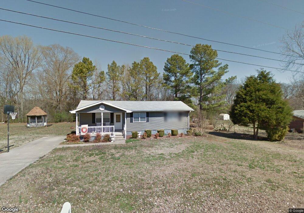
764 Ruby Johnson Dr Scottsboro, AL 35769
Estimated Value: $163,578 - $282,000
Studio
--
Bath
1,224
Sq Ft
$165/Sq Ft
Est. Value
About This Home
This home is located at 764 Ruby Johnson Dr, Scottsboro, AL 35769 and is currently estimated at $202,145, approximately $165 per square foot. 764 Ruby Johnson Dr is a home located in Jackson County with nearby schools including Hollywood Elementary School and North Jackson High School.
Ownership History
Date
Name
Owned For
Owner Type
Purchase Details
Closed on
Mar 30, 2007
Sold by
Habitat For Humanity Of Jackson County I
Bought by
Matthews Teri Lynn
Current Estimated Value
Home Financials for this Owner
Home Financials are based on the most recent Mortgage that was taken out on this home.
Original Mortgage
$30,000
Outstanding Balance
$17,868
Interest Rate
6.15%
Estimated Equity
$184,277
Purchase Details
Closed on
Apr 7, 2006
Sold by
Moody E D
Bought by
Habitat For Humanity Of Jackson County I
Create a Home Valuation Report for This Property
The Home Valuation Report is an in-depth analysis detailing your home's value as well as a comparison with similar homes in the area
Purchase History
| Date | Buyer | Sale Price | Title Company |
|---|---|---|---|
| Matthews Teri Lynn | -- | -- | |
| Habitat For Humanity Of Jackson County I | -- | -- |
Source: Public Records
Mortgage History
| Date | Status | Borrower | Loan Amount |
|---|---|---|---|
| Open | Matthews Teri Lynn | $30,000 | |
| Open | Matthews Teri Lynn | $52,000 |
Source: Public Records
Tax History
| Year | Tax Paid | Tax Assessment Tax Assessment Total Assessment is a certain percentage of the fair market value that is determined by local assessors to be the total taxable value of land and additions on the property. | Land | Improvement |
|---|---|---|---|---|
| 2025 | $303 | $10,060 | $0 | $0 |
| 2024 | $303 | $9,420 | $0 | $0 |
| 2023 | $281 | $9,420 | $0 | $0 |
| 2022 | $251 | $8,580 | $0 | $0 |
| 2021 | $251 | $8,580 | $0 | $0 |
| 2020 | $207 | $7,320 | $0 | $0 |
| 2019 | $207 | $7,320 | $0 | $0 |
| 2018 | $220 | $7,680 | $0 | $0 |
| 2017 | $220 | $76,800 | $0 | $0 |
| 2016 | $204 | $72,400 | $0 | $0 |
| 2015 | $204 | $72,400 | $0 | $0 |
| 2014 | $211 | $74,400 | $0 | $0 |
| 2013 | -- | $74,400 | $0 | $0 |
Source: Public Records
Map
Nearby Homes
- 3.30 ACRES Highway 72
- 0 Highway 72 Unit RTC3093512
- 905 County Road 33
- 5989 County Road 33
- 206 Linwood St
- 5976 with 1 ac County Road 33
- 5976 with 4 ac County Road 33
- 417 McFoilton Ln
- 1646 Gant Rd
- 346 Scenic Dr
- 610 E Willow St
- 14.5 ac County Road 42
- 10 Scenic Dr
- 1289 Ridgedale Rd
- 1812 E Willow St
- 3802 Edmonds Dr
- Lots 122 & 123 River Dr
- 00 Hwy 72
- 714 Forrest Ave
- 175 Drew Dr
- 794 Ruby Johnson Dr Unit 1
- 794 Ruby Johnson Dr
- 740 Ruby Johnson Dr
- 800 Ruby Johnson Dr
- 777 Ruby Johnson Dr
- 799 Ruby Johnson Dr
- 818 Ruby Johnson Dr
- 837 Ruby Johnson Dr
- 141 Bobby Rogers St
- 707 Ruby Johnson Dr
- 109 Bobby Rogers St
- 151 Bobby Rodgers Rd
- 151 Bobby Rogers St
- 91 Bobby Rogers St
- 853 Ruby Johnson Dr
- 692 Ruby Johnson Dr
- 693 Ruby Johnson Dr
- 854 Ruby Johnson Dr
- 83 Bobby Rogers St
- 85 Bobby Rodgers Rd
Your Personal Tour Guide
Ask me questions while you tour the home.