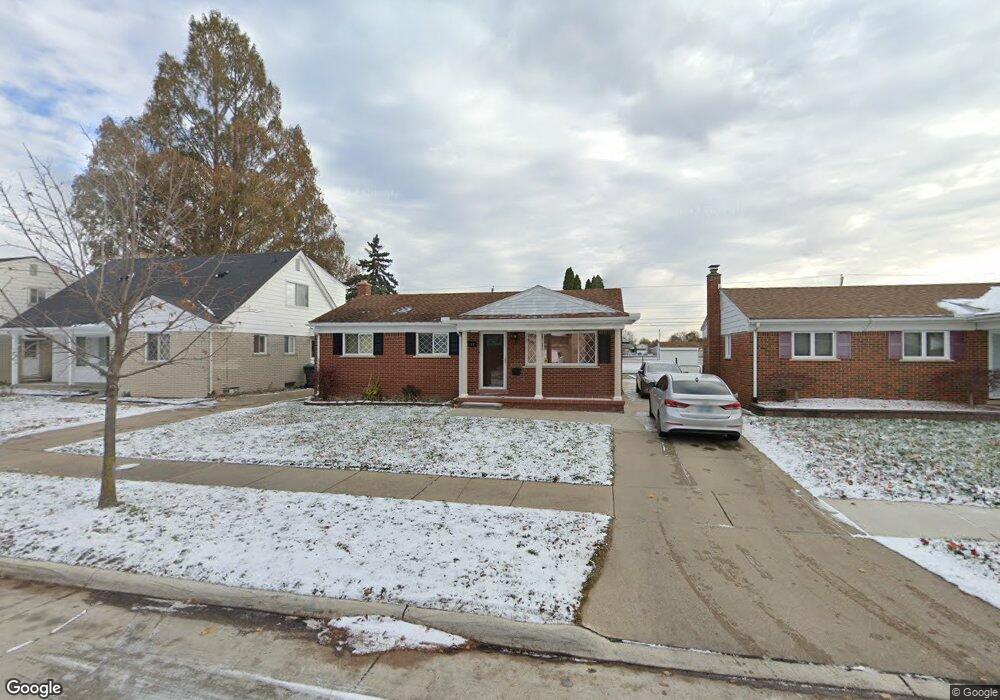
7640 Anthony St Dearborn, MI 48126
Oakman Grove NeighborhoodEstimated Value: $279,329 - $307,000
3
Beds
2
Baths
1,500
Sq Ft
$199/Sq Ft
Est. Value
About This Home
This home is located at 7640 Anthony St, Dearborn, MI 48126 and is currently estimated at $299,082, approximately $199 per square foot. 7640 Anthony St is a home located in Wayne County with nearby schools including McCollough-Unis School, Fordson High School, and International Islamic Academy.
Ownership History
Date
Name
Owned For
Owner Type
Purchase Details
Closed on
Sep 23, 2016
Sold by
Berro Mohamad Ali Salah and Berro Kassam Salah
Bought by
Berro Kassam
Current Estimated Value
Purchase Details
Closed on
Aug 16, 2016
Sold by
Berro Mohamad Ali Salah
Bought by
Berro Mohamad Ali Salah
Purchase Details
Closed on
Jul 8, 2013
Sold by
Berro Mohamed Sadic Abdelcream and Berro Zeinab
Bought by
Berro Mohamad Ali
Purchase Details
Closed on
Aug 31, 1983
Sold by
Esse Abdelcream
Bought by
Berro Abdelcream
Create a Home Valuation Report for This Property
The Home Valuation Report is an in-depth analysis detailing your home's value as well as a comparison with similar homes in the area
Home Values in the Area
Average Home Value in this Area
Purchase History
| Date | Buyer | Sale Price | Title Company |
|---|---|---|---|
| Berro Kassam | -- | None Available | |
| Berro Mohamad Ali Salah | -- | None Available | |
| Berro Mohamad Ali | $120,000 | Title One Inc | |
| Berro Abdelcream | -- | -- |
Source: Public Records
Tax History
| Year | Tax Paid | Tax Assessment Tax Assessment Total Assessment is a certain percentage of the fair market value that is determined by local assessors to be the total taxable value of land and additions on the property. | Land | Improvement |
|---|---|---|---|---|
| 2025 | $2,710 | $138,500 | $0 | $0 |
| 2024 | $2,650 | $105,800 | $0 | $0 |
| 2023 | $2,508 | $109,800 | $0 | $0 |
| 2022 | $2,822 | $101,100 | $0 | $0 |
| 2021 | $3,279 | $86,600 | $0 | $0 |
| 2019 | $3,246 | $79,400 | $0 | $0 |
| 2018 | $2,750 | $71,500 | $0 | $0 |
| 2017 | $789 | $67,400 | $0 | $0 |
| 2016 | $2,573 | $67,200 | $0 | $0 |
| 2015 | $4,862 | $52,650 | $0 | $0 |
| 2013 | $3,944 | $45,550 | $0 | $0 |
| 2011 | -- | $53,600 | $0 | $0 |
Source: Public Records
Map
Nearby Homes
- 7449 Williamson St
- 7444 Kendal St
- 7517 Horger St
- 7247 Middlesex St
- 7241 Middlesex St
- 7639 Ternes St
- 7308 Orchard Ave
- 7813 Neckel St
- 7113 Kendal St
- 7800 Mead St
- 8121 Hubbell St
- 8154 Decatur St
- 8090 Robson St
- 8232 Marlowe St
- 8029 Hartwell St
- 7750 Morross Ct
- 15100 Tireman St
- 7309 Payne Ave
- 7927 Bingham St
- 7733 Barrie St
- 7650 Anthony St
- 7630 Anthony St
- 7700 Anthony St
- 7620 Anthony St
- 7710 Anthony St
- 7600 Anthony St
- 7639 Anthony St
- 7647 Anthony St
- 7627 Anthony St
- 7720 Anthony St
- 7655 Anthony St
- 7619 Anthony St
- 7730 Anthony St
- 7705 Anthony St
- 7601 Anthony St
- 7715 Anthony St
- 7556 Anthony St
- 7721 Anthony St
- 7555 Williamson St Unit Bldg-Unit
- 7555 Williamson St
Your Personal Tour Guide
Ask me questions while you tour the home.