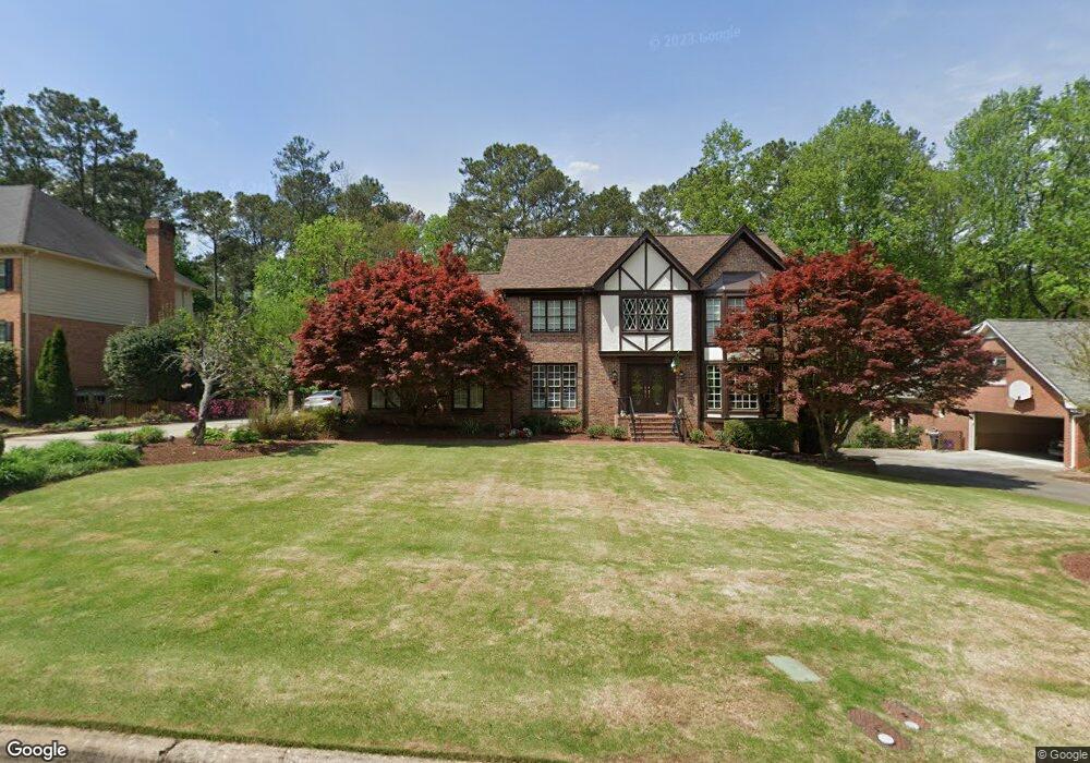
7640 Brigham Dr Atlanta, GA 30350
Dunwoody Panhandle NeighborhoodEstimated Value: $871,000 - $967,000
4
Beds
4
Baths
3,558
Sq Ft
$257/Sq Ft
Est. Value
About This Home
This home is located at 7640 Brigham Dr, Atlanta, GA 30350 and is currently estimated at $914,019, approximately $256 per square foot. 7640 Brigham Dr is a home located in Fulton County with nearby schools including Dunwoody Springs Elementary School, Sandy Springs Middle School, and North Springs High School.
Ownership History
Date
Name
Owned For
Owner Type
Purchase Details
Closed on
May 26, 1998
Sold by
Mcginnis John E and Mcginnis Kathie M
Bought by
Foley James P
Current Estimated Value
Home Financials for this Owner
Home Financials are based on the most recent Mortgage that was taken out on this home.
Original Mortgage
$289,600
Outstanding Balance
$58,238
Interest Rate
7.11%
Mortgage Type
New Conventional
Estimated Equity
$855,781
Create a Home Valuation Report for This Property
The Home Valuation Report is an in-depth analysis detailing your home's value as well as a comparison with similar homes in the area
Home Values in the Area
Average Home Value in this Area
Purchase History
| Date | Buyer | Sale Price | Title Company |
|---|---|---|---|
| Foley James P | $362,000 | -- |
Source: Public Records
Mortgage History
| Date | Status | Borrower | Loan Amount |
|---|---|---|---|
| Open | Foley James P | $289,600 |
Source: Public Records
Tax History Compared to Growth
Tax History
| Year | Tax Paid | Tax Assessment Tax Assessment Total Assessment is a certain percentage of the fair market value that is determined by local assessors to be the total taxable value of land and additions on the property. | Land | Improvement |
|---|---|---|---|---|
| 2025 | $6,744 | $242,600 | $57,000 | $185,600 |
| 2023 | $6,744 | $253,800 | $53,280 | $200,520 |
| 2022 | $6,378 | $255,360 | $75,360 | $180,000 |
| 2021 | $6,340 | $247,920 | $73,160 | $174,760 |
| 2020 | $6,384 | $237,480 | $48,720 | $188,760 |
| 2019 | $6,286 | $233,240 | $47,840 | $185,400 |
| 2018 | $6,256 | $202,800 | $34,040 | $168,760 |
| 2017 | $6,194 | $195,040 | $32,760 | $162,280 |
| 2016 | $6,105 | $192,440 | $32,760 | $159,680 |
| 2015 | $6,298 | $192,440 | $32,760 | $159,680 |
| 2014 | $6,298 | $192,440 | $32,760 | $159,680 |
Source: Public Records
Map
Nearby Homes
- 7695 Brigham Dr
- 355 Aldenshire Place
- 5352 Waterford Dr
- 7700 Wickley Way
- 4641 Brunning Ct
- 130 Belvedere Ct
- 2820 Harwick Dr
- 7611 Regency Cir
- 7611 Regency Cir
- 2381 Briarleigh Way
- 230 Westminster Place
- 5264 Brooke Ridge Dr
- 7750 Landowne Dr Unit 2
- 7465 Stoneykirk Close
- 7790 Stables Dr
- 7770 N Spalding Lake Dr Unit 2
- 5284 Brookelake Dr
- 7640 Ryefield Dr
- 7650 Brigham Dr Unit 2
- 7630 Brigham Dr
- 2385 Kimbrough Ct
- 7660 Brigham Dr
- 2375 Kimbrough Ct
- 7685 Brigham Dr
- 7620 Brigham Dr
- 7675 Brigham Dr
- 7670 Brigham Dr
- 7705 Brigham Dr
- 2405 Kimbrough Ct Unit 9
- 7665 Brigham Dr
- 7610 Brigham Dr Unit 1
- 2365 Kimbrough Ct
- 7715 Brigham Dr
- 7655 Brigham Dr
- 2410 Kimbrough Ct
- 0 Redbourne Dr Unit 8580268
- 0 Redbourne Dr Unit 8570065
- 0 Redbourne Dr Unit 8555687