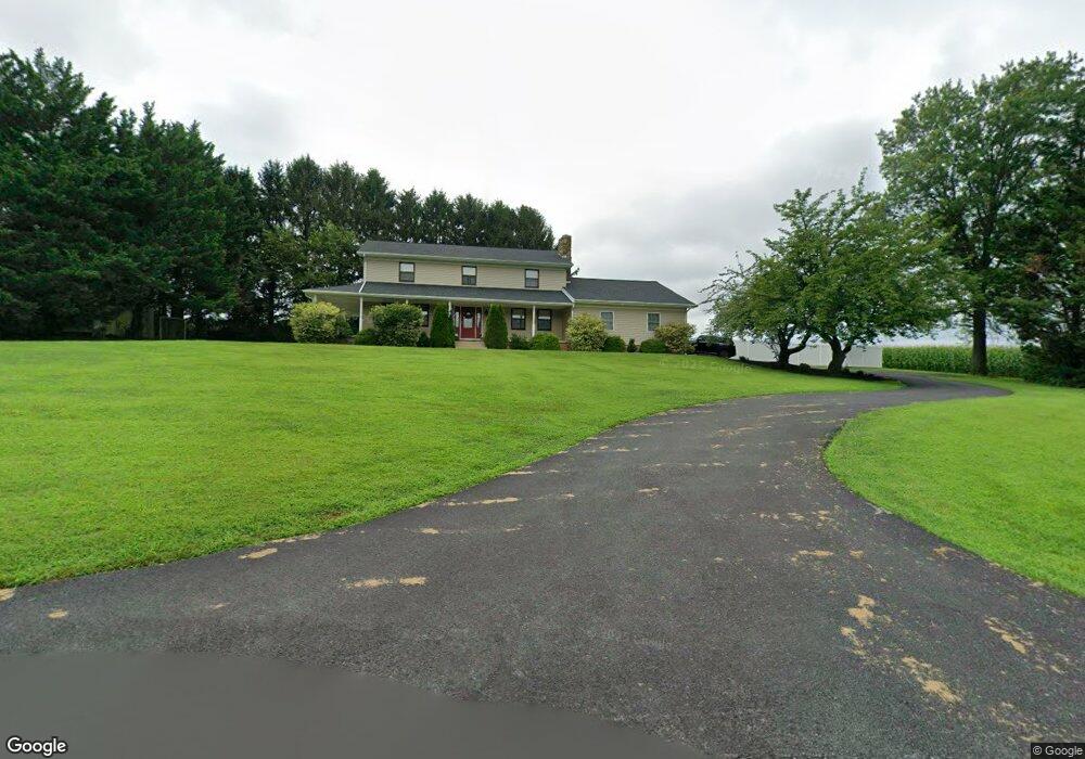
7641 Rock Jim Rd Stewartstown, PA 17363
Estimated Value: $439,240 - $531,000
4
Beds
2
Baths
2,902
Sq Ft
$171/Sq Ft
Est. Value
About This Home
This home is located at 7641 Rock Jim Rd, Stewartstown, PA 17363 and is currently estimated at $496,810, approximately $171 per square foot. 7641 Rock Jim Rd is a home located in York County with nearby schools including South Eastern Intermediate School, South Eastern Middle School, and Kennard-Dale High School.
Ownership History
Date
Name
Owned For
Owner Type
Purchase Details
Closed on
Jan 22, 2020
Sold by
Mitchell Barry A and Mitchell Suzanne M
Bought by
Mitchell Barry A
Current Estimated Value
Home Financials for this Owner
Home Financials are based on the most recent Mortgage that was taken out on this home.
Original Mortgage
$266,050
Outstanding Balance
$182,379
Interest Rate
3.7%
Mortgage Type
New Conventional
Estimated Equity
$314,431
Purchase Details
Closed on
Dec 10, 2004
Sold by
Burgess Andrew L
Bought by
Mitchell Barry A and Mitchell Suzanne M
Home Financials for this Owner
Home Financials are based on the most recent Mortgage that was taken out on this home.
Original Mortgage
$210,600
Interest Rate
7.75%
Mortgage Type
Fannie Mae Freddie Mac
Purchase Details
Closed on
Jun 29, 1998
Sold by
Bindon Mark C and Bindon Susan L
Bought by
Burgess Andrew L
Home Financials for this Owner
Home Financials are based on the most recent Mortgage that was taken out on this home.
Original Mortgage
$140,160
Interest Rate
7.02%
Create a Home Valuation Report for This Property
The Home Valuation Report is an in-depth analysis detailing your home's value as well as a comparison with similar homes in the area
Home Values in the Area
Average Home Value in this Area
Purchase History
| Date | Buyer | Sale Price | Title Company |
|---|---|---|---|
| Mitchell Barry A | -- | National Link Originations | |
| Mitchell Barry A | $234,500 | Lawyers Title Ins | |
| Burgess Andrew L | $164,900 | -- |
Source: Public Records
Mortgage History
| Date | Status | Borrower | Loan Amount |
|---|---|---|---|
| Open | Mitchell Barry A | $266,050 | |
| Closed | Mitchell Barry A | $210,600 | |
| Previous Owner | Burgess Andrew L | $140,160 |
Source: Public Records
Tax History Compared to Growth
Tax History
| Year | Tax Paid | Tax Assessment Tax Assessment Total Assessment is a certain percentage of the fair market value that is determined by local assessors to be the total taxable value of land and additions on the property. | Land | Improvement |
|---|---|---|---|---|
| 2025 | $7,150 | $237,130 | $50,570 | $186,560 |
| 2024 | $7,114 | $237,130 | $50,570 | $186,560 |
| 2023 | $7,114 | $237,130 | $50,570 | $186,560 |
| 2022 | $7,114 | $237,130 | $50,570 | $186,560 |
| 2021 | $6,851 | $237,130 | $50,570 | $186,560 |
| 2020 | $6,851 | $237,130 | $50,570 | $186,560 |
| 2019 | $6,827 | $237,130 | $50,570 | $186,560 |
| 2018 | $6,827 | $237,130 | $50,570 | $186,560 |
| 2017 | $6,813 | $237,130 | $50,570 | $186,560 |
| 2016 | $0 | $237,130 | $50,570 | $186,560 |
| 2015 | -- | $237,130 | $50,570 | $186,560 |
| 2014 | -- | $237,130 | $50,570 | $186,560 |
Source: Public Records
Map
Nearby Homes
- 7923 Hickory Rd
- 8292 Hickory Rd
- 14754 Lowe Rd
- 15792 Cross Mill Rd
- 14639 Hyson School Rd
- 18010 Dave Anne Cir
- 18183 Piedmont Rd
- 13503 Fishel Rd
- 9377 Hickory Rd
- 545 Log House Rd Unit 116
- 210 Runningboard Rd
- 525 Log House Rd Unit 118
- 119 Edie Cir
- 515 Log House Rd Unit 119
- 4389 Hess Rd
- 200 Patterson Dr Unit 52
- 180 Patterson Dr Unit 50
- 170 Patterson Dr Unit 49
- 10 Black Oak Ct
- 160 Patterson Dr Unit 48
- 7591 Rock Jim Rd
- 7561 Rock Jim Rd
- 7431 Rock Jim Rd
- 7527 Rock Jim Rd
- 7530 Rock Jim Rd
- 7427 Rock Jim Rd
- 7465 Rock Jim Rd
- 7415 Rock Jim Rd
- 5878 Marys Cir
- 5870 Marys Cir
- 7528 Rock Jim Rd
- 5900 Marys Cir
- 5932 Marys Cir
- 5881 Marys Cir
- 5917 Marys Cir
- 5980 Marys Cir
- 5943 Marys Cir
- 5975 Marys Cir
- 8006 Rock Jim Rd
- 6014 Marys Cir