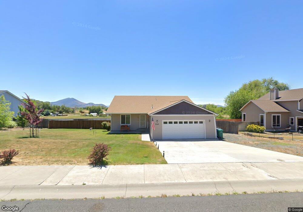
7642 Andrew Dr Klamath Falls, OR 97603
Estimated Value: $378,953 - $384,000
3
Beds
2
Baths
1,968
Sq Ft
$194/Sq Ft
Est. Value
About This Home
This home is located at 7642 Andrew Dr, Klamath Falls, OR 97603 and is currently estimated at $381,477, approximately $193 per square foot. 7642 Andrew Dr is a home with nearby schools including Shasta Elementary School, Henley Middle School, and Henley High School.
Ownership History
Date
Name
Owned For
Owner Type
Purchase Details
Closed on
Aug 12, 2022
Sold by
Davis Michael E
Bought by
Larsen Denise M
Current Estimated Value
Purchase Details
Closed on
Dec 5, 2014
Sold by
Dan Martin Construction Inc
Bought by
Davis Michael E
Home Financials for this Owner
Home Financials are based on the most recent Mortgage that was taken out on this home.
Original Mortgage
$120,000
Interest Rate
3.95%
Mortgage Type
New Conventional
Create a Home Valuation Report for This Property
The Home Valuation Report is an in-depth analysis detailing your home's value as well as a comparison with similar homes in the area
Home Values in the Area
Average Home Value in this Area
Purchase History
| Date | Buyer | Sale Price | Title Company |
|---|---|---|---|
| Larsen Denise M | -- | None Listed On Document | |
| Davis Michael E | $150,000 | Amerititle |
Source: Public Records
Mortgage History
| Date | Status | Borrower | Loan Amount |
|---|---|---|---|
| Previous Owner | Davis Michael E | $120,000 |
Source: Public Records
Tax History Compared to Growth
Tax History
| Year | Tax Paid | Tax Assessment Tax Assessment Total Assessment is a certain percentage of the fair market value that is determined by local assessors to be the total taxable value of land and additions on the property. | Land | Improvement |
|---|---|---|---|---|
| 2024 | $2,616 | $218,030 | -- | -- |
| 2023 | $2,518 | $175,530 | $35,800 | $139,730 |
| 2022 | $2,451 | $205,520 | $0 | $0 |
| 2021 | $2,374 | $199,540 | $0 | $0 |
| 2020 | $2,301 | $193,730 | $0 | $0 |
| 2019 | $2,244 | $188,090 | $0 | $0 |
| 2018 | $2,179 | $182,620 | $0 | $0 |
| 2017 | $2,123 | $177,310 | $0 | $0 |
| 2016 | $2,066 | $172,150 | $0 | $0 |
| 2015 | $2,238 | $172,150 | $0 | $0 |
| 2014 | $357 | $28,520 | $0 | $0 |
| 2013 | -- | $27,690 | $0 | $0 |
Source: Public Records
Map
Nearby Homes
- 7575 Cannon Ave
- 0 Vermont St
- 6800 S 6th St Unit 68
- 6800 S 6th St Unit 1
- 7649 Booth Rd
- 8333 Oregon 140
- 2780 Windsor Ave
- 2113 Watson St
- 2106 Dawn Dr
- 6506 Sarah Cir
- 2003 Kimberly Dr
- 0 Vale (Parcel 2 of 2 53 Acres) Rd Unit 220183710
- 3323 Barnes Way
- 0 Vale Rd Unit Lot 604 220206106
- 0 Vale Rd Unit Lot 601 220206104
- 2003 Carlson Dr
- 0 Shamrock Unit 900 220196182
- 0 Joe Wright Rd Unit Parcel 1 220191811
- 0 Hwy 39 Unit 220173061
- 0 Southside Bypass Unit 220171004
- 7536 Andrew Dr
- 7648 Andrew Dr
- 7643 Andrew Dr
- 7654 Andrew Dr
- 7530 Andrew Dr
- 7537 Hilyard Ave
- 2725 Heritage Ct
- 2722 Sierra Heights Dr
- 0 Sierra Heights Dr
- 2717 Heritage Ct
- 2724 Heritage Ct
- 7418 Andrew Dr
- 2805 Sierra Heights Dr
- 2716 Sierra Heights Dr
- 2811 Sierra Heights Dr
- 2817 Sierra Heights Dr
- 2705 Watson St
- 2711 Heritage Ct
- 2710 Sierra Heights Dr
- 2721 Sierra Heights Dr