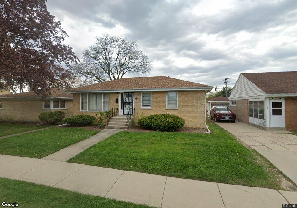
7642 Crawford Ave Skokie, IL 60076
Southeast Skokie NeighborhoodEstimated Value: $384,000 - $406,474
3
Beds
1
Bath
1,025
Sq Ft
$385/Sq Ft
Est. Value
About This Home
This home is located at 7642 Crawford Ave, Skokie, IL 60076 and is currently estimated at $394,619, approximately $384 per square foot. 7642 Crawford Ave is a home located in Cook County with nearby schools including East Prairie Elementary School, Niles North High School, and Skokie Montessori School.
Ownership History
Date
Name
Owned For
Owner Type
Purchase Details
Closed on
Feb 16, 2004
Sold by
Monzon Walter E
Bought by
Monzon Walter E and Hernandez Monzon Luz
Current Estimated Value
Purchase Details
Closed on
Aug 16, 1996
Sold by
American National Bk & Tr Co Of Chicago
Bought by
Monzon Walter E
Home Financials for this Owner
Home Financials are based on the most recent Mortgage that was taken out on this home.
Original Mortgage
$125,600
Outstanding Balance
$10,008
Interest Rate
8.3%
Estimated Equity
$384,611
Create a Home Valuation Report for This Property
The Home Valuation Report is an in-depth analysis detailing your home's value as well as a comparison with similar homes in the area
Home Values in the Area
Average Home Value in this Area
Purchase History
| Date | Buyer | Sale Price | Title Company |
|---|---|---|---|
| Monzon Walter E | -- | -- | |
| Monzon Walter E | $157,000 | -- |
Source: Public Records
Mortgage History
| Date | Status | Borrower | Loan Amount |
|---|---|---|---|
| Open | Monzon Walter E | $125,600 |
Source: Public Records
Tax History Compared to Growth
Tax History
| Year | Tax Paid | Tax Assessment Tax Assessment Total Assessment is a certain percentage of the fair market value that is determined by local assessors to be the total taxable value of land and additions on the property. | Land | Improvement |
|---|---|---|---|---|
| 2024 | $4,075 | $15,693 | $3,983 | $11,710 |
| 2023 | $3,901 | $15,693 | $3,983 | $11,710 |
| 2022 | $3,901 | $15,693 | $3,983 | $11,710 |
| 2021 | $3,619 | $12,768 | $2,802 | $9,966 |
| 2020 | $3,588 | $12,768 | $2,802 | $9,966 |
| 2019 | $3,691 | $14,187 | $2,802 | $11,385 |
| 2018 | $3,087 | $10,992 | $2,433 | $8,559 |
| 2017 | $2,805 | $10,992 | $2,433 | $8,559 |
| 2016 | $2,722 | $10,992 | $2,433 | $8,559 |
| 2015 | $2,474 | $9,416 | $2,065 | $7,351 |
| 2014 | $2,453 | $9,416 | $2,065 | $7,351 |
| 2013 | $2,432 | $9,416 | $2,065 | $7,351 |
Source: Public Records
Map
Nearby Homes
- 4050 Harvard Terrace
- 7842 E Prairie Rd
- 4053 Kirk St
- 7412 Keeler Ave
- 7427 Tripp Ave
- 3818 Hull St
- 3814 Hull St
- 3814 W Sherwin Ave
- 3832 W Chase Ave
- 7330 N Kildare Ave
- 7230 N Keeler Ave
- 3846 W Touhy Ave
- 7226 N Kildare Ave
- 7245 N Kostner Ave
- 3836 W Estes Ave
- 4021 W Estes Ave
- 4019 Cleveland St
- 3924 W Greenleaf Ave
- 8100 Lowell Ave
- 7201 N Lincoln Ave Unit 308
- 7642 Crawford Ave
- 7646 Crawford Ave
- 7646 Crawford Ave
- 4002 Dobson St
- 7648 Crawford Ave
- 4016 Dobson St
- 7652 Crawford Ave
- 4015 Brummel St
- 7656 Crawford Ave
- 4020 Dobson St
- 4017 Brummel St
- 7641 Crawford Ave
- 7645 Crawford Ave
- 4026 Dobson St
- 3940 Dobson St
- 3940 Dobson St
- 7651 Crawford Ave
- 4027 Brummel St
- 4015 Dobson St
- 4006 Brummel St