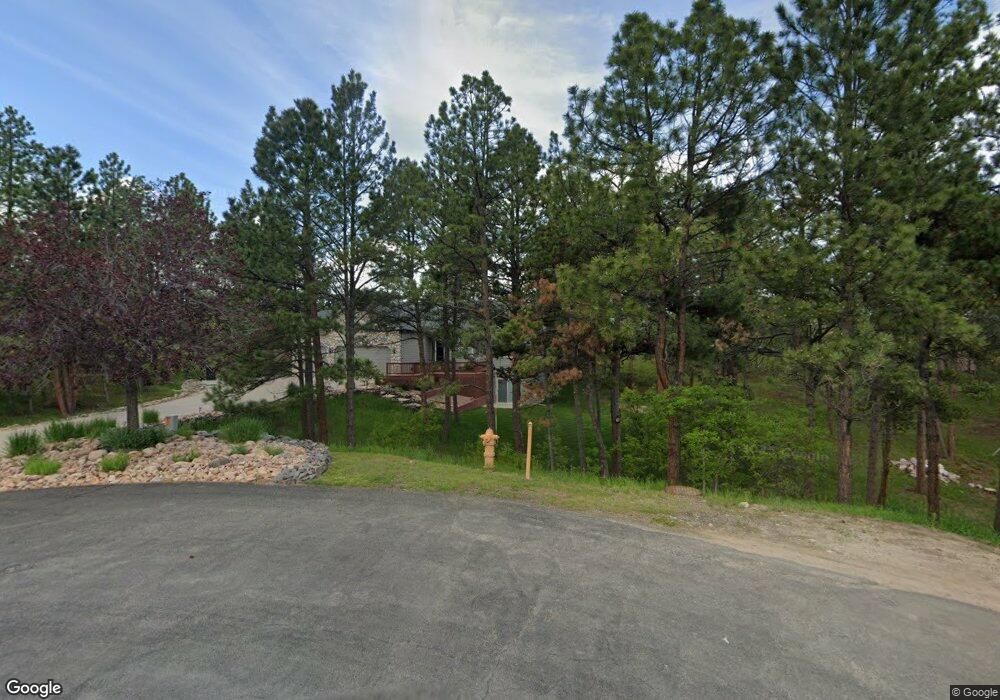
7643 Vail Cir Larkspur, CO 80118
Estimated Value: $826,841 - $962,000
3
Beds
2
Baths
1,842
Sq Ft
$480/Sq Ft
Est. Value
About This Home
This home is located at 7643 Vail Cir, Larkspur, CO 80118 and is currently estimated at $884,210, approximately $480 per square foot. 7643 Vail Cir is a home located in Douglas County with nearby schools including Larkspur Elementary School, Castle Rock Middle School, and Castle View High School.
Ownership History
Date
Name
Owned For
Owner Type
Purchase Details
Closed on
Apr 27, 2004
Sold by
Pierman Lloyd V and Pierman Virginia
Bought by
Niemeier Mel and Niemeier Sheila E
Current Estimated Value
Home Financials for this Owner
Home Financials are based on the most recent Mortgage that was taken out on this home.
Original Mortgage
$312,800
Outstanding Balance
$145,833
Interest Rate
5.42%
Mortgage Type
Unknown
Estimated Equity
$738,377
Purchase Details
Closed on
Jun 30, 1999
Sold by
Money Michael A
Bought by
Pierman Lloyd V and Pierman Virginia
Purchase Details
Closed on
Sep 11, 1998
Sold by
Dudley Gary W and Dudley Christine
Bought by
Money Michael A
Purchase Details
Closed on
Mar 26, 1980
Sold by
Unavailable
Bought by
Unavailable
Create a Home Valuation Report for This Property
The Home Valuation Report is an in-depth analysis detailing your home's value as well as a comparison with similar homes in the area
Home Values in the Area
Average Home Value in this Area
Purchase History
| Date | Buyer | Sale Price | Title Company |
|---|---|---|---|
| Niemeier Mel | $391,000 | Land Title | |
| Pierman Lloyd V | $293,900 | First American Heritage Titl | |
| Money Michael A | $33,350 | -- | |
| Unavailable | $8,600 | -- |
Source: Public Records
Mortgage History
| Date | Status | Borrower | Loan Amount |
|---|---|---|---|
| Open | Niemeier Mel | $312,800 |
Source: Public Records
Tax History Compared to Growth
Tax History
| Year | Tax Paid | Tax Assessment Tax Assessment Total Assessment is a certain percentage of the fair market value that is determined by local assessors to be the total taxable value of land and additions on the property. | Land | Improvement |
|---|---|---|---|---|
| 2024 | $4,604 | $57,610 | $12,670 | $44,940 |
| 2023 | $4,649 | $57,610 | $12,670 | $44,940 |
| 2022 | $3,115 | $39,830 | $8,650 | $31,180 |
| 2021 | $3,224 | $39,830 | $8,650 | $31,180 |
| 2020 | $2,891 | $37,250 | $7,460 | $29,790 |
| 2019 | $2,901 | $37,250 | $7,460 | $29,790 |
| 2018 | $2,476 | $32,440 | $6,850 | $25,590 |
| 2017 | $2,327 | $32,440 | $6,850 | $25,590 |
| 2016 | $2,269 | $32,170 | $6,530 | $25,640 |
| 2015 | $2,219 | $32,170 | $6,530 | $25,640 |
| 2014 | $2,540 | $25,980 | $4,700 | $21,280 |
Source: Public Records
Map
Nearby Homes
- 0 E Cherry Creek Rd Unit 2541327
- 0 E Cherry Creek Rd Unit REC1786246
- 929 Tenderfoot Dr
- 7596 Rollins Dr
- 950 Tenderfoot Dr
- 1038 Tenderfoot Dr
- 1600 Independence Dr
- 1600 Independence Dr Unit 50
- 691 Cumberland Rd
- 670 Independence Dr
- 7737 Taylor Cir
- 7317 Fremont Place
- 7994 Monarch Rd
- 773 Copper Fox Place
- 1025 Tenderfoot Dr
- 682 Copper Fox Place
- 720 Copper Fox Place
- 533 Tenderfoot Dr
- 1275 Fremont Dr
- 7076 Boreas Rd
- 991 Cottonwood Ln
- 988 Independence Dr
- 960 Independence Dr
- 7644 Vail Cir
- 1023 Cottonwood Ln
- 969 Cottonwood Ln
- 928 Independence Dr
- 882 Independence Dr
- 1010 Independence Dr
- 7674 Vail Cir
- 879 Cottonwood Ln
- 1055 Cottonwood Ln
- 899 Cottonwood Ln
- 1020 Cottonwood Ln
- 994 Cottonwood Ln
- 861 Cottonwood Ln
- 976 Cottonwood Ln
- 0 Tract 16 Nauitque Cir Unit 939913
- 0 Vacant Land Unit 943327
- 0 Vacant Land Unit 943303