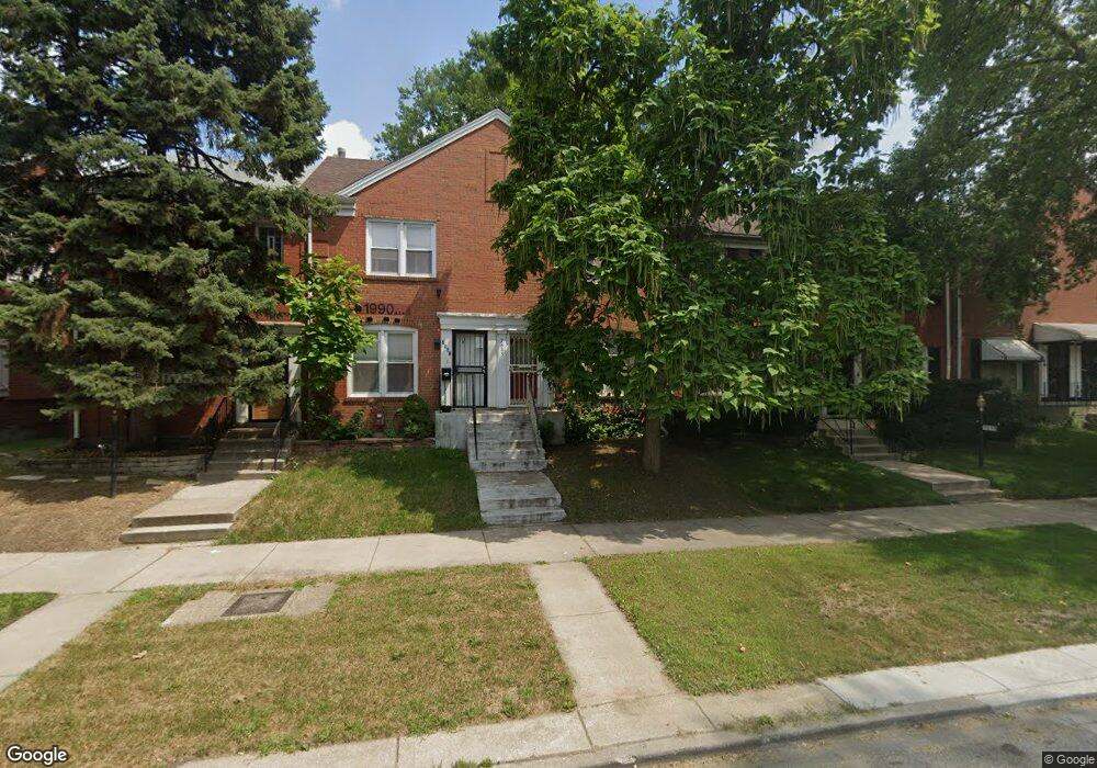
7645 S Euclid Ave Chicago, IL 60649
South Shore NeighborhoodEstimated Value: $114,000 - $167,000
2
Beds
1
Bath
896
Sq Ft
$159/Sq Ft
Est. Value
About This Home
This home is located at 7645 S Euclid Ave, Chicago, IL 60649 and is currently estimated at $142,249, approximately $158 per square foot. 7645 S Euclid Ave is a home located in Cook County with nearby schools including Bouchet Elementary Math & Science Academy, St Paul Lutheran School, and Muhammad University.
Ownership History
Date
Name
Owned For
Owner Type
Purchase Details
Closed on
May 25, 2004
Sold by
First Union National Bank
Bought by
Sherrill Michael
Current Estimated Value
Home Financials for this Owner
Home Financials are based on the most recent Mortgage that was taken out on this home.
Original Mortgage
$75,000
Interest Rate
6.34%
Mortgage Type
Unknown
Purchase Details
Closed on
Dec 16, 2003
Sold by
Lowe Wilma N
Bought by
First Union National Bank
Purchase Details
Closed on
Aug 11, 1998
Sold by
Cole Taylor Bank
Bought by
Lowe Wilma N
Home Financials for this Owner
Home Financials are based on the most recent Mortgage that was taken out on this home.
Original Mortgage
$60,350
Interest Rate
10.87%
Purchase Details
Closed on
Jan 23, 1998
Sold by
Hud
Bought by
U S Bank Trust #2996
Create a Home Valuation Report for This Property
The Home Valuation Report is an in-depth analysis detailing your home's value as well as a comparison with similar homes in the area
Home Values in the Area
Average Home Value in this Area
Purchase History
| Date | Buyer | Sale Price | Title Company |
|---|---|---|---|
| Sherrill Michael | $75,000 | -- | |
| First Union National Bank | -- | -- | |
| Lowe Wilma N | $55,000 | -- | |
| U S Bank Trust #2996 | -- | -- |
Source: Public Records
Mortgage History
| Date | Status | Borrower | Loan Amount |
|---|---|---|---|
| Previous Owner | Sherrill Michael | $75,000 | |
| Previous Owner | Lowe Wilma N | $60,350 |
Source: Public Records
Tax History
| Year | Tax Paid | Tax Assessment Tax Assessment Total Assessment is a certain percentage of the fair market value that is determined by local assessors to be the total taxable value of land and additions on the property. | Land | Improvement |
|---|---|---|---|---|
| 2025 | -- | $5,900 | $2,540 | $3,360 |
| 2024 | -- | $5,900 | $2,540 | $3,360 |
| 2023 | -- | $6,500 | $2,540 | $3,960 |
| 2022 | $0 | $6,500 | $2,540 | $3,960 |
| 2021 | $1,709 | $6,500 | $2,540 | $3,960 |
| 2020 | $1,709 | $7,670 | $1,828 | $5,842 |
| 2019 | $1,023 | $8,523 | $1,828 | $6,695 |
| 2018 | $1,005 | $8,523 | $1,828 | $6,695 |
| 2017 | $1,117 | $8,565 | $1,625 | $6,940 |
| 2016 | $1,215 | $8,565 | $1,625 | $6,940 |
| 2015 | $1,089 | $8,565 | $1,625 | $6,940 |
| 2014 | $1,018 | $8,055 | $1,422 | $6,633 |
| 2013 | $987 | $8,055 | $1,422 | $6,633 |
Source: Public Records
Map
Nearby Homes
- 7629 S Euclid Ave
- 7718 S Jeffery Blvd Unit GN
- 7720 S Jeffery Blvd Unit 1S
- 7741 S Chappel Ave
- 7655 S Clyde Ave
- 7816 S Jeffery Blvd
- 7642 S Merrill Ave
- 7650 S Cregier Ave
- 7847 S Bennett Ave
- 7449 S Bennett Ave
- 7719 S Merrill Ave
- 7716 S Paxton Ave
- 7712 S Ridgeland Ave
- 7818 S Merrill Ave
- 7732 S Paxton Ave
- 7643 S Paxton Ave
- 7815 S Merrill Ave
- 7420 S Bennett Ave
- 7804 S Paxton Ave
- 7444 S Merrill Ave
- 7641 S Euclid Ave
- 7643 S Euclid Ave
- 7647 S Euclid Ave
- 7649 S Euclid Ave
- 7651 S Euclid Ave
- 7639 S Euclid Ave
- 7653 S Euclid Ave
- 7637 S Euclid Ave
- 7635 S Euclid Ave
- 7655 S Euclid Ave
- 7657 S Euclid Ave
- 7633 S Euclid Ave
- 7631 S Euclid Ave
- 7659 S Euclid Ave
- 7661 S Euclid Ave
- 7634 S Jeffery Blvd
- 7640 S Jeffery Blvd
- 7632 S Jeffery Blvd Unit 1
- 7663 S Euclid Ave
- 7627 S Euclid Ave
Your Personal Tour Guide
Ask me questions while you tour the home.