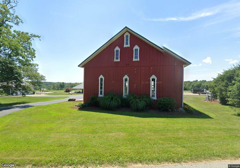
7646 Cedar Valley Rd West Salem, OH 44287
Estimated Value: $388,000 - $1,174,768
4
Beds
3
Baths
2,691
Sq Ft
$316/Sq Ft
Est. Value
About This Home
This home is located at 7646 Cedar Valley Rd, West Salem, OH 44287 and is currently estimated at $849,923, approximately $315 per square foot. 7646 Cedar Valley Rd is a home located in Wayne County with nearby schools including Northwestern Elementary School, Northwestern Middle School, and Northwestern High School.
Ownership History
Date
Name
Owned For
Owner Type
Purchase Details
Closed on
Jul 31, 2014
Sold by
Box Patricia M Barr
Bought by
Hard Rock Drilling & Producing Llc
Current Estimated Value
Purchase Details
Closed on
Jul 6, 2009
Sold by
Duer Dick Margaret A
Bought by
Cutter Charles J and Cutter Elisabeth I
Home Financials for this Owner
Home Financials are based on the most recent Mortgage that was taken out on this home.
Original Mortgage
$380,000
Interest Rate
5.37%
Mortgage Type
Adjustable Rate Mortgage/ARM
Purchase Details
Closed on
Jan 28, 2008
Sold by
Duer Dick Margaret A
Bought by
Duer Dick Margaret A and The Margaret A Dick Family Trust
Purchase Details
Closed on
Nov 1, 1989
Bought by
Dick James E and Dick Margaret A
Create a Home Valuation Report for This Property
The Home Valuation Report is an in-depth analysis detailing your home's value as well as a comparison with similar homes in the area
Home Values in the Area
Average Home Value in this Area
Purchase History
| Date | Buyer | Sale Price | Title Company |
|---|---|---|---|
| Hard Rock Drilling & Producing Llc | -- | Attorney | |
| Cutter Charles J | $475,000 | Service First | |
| Duer Dick Margaret A | -- | Attorney | |
| Dick James E | $120,000 | -- |
Source: Public Records
Mortgage History
| Date | Status | Borrower | Loan Amount |
|---|---|---|---|
| Previous Owner | Cutter Charles J | $380,000 |
Source: Public Records
Tax History Compared to Growth
Tax History
| Year | Tax Paid | Tax Assessment Tax Assessment Total Assessment is a certain percentage of the fair market value that is determined by local assessors to be the total taxable value of land and additions on the property. | Land | Improvement |
|---|---|---|---|---|
| 2024 | $7,777 | $345,560 | $172,060 | $173,500 |
| 2023 | $7,777 | $345,760 | $172,060 | $173,700 |
| 2022 | $7,725 | $345,760 | $172,060 | $173,700 |
| 2021 | $7,741 | $345,760 | $172,060 | $173,700 |
| 2020 | $7,833 | $345,760 | $172,060 | $173,700 |
| 2019 | $6,752 | $277,010 | $160,220 | $116,790 |
| 2018 | $6,339 | $277,010 | $160,220 | $116,790 |
| 2017 | $6,485 | $277,010 | $160,220 | $116,790 |
| 2016 | $6,777 | $220,460 | $103,670 | $116,790 |
| 2015 | $6,680 | $220,460 | $103,670 | $116,790 |
| 2014 | -- | $220,460 | $103,670 | $116,790 |
| 2013 | $5,848 | $192,610 | $75,030 | $117,580 |
Source: Public Records
Map
Nearby Homes
- V/L #10 Rice Hill Rd
- V/L #8 Rice Hill Rd
- V/L #9 Rice Hill Rd
- V/L #7 Rice Hill Rd
- V/L #13 Rice Hill Rd
- V/L #6 Rice Hill Rd
- V/L #5 Rice Hill Rd
- V/L #2 Rice Hill Rd
- V/L #11 Rice Hill Rd
- V/L #4 Rice Hill Rd
- V/L #3 Rice Hill Rd
- V/L #1 Rice Hill Rd
- 6929 Bates Rd
- 5167 Overton Rd
- 3303 W Smithville Western Rd
- 4156 Fieldridge Ct
- 11282 Stratton Rd
- 10575 Burbank Rd
- 3125 Henderson Rd
- 3351 W Easton Rd
- 7789 Cedar Valley Rd
- 7271 Cedar Valley Rd
- 5258 Martin Rd
- 7320 Cedar Valley Rd
- 8119 Cedar Valley Rd
- 7130 Cedar Valley Rd
- 7832 Rice Hill Rd
- 7053 Cedar Valley Rd
- 7550 Rice Hill Rd
- 7550 Rice Hill Rd
- 0 Rice Hill Rd
- 7428 Rice Hill Rd
- 6928 Cedar Valley Rd
- 7400 Rice Hill Rd
- 8481 Cedar Valley Rd
- 8208 Rice Hill Rd
- 7272 Rice Hill Rd
- 0 Lot 3 Martin Rd Unit 3224032
- 7797 Congress Rd