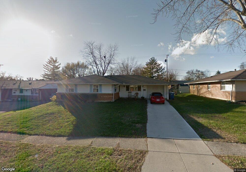
7649 Harshmanville Rd Dayton, OH 45424
Estimated Value: $155,000 - $231,000
4
Beds
2
Baths
1,579
Sq Ft
$128/Sq Ft
Est. Value
About This Home
This home is located at 7649 Harshmanville Rd, Dayton, OH 45424 and is currently estimated at $201,359, approximately $127 per square foot. 7649 Harshmanville Rd is a home located in Montgomery County with nearby schools including Wayne High School and Huber Heights Christian Academy.
Ownership History
Date
Name
Owned For
Owner Type
Purchase Details
Closed on
Jun 21, 2019
Sold by
Vargo Janis L and The Janis L Vargo Revocable Li
Bought by
Ploutz Spencer T
Current Estimated Value
Home Financials for this Owner
Home Financials are based on the most recent Mortgage that was taken out on this home.
Original Mortgage
$86,450
Outstanding Balance
$75,575
Interest Rate
3.82%
Mortgage Type
New Conventional
Estimated Equity
$125,784
Purchase Details
Closed on
Jun 17, 2009
Sold by
Vargo Janis L
Bought by
Vargo Janis L and The Janis L Vargo Revocable Living Trust
Create a Home Valuation Report for This Property
The Home Valuation Report is an in-depth analysis detailing your home's value as well as a comparison with similar homes in the area
Home Values in the Area
Average Home Value in this Area
Purchase History
| Date | Buyer | Sale Price | Title Company |
|---|---|---|---|
| Ploutz Spencer T | $91,000 | Partners Land Title Agency | |
| Vargo Janis L | -- | Attorney |
Source: Public Records
Mortgage History
| Date | Status | Borrower | Loan Amount |
|---|---|---|---|
| Open | Ploutz Spencer T | $86,450 |
Source: Public Records
Tax History Compared to Growth
Tax History
| Year | Tax Paid | Tax Assessment Tax Assessment Total Assessment is a certain percentage of the fair market value that is determined by local assessors to be the total taxable value of land and additions on the property. | Land | Improvement |
|---|---|---|---|---|
| 2024 | $2,598 | $49,080 | $10,150 | $38,930 |
| 2023 | $2,598 | $49,080 | $10,150 | $38,930 |
| 2022 | $2,271 | $33,820 | $7,000 | $26,820 |
| 2021 | $2,305 | $33,820 | $7,000 | $26,820 |
| 2020 | $2,307 | $33,820 | $7,000 | $26,820 |
| 2019 | $2,412 | $31,310 | $7,000 | $24,310 |
| 2018 | $2,420 | $31,310 | $7,000 | $24,310 |
| 2017 | $2,406 | $31,310 | $7,000 | $24,310 |
| 2016 | $2,291 | $29,030 | $7,000 | $22,030 |
| 2015 | $2,262 | $29,030 | $7,000 | $22,030 |
| 2014 | $2,262 | $29,030 | $7,000 | $22,030 |
| 2012 | -- | $32,360 | $8,750 | $23,610 |
Source: Public Records
Map
Nearby Homes
- 7833 Harshmanville Rd
- 6150 Taylorsville Rd
- 7500 Mount Ranier Unit 12077
- 7866 Harshmanville Rd
- 6447 Highbury Rd
- 7371 Damascus Dr
- 5580 Clagston Ct
- 6681 Spokane Dr
- 5582 Camerford Dr
- 6605 Highbury Rd
- 6701 Springport Way
- 6089 Green Knolls Dr
- 7126 Mandrake Dr
- 8282 Briar Ridge Ct
- 6601 Grovehill Dr
- 6245 Longford Rd
- 7315 Glengate Ct
- 8436 Indian Mound Dr
- 5631 Longford Rd
- 6219 Beacon Tree Ct
- 7701 Harshmanville Rd
- 7643 Harshmanville Rd
- 7642 Blackshear Dr
- 7700 Blackshear Dr
- 7636 Blackshear Dr
- 7707 Harshmanville Rd
- 7637 Harshmanville Rd
- 7648 Harshmanville Rd
- 7700 Harshmanville Rd
- 7642 Harshmanville Rd
- 7706 Blackshear Dr
- 7630 Blackshear Dr
- 7706 Harshmanville Rd
- 7713 Harshmanville Rd
- 7636 Harshmanville Rd
- 7631 Harshmanville Rd
- 7712 Blackshear Dr
- 7624 Blackshear Dr
- 7712 Harshmanville Rd
- 7645 Blackshear Dr