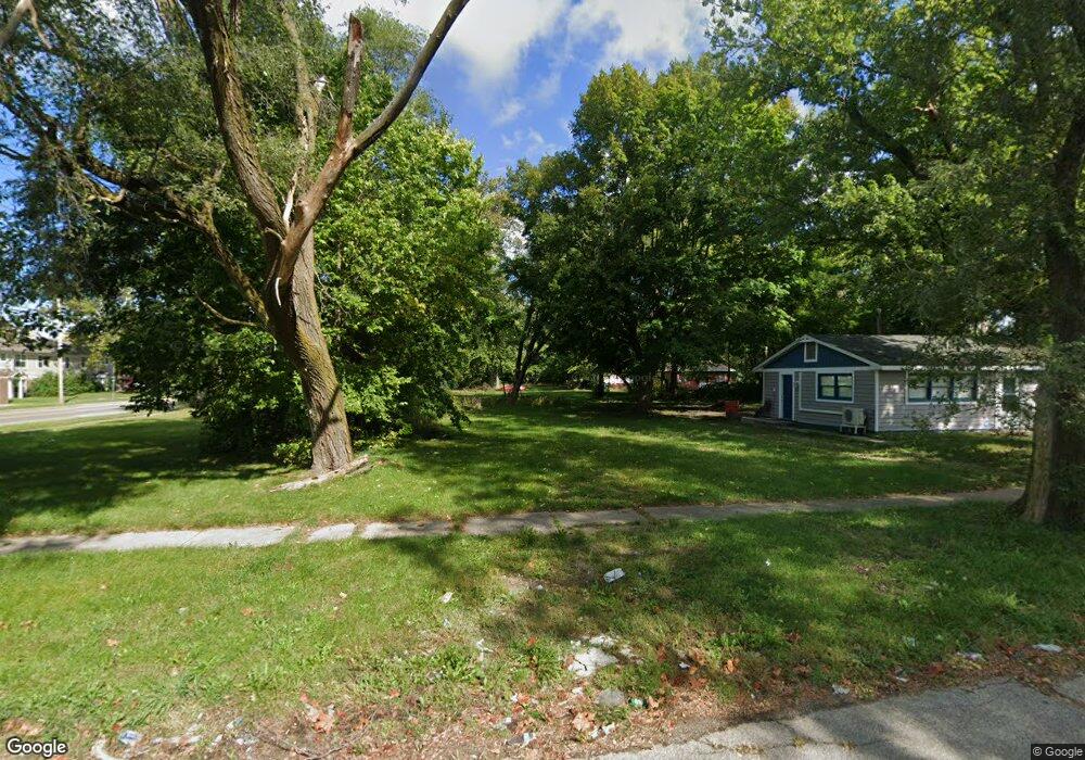
765 E Vineyard Ave Benton Harbor, MI 49022
Estimated Value: $74,000 - $79,000
Studio
--
Bath
--
Sq Ft
6,229
Sq Ft Lot
About This Home
This home is located at 765 E Vineyard Ave, Benton Harbor, MI 49022 and is currently estimated at $76,500. 765 E Vineyard Ave is a home located in Berrien County with nearby schools including Fair Plain Middle School, Benton Harbor High School, and Benton Harbor Charter School Academy.
Ownership History
Date
Name
Owned For
Owner Type
Purchase Details
Closed on
Jan 14, 2022
Sold by
Shekia Echols
Bought by
Saros Daniel Earl and Hoult-Saros Stacy Ellen
Current Estimated Value
Purchase Details
Closed on
May 19, 2021
Sold by
Beach House Rentals Llc
Bought by
Echols Shekia
Purchase Details
Closed on
Oct 21, 2008
Sold by
Lannert Barbara A
Bought by
Beach House Rentals Llc
Purchase Details
Closed on
Jul 18, 2006
Sold by
Witkowski Bret
Bought by
Lannert Barbara A
Purchase Details
Closed on
Aug 26, 2004
Sold by
Johnson Beatrice
Bought by
Spencer Terry Lee
Create a Home Valuation Report for This Property
The Home Valuation Report is an in-depth analysis detailing your home's value as well as a comparison with similar homes in the area
Home Values in the Area
Average Home Value in this Area
Purchase History
| Date | Buyer | Sale Price | Title Company |
|---|---|---|---|
| Saros Daniel Earl | $61,900 | First American Title | |
| Echols Shekia | $29,500 | None Available | |
| Beach House Rentals Llc | -- | None Available | |
| Lannert Barbara A | $11,348 | None Available | |
| Spencer Terry Lee | -- | -- |
Source: Public Records
Tax History
| Year | Tax Paid | Tax Assessment Tax Assessment Total Assessment is a certain percentage of the fair market value that is determined by local assessors to be the total taxable value of land and additions on the property. | Land | Improvement |
|---|---|---|---|---|
| 2025 | $39 | $3,300 | $0 | $0 |
| 2024 | $38 | $2,800 | $0 | $0 |
| 2023 | $30 | $600 | $0 | $0 |
| 2022 | $24 | $400 | $0 | $0 |
| 2021 | $44 | $700 | $700 | $0 |
| 2020 | $44 | $700 | $0 | $0 |
| 2019 | $44 | $700 | $0 | $0 |
Source: Public Records
Map
Nearby Homes
- 710 Buss Ave
- 810 Thresher Ave
- 696 Highland Ave
- 561 Heck Ct
- 992 Highland Ave
- 137 Cornelia St
- 627 E Main St
- 635 E Main St
- 770 Territorial Rd
- 378 Pipestone St
- 363 Brunson Ave
- 596 Superior St
- 490 Territorial Rd
- 520 Broadway
- 410 Division St
- 380 N Mccord St
- 730 Superior St
- 470 N Mccord St
- 381 N Hull Ave
- 614 Pavone St
- 325 S Mccord St
- 771 E Vineyard Ave
- 775 E Vineyard Ave
- 754 E Vineyard Ave
- 787 E Vineyard Ave
- 772 E Vineyard Ave
- 764 N Wells Ave
- 772 N Wells Ave
- 780 E Vineyard Ave
- 301 S Mccord St
- 795 E Vineyard Ave
- 780 Nate Wells Sr Dr
- 803 E Vineyard Ave
- 794 E Vineyard Ave
- 794 N Wells Ave
- 798 E Vineyard Ave
- 802 E Vineyard Ave
- 802 Nate Wells Sr Dr
- 805 E Vineyard Ave
- 789 Nate Wells Sr Dr
Your Personal Tour Guide
Ask me questions while you tour the home.