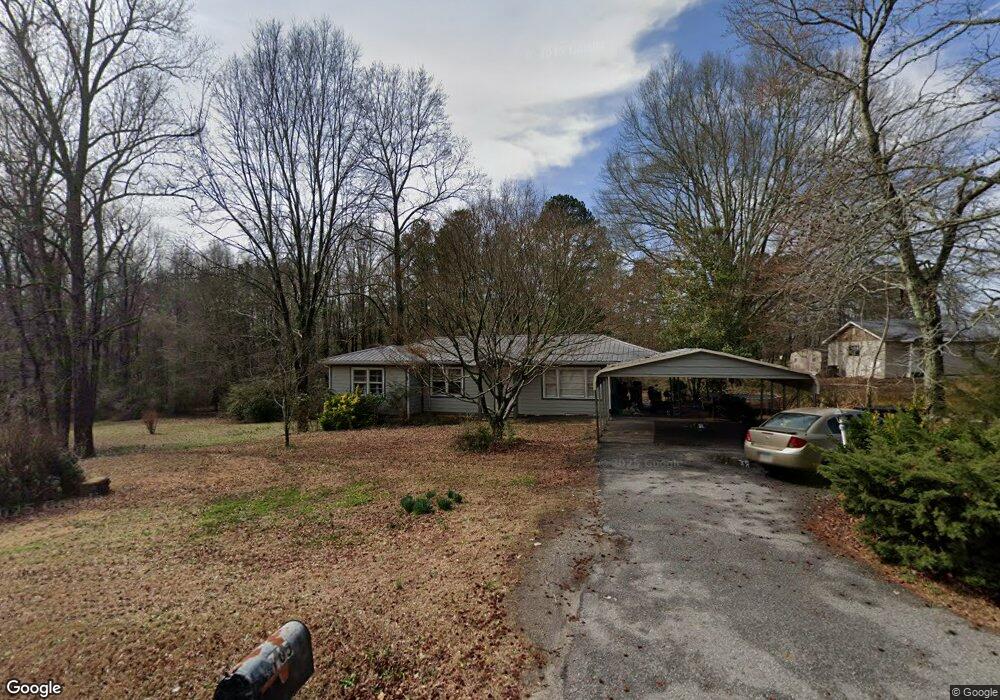
765 Harve Mathis Rd Athens, GA 30601
Estimated Value: $185,000 - $318,000
--
Bed
--
Bath
878
Sq Ft
$256/Sq Ft
Est. Value
About This Home
This home is located at 765 Harve Mathis Rd, Athens, GA 30601 and is currently estimated at $224,434, approximately $255 per square foot. 765 Harve Mathis Rd is a home located in Clarke County with nearby schools including Judia Jackson Harris Elementary School, Coile Middle School, and Cedar Shoals High School.
Ownership History
Date
Name
Owned For
Owner Type
Purchase Details
Closed on
Jun 14, 2016
Sold by
Batchelor Brenda
Bought by
Dean Gary Harold
Current Estimated Value
Home Financials for this Owner
Home Financials are based on the most recent Mortgage that was taken out on this home.
Original Mortgage
$70,000
Outstanding Balance
$55,428
Interest Rate
3.58%
Mortgage Type
New Conventional
Estimated Equity
$169,006
Create a Home Valuation Report for This Property
The Home Valuation Report is an in-depth analysis detailing your home's value as well as a comparison with similar homes in the area
Home Values in the Area
Average Home Value in this Area
Purchase History
| Date | Buyer | Sale Price | Title Company |
|---|---|---|---|
| Dean Gary Harold | $42,500 | -- |
Source: Public Records
Mortgage History
| Date | Status | Borrower | Loan Amount |
|---|---|---|---|
| Open | Dean Gary Harold | $70,000 |
Source: Public Records
Tax History Compared to Growth
Tax History
| Year | Tax Paid | Tax Assessment Tax Assessment Total Assessment is a certain percentage of the fair market value that is determined by local assessors to be the total taxable value of land and additions on the property. | Land | Improvement |
|---|---|---|---|---|
| 2025 | $1,591 | $51,230 | $12,000 | $39,230 |
| 2024 | $1,591 | $48,966 | $12,000 | $36,966 |
| 2023 | $1,530 | $43,144 | $8,000 | $35,144 |
| 2022 | $1,138 | $35,685 | $8,000 | $27,685 |
| 2021 | $919 | $27,256 | $4,760 | $22,496 |
| 2020 | $869 | $25,793 | $4,760 | $21,033 |
| 2019 | $828 | $24,399 | $4,760 | $19,639 |
| 2018 | $732 | $21,554 | $4,420 | $17,134 |
| 2017 | $738 | $21,773 | $4,420 | $17,353 |
| 2016 | $399 | $11,761 | $4,420 | $7,341 |
| 2015 | $400 | $11,761 | $4,420 | $7,341 |
| 2014 | $401 | $11,762 | $4,420 | $7,342 |
Source: Public Records
Map
Nearby Homes
- 3080 Danielsville Rd
- 121 Sweetgum Way
- 481 Bedford Dr
- 8986 Highway 29 S
- 136 Wellington Dr
- 525 Virginia Ln
- 424 Belhaven Ln
- 685 Bedford Dr
- 181 Bedford Dr
- 540 & 542 Harve Mathis Rd
- 0 Woodland Creek Place Unit 10421130
- 838 Virginia Ln
- 1176 Kimberly Cir
- 300 Harve Mathis Rd
- 336 Old Pittard Rd
- 185 Berry Dr
- 0 Virginia Ln Unit Lot 15 CL336098
- 0 Virginia Ln Unit LOT 15 10579204
- 745 Harve Mathis Rd
- 740 Harve Mathis Rd
- 720 Harve Mathis Rd
- 725 Harve Mathis Rd
- 700 Harve Mathis Rd
- 650 Harve Mathis Rd
- 4045 Danielsville Rd
- 4025 Danielesville Rd
- 715 Harve Mathis Rd
- 4010 Danielsville Rd
- 640 Harve Mathis Rd
- 644 Harve Mathis Rd
- 648 Harve Mathis Rd
- 705 Harve Mathis Rd
- 4109 Old Danielsville Rd
- 4121 Old Danielsville Rd
- 190 Ila Rd
- 1761 Hwy 29n
- 4011 Danielsville Rd
- 1761 Highway 29 N