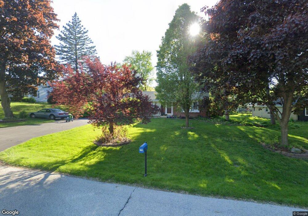
765 S Bobolink Dr Brookfield, WI 53005
Estimated Value: $416,000 - $466,000
3
Beds
2
Baths
1,707
Sq Ft
$259/Sq Ft
Est. Value
About This Home
This home is located at 765 S Bobolink Dr, Brookfield, WI 53005 and is currently estimated at $441,978, approximately $258 per square foot. 765 S Bobolink Dr is a home located in Waukesha County with nearby schools including Swanson Elementary School, Wisconsin Hills Middle School, and Brookfield Central High School.
Ownership History
Date
Name
Owned For
Owner Type
Purchase Details
Closed on
Sep 15, 2017
Sold by
Bursi Paul and Bursi Katie
Bought by
Stamm Karl D
Current Estimated Value
Home Financials for this Owner
Home Financials are based on the most recent Mortgage that was taken out on this home.
Original Mortgage
$216,000
Outstanding Balance
$149,170
Interest Rate
3.93%
Mortgage Type
New Conventional
Estimated Equity
$292,808
Purchase Details
Closed on
May 9, 2013
Sold by
Roche Stephen W and Roche Nancy R
Bought by
Bursi Paul and Bursi Katie
Home Financials for this Owner
Home Financials are based on the most recent Mortgage that was taken out on this home.
Original Mortgage
$213,750
Interest Rate
3.52%
Mortgage Type
New Conventional
Purchase Details
Closed on
Aug 29, 2002
Sold by
Roche Stephen W and Roche Nancy R
Bought by
Roche Stephen W and Roche Nancy R
Create a Home Valuation Report for This Property
The Home Valuation Report is an in-depth analysis detailing your home's value as well as a comparison with similar homes in the area
Home Values in the Area
Average Home Value in this Area
Purchase History
| Date | Buyer | Sale Price | Title Company |
|---|---|---|---|
| Stamm Karl D | $270,100 | None Available | |
| Bursi Paul | $225,000 | Priority Title Corp | |
| Roche Stephen W | -- | -- |
Source: Public Records
Mortgage History
| Date | Status | Borrower | Loan Amount |
|---|---|---|---|
| Open | Stamm Karl D | $216,000 | |
| Previous Owner | Bursi Paul | $213,750 |
Source: Public Records
Tax History Compared to Growth
Tax History
| Year | Tax Paid | Tax Assessment Tax Assessment Total Assessment is a certain percentage of the fair market value that is determined by local assessors to be the total taxable value of land and additions on the property. | Land | Improvement |
|---|---|---|---|---|
| 2024 | $3,670 | $335,800 | $105,000 | $230,800 |
| 2023 | $3,663 | $335,800 | $105,000 | $230,800 |
| 2022 | $3,838 | $274,400 | $100,000 | $174,400 |
| 2021 | $4,059 | $274,400 | $100,000 | $174,400 |
| 2020 | $4,257 | $274,400 | $100,000 | $174,400 |
| 2019 | $4,081 | $274,400 | $100,000 | $174,400 |
| 2018 | $3,456 | $227,500 | $90,000 | $137,500 |
| 2017 | $3,474 | $227,500 | $90,000 | $137,500 |
| 2016 | $3,524 | $227,500 | $90,000 | $137,500 |
| 2015 | $3,511 | $227,500 | $90,000 | $137,500 |
| 2014 | $3,641 | $227,500 | $90,000 | $137,500 |
| 2013 | $3,641 | $227,500 | $90,000 | $137,500 |
Source: Public Records
Map
Nearby Homes
- 1270 Alfred St
- 1345 S Elm Grove Rd
- 828 S 124th St
- 13008 W Meadow Ln
- 13613 W Prospect Place
- 12980 W Bluemound Rd Unit 308
- 13010 W Honey Ln
- 12990 W Bluemound Rd Unit 205
- 13050 W Bluemound Rd Unit 303
- 13485 Braemar Dr
- 12207 W Bluemound Rd
- 1105 S 113th St
- 12000 W Bluemound Rd Unit 111
- 242 N 116th St
- 14400 W Rogers Dr
- 540 Crystal Ln
- 15275 Casey Cir
- 11510 W Wisconsin Ave
- 824 S 109th St
- 14775 W Honey Ln
- 755 S Bobolink Dr
- 805 S Bobolink Dr
- 770 S Elm Grove Rd
- 820 S Elm Grove Rd
- 750 S Elm Grove Rd
- 770 S Bobolink Dr
- 800 S Bobolink Dr
- 840 S Elm Grove Rd
- 13165 Robinwood St
- 13130 Tremont St
- 830 S Bobolink Dr
- 501 S Elm Grove Rd
- 720 S Elm Grove Rd
- 720 S Bobolink Dr
- 13160 Tremont St
- 13060 Tremont St
- 755 Wilson Dr
- 785 Wilson Dr
- 13065 Robinwood St
- 13245 Kinsey Park Dr