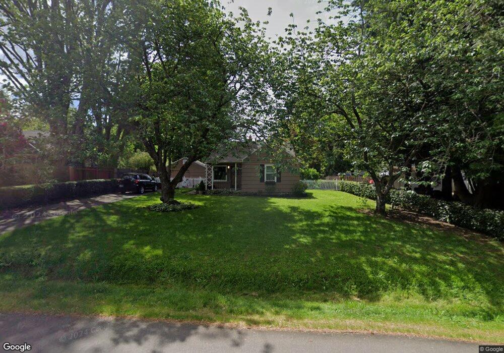
7650 SW Cedarcrest St Portland, OR 97223
Estimated Value: $446,000 - $593,000
2
Beds
2
Baths
734
Sq Ft
$691/Sq Ft
Est. Value
About This Home
This home is located at 7650 SW Cedarcrest St, Portland, OR 97223 and is currently estimated at $507,291, approximately $691 per square foot. 7650 SW Cedarcrest St is a home located in Washington County with nearby schools including Metzger Elementary School, Thomas R. Fowler Middle School, and Tigard High School.
Ownership History
Date
Name
Owned For
Owner Type
Purchase Details
Closed on
Oct 6, 2025
Sold by
Nunn Ronda Rue
Bought by
Nunn Ronda Rue and Moxiey David Daniel
Current Estimated Value
Purchase Details
Closed on
Jul 8, 2013
Sold by
Nunn William Calvin
Bought by
Nunn Ronda Rue
Purchase Details
Closed on
Aug 21, 2003
Sold by
Nunn William C and Nunn Ronda R
Bought by
Nunn William C and Nunn Ronda R
Home Financials for this Owner
Home Financials are based on the most recent Mortgage that was taken out on this home.
Original Mortgage
$105,600
Interest Rate
5.46%
Mortgage Type
Unknown
Create a Home Valuation Report for This Property
The Home Valuation Report is an in-depth analysis detailing your home's value as well as a comparison with similar homes in the area
Home Values in the Area
Average Home Value in this Area
Purchase History
| Date | Buyer | Sale Price | Title Company |
|---|---|---|---|
| Nunn Ronda Rue | -- | None Listed On Document | |
| Nunn Ronda Rue | -- | None Available | |
| Nunn William C | -- | Ticor Title Insurance Compan | |
| Nunn William C | -- | Ticor Title |
Source: Public Records
Mortgage History
| Date | Status | Borrower | Loan Amount |
|---|---|---|---|
| Previous Owner | Nunn William C | $105,600 |
Source: Public Records
Tax History Compared to Growth
Tax History
| Year | Tax Paid | Tax Assessment Tax Assessment Total Assessment is a certain percentage of the fair market value that is determined by local assessors to be the total taxable value of land and additions on the property. | Land | Improvement |
|---|---|---|---|---|
| 2026 | $2,762 | $176,780 | -- | -- |
| 2025 | $2,762 | $171,640 | -- | -- |
| 2024 | $2,668 | $166,650 | -- | -- |
| 2023 | $2,668 | $161,800 | $0 | $0 |
| 2022 | $2,558 | $161,800 | $0 | $0 |
| 2021 | $2,498 | $152,520 | $0 | $0 |
| 2020 | $2,424 | $148,080 | $0 | $0 |
| 2019 | $2,374 | $143,770 | $0 | $0 |
| 2018 | $2,267 | $139,590 | $0 | $0 |
| 2017 | $2,183 | $135,530 | $0 | $0 |
| 2016 | $2,078 | $131,590 | $0 | $0 |
| 2015 | $2,000 | $127,760 | $0 | $0 |
| 2014 | $1,938 | $124,040 | $0 | $0 |
Source: Public Records
Map
Nearby Homes
- 7849 SW Birch St
- 7480 SW Taylors Ferry Rd
- 7830 SW Hemlock St
- 8925 SW 80th Ave
- 7080 SW Taylors Ferry Rd
- 9335 SW 69th Ave
- 10022 SW 72nd Ave
- 8770 SW 71st Place
- 10125 SW 72nd Ave
- 7402 SW Locust St
- 6985 SW Florence Ln
- 9825 SW Ventura Ct
- 7375 SW Ashdale Dr
- 10010 SW Hall Blvd Unit 5
- 10200 SW 70th Ave
- 7705 SW Alden St
- 10534 SW 80th Ave
- 6551 SW Taylors Ferry Rd
- 6512 SW Taylors Ferry Rd
- 8815 SW Oleson Rd
- 7640 SW Cedarcrest St
- 7670 SW Cedarcrest St
- 9400 SW 77th Ave
- 9430 SW 77th Ave
- 7630 SW Cedarcrest St
- 7655 SW Chestnut St
- 7655 SW Cedarcrest St
- 7621 SW Chestnut St
- 9288 SW 77th Ave
- 7645 SW Cedarcrest St
- 7710 SW Cedarcrest St
- 9417 SW 77th Ave
- 7620 SW Cedarcrest St
- 9450 SW 77th Ave
- 7619 SW Chestnut St
- 7625 SW Cedarcrest St
- 9425 SW 77th Ave
- 9266 SW 77th Ave
- 7735 SW Cedarcrest St
- 7715 SW Chestnut St