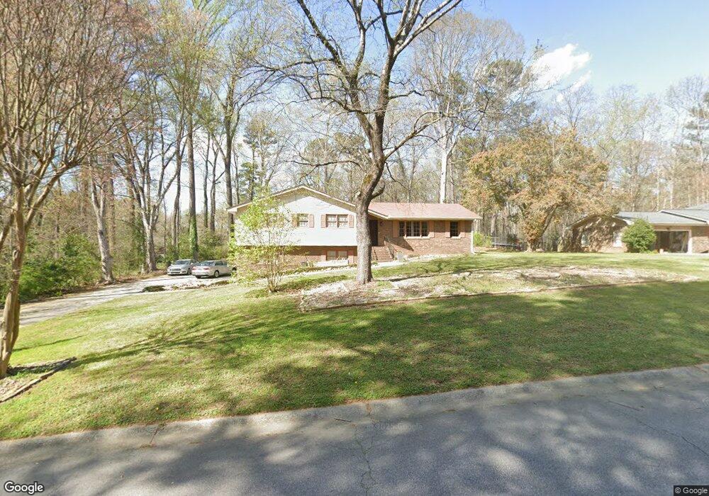
7653 Morant Dr Jonesboro, GA 30236
Estimated Value: $237,471 - $326,000
4
Beds
2
Baths
1,924
Sq Ft
$146/Sq Ft
Est. Value
About This Home
This home is located at 7653 Morant Dr, Jonesboro, GA 30236 and is currently estimated at $281,736, approximately $146 per square foot. 7653 Morant Dr is a home located in Clayton County with nearby schools including James Jackson Elementary School, M. D. Roberts Middle School, and Mount Zion High School.
Ownership History
Date
Name
Owned For
Owner Type
Purchase Details
Closed on
Dec 20, 2023
Sold by
Mcgee Churon L
Bought by
Mcgee Amadi Z
Current Estimated Value
Home Financials for this Owner
Home Financials are based on the most recent Mortgage that was taken out on this home.
Original Mortgage
$244,200
Outstanding Balance
$239,891
Interest Rate
7.44%
Mortgage Type
FHA
Estimated Equity
$41,845
Purchase Details
Closed on
Jun 22, 2017
Sold by
Mcgee Amadi Z
Bought by
Mcgee Amadi Z and Mcgee Churon L
Home Financials for this Owner
Home Financials are based on the most recent Mortgage that was taken out on this home.
Original Mortgage
$134,518
Interest Rate
4.75%
Mortgage Type
FHA
Purchase Details
Closed on
May 3, 2017
Sold by
Paulk Jerry
Bought by
Mcgee Amadi Z
Home Financials for this Owner
Home Financials are based on the most recent Mortgage that was taken out on this home.
Original Mortgage
$134,518
Interest Rate
4.75%
Mortgage Type
FHA
Purchase Details
Closed on
Aug 5, 2008
Sold by
Smith Billy J
Bought by
Paulk Jerry
Purchase Details
Closed on
Dec 26, 2001
Sold by
Maughon Jacqueline
Bought by
Smith Billy Joe
Create a Home Valuation Report for This Property
The Home Valuation Report is an in-depth analysis detailing your home's value as well as a comparison with similar homes in the area
Home Values in the Area
Average Home Value in this Area
Purchase History
| Date | Buyer | Sale Price | Title Company |
|---|---|---|---|
| Mcgee Amadi Z | -- | -- | |
| Mcgee Amadi Z | -- | -- | |
| Mcgee Amadi Z | $137,000 | -- | |
| Paulk Jerry | $170,000 | -- | |
| Smith Billy Joe | -- | -- |
Source: Public Records
Mortgage History
| Date | Status | Borrower | Loan Amount |
|---|---|---|---|
| Open | Mcgee Amadi Z | $244,200 | |
| Previous Owner | Mcgee Amadi Z | $134,518 |
Source: Public Records
Tax History Compared to Growth
Tax History
| Year | Tax Paid | Tax Assessment Tax Assessment Total Assessment is a certain percentage of the fair market value that is determined by local assessors to be the total taxable value of land and additions on the property. | Land | Improvement |
|---|---|---|---|---|
| 2024 | $2,735 | $79,200 | $9,600 | $69,600 |
| 2023 | $1,921 | $80,240 | $9,600 | $70,640 |
| 2022 | $2,668 | $77,080 | $9,600 | $67,480 |
| 2021 | $2,225 | $65,440 | $9,600 | $55,840 |
| 2020 | $2,098 | $61,570 | $9,600 | $51,970 |
| 2019 | $1,939 | $56,906 | $9,600 | $47,306 |
| 2018 | $1,854 | $54,800 | $9,600 | $45,200 |
| 2017 | $2,302 | $55,720 | $9,600 | $46,120 |
| 2016 | $1,897 | $45,754 | $9,600 | $36,154 |
| 2015 | $1,885 | $0 | $0 | $0 |
| 2014 | $1,427 | $35,000 | $9,600 | $25,400 |
Source: Public Records
Map
Nearby Homes
- 2884 Kevin Ln Unit 2
- 2919 Cushing Ct Unit 2
- 7719 Glen Devon Rd
- 2809 Highway 138 E
- 277 Epping St
- 277 Epping St Unit 79
- 273 Epping St Unit 80
- 7595 Teton Ct
- 269 Epping St Unit 81
- 269 Epping St
- 253 Epping St
- 253 Epping St Unit 85
- 2846 Highway 138 E
- 241 Epping St Unit 88
- 241 Epping St
- 228 Epping St Unit 8
- 216 Eping St
- Edmund 4 Bedroom Plan at Reeves Park
- Edmund Plan at Reeves Park
- 7436 Fielder Rd
- 7653 Morant Dr Unit 17
- 7657 Morant Dr
- 7649 Morant Dr
- 2931 Kevin Ln Unit 2
- 2923 Kevin Ln Unit 2
- 7686 Morant Dr
- 7661 Morant Dr
- 2915 Kevin Ln
- 7645 Ciboney Dr Unit 2
- 7681 Morant Dr
- 7649 Ciboney Dr
- 2907 Kevin Ln
- 7687 Tyra Cove
- 7698 Tyra Cove Unit 18
- 7698 Tyra Cove
- 2932 Kevin Ln
- 7665 Morant Dr
- 2924 Kevin Ln Unit 2
- 7637 Ciboney Dr
- 2899 Kevin Ln