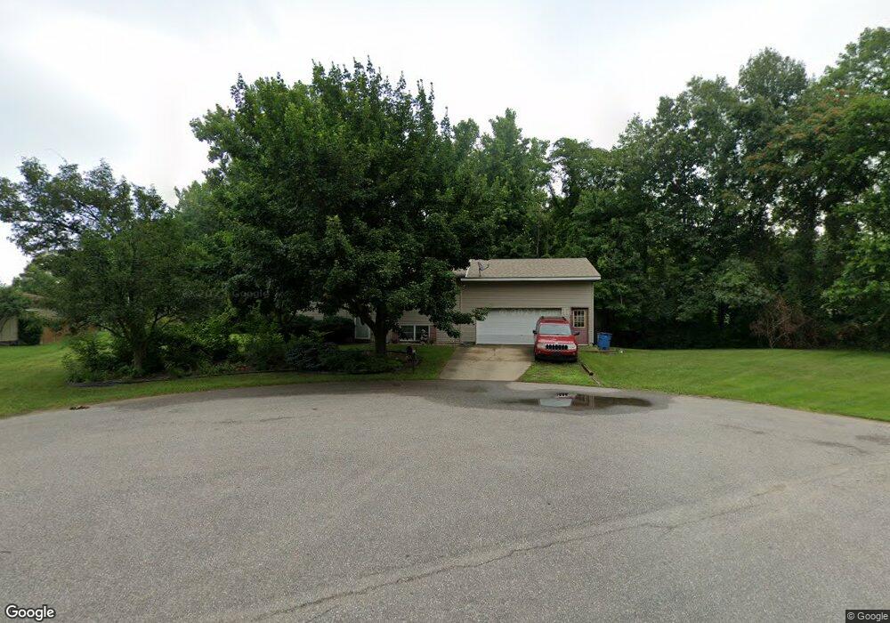
7655 N Brookside Ct Michigan City, IN 46360
Estimated Value: $240,000 - $262,000
3
Beds
2
Baths
1,632
Sq Ft
$152/Sq Ft
Est. Value
About This Home
This home is located at 7655 N Brookside Ct, Michigan City, IN 46360 and is currently estimated at $247,626, approximately $151 per square foot. 7655 N Brookside Ct is a home located in LaPorte County with nearby schools including Edgewood Elementary School, Barker Middle School, and Michigan City High School.
Ownership History
Date
Name
Owned For
Owner Type
Purchase Details
Closed on
May 26, 2023
Sold by
Sofranko Anthony
Bought by
Swain Trent
Current Estimated Value
Home Financials for this Owner
Home Financials are based on the most recent Mortgage that was taken out on this home.
Original Mortgage
$150,750
Outstanding Balance
$146,719
Interest Rate
6.39%
Mortgage Type
New Conventional
Estimated Equity
$100,907
Purchase Details
Closed on
Dec 5, 2022
Sold by
Sofranko George R
Bought by
Sofranko Anthony
Create a Home Valuation Report for This Property
The Home Valuation Report is an in-depth analysis detailing your home's value as well as a comparison with similar homes in the area
Home Values in the Area
Average Home Value in this Area
Purchase History
| Date | Buyer | Sale Price | Title Company |
|---|---|---|---|
| Swain Trent | $201,000 | First American Title | |
| Sofranko Anthony | -- | -- |
Source: Public Records
Mortgage History
| Date | Status | Borrower | Loan Amount |
|---|---|---|---|
| Open | Swain Trent | $150,750 |
Source: Public Records
Tax History Compared to Growth
Tax History
| Year | Tax Paid | Tax Assessment Tax Assessment Total Assessment is a certain percentage of the fair market value that is determined by local assessors to be the total taxable value of land and additions on the property. | Land | Improvement |
|---|---|---|---|---|
| 2024 | $2,957 | $170,300 | $30,300 | $140,000 |
| 2022 | $1,183 | $154,400 | $30,300 | $124,100 |
| 2021 | $1,081 | $143,900 | $30,300 | $113,600 |
| 2020 | $1,035 | $143,900 | $30,300 | $113,600 |
| 2019 | $965 | $130,700 | $22,800 | $107,900 |
| 2018 | $969 | $130,200 | $22,800 | $107,400 |
| 2017 | $995 | $132,800 | $22,800 | $110,000 |
| 2016 | $764 | $117,100 | $22,800 | $94,300 |
| 2014 | $956 | $128,500 | $17,100 | $111,400 |
Source: Public Records
Map
Nearby Homes
- 7232 W Lynwood Dr
- 4554 N Wozniak Rd
- 4851 Clover Ln
- 7395 W Johnson Rd
- 404 Cricket Ln
- 8343 W Pahs Rd
- 520 Johnson Rd
- 613 Dogwood Dr
- 617 Black Oak Dr
- 419 Spruce Dr
- 0 Meer Rd Unit NRA828411
- 0 E Hwy 212 Unit NRA826868
- 0 N County Line Rd Unit NRA824227
- 0 W 400 N Unit NRA818882
- 0 California St Unit NRA818181
- 0 Connecticut Ave Unit NRA815022
- 0 Lakeshore Dr Unit NRA805240
- 0 Ohio St Unit GNR541963
- 0 Springland Ave Unit 529316
- 0 W Highway 20 Unit NRA803069
- 4955 N Brookside Dr
- 4888 N Johnson Rd
- 4977 N Brookside Dr
- 7656 N Brookside Ct
- 4974 N Johnson Rd
- 7678 N Brookside Ct
- 4904 N Johnson Rd
- 4995 N Brookside Dr
- 7652 W Pahs Rd
- 4906 N Johnson Rd
- 7645 W Glenbrook Dr
- 4909 N Brookside Dr
- 7667 W Glenbrook Dr
- 4954 N Brookside Dr
- 4951 N Johnson Rd
- 4976 N Brookside Dr
- 4932 N Brookside Dr
- 4996 N Brookside Dr
- 4935 N Johnson Rd
- 4973 N Johnson Rd