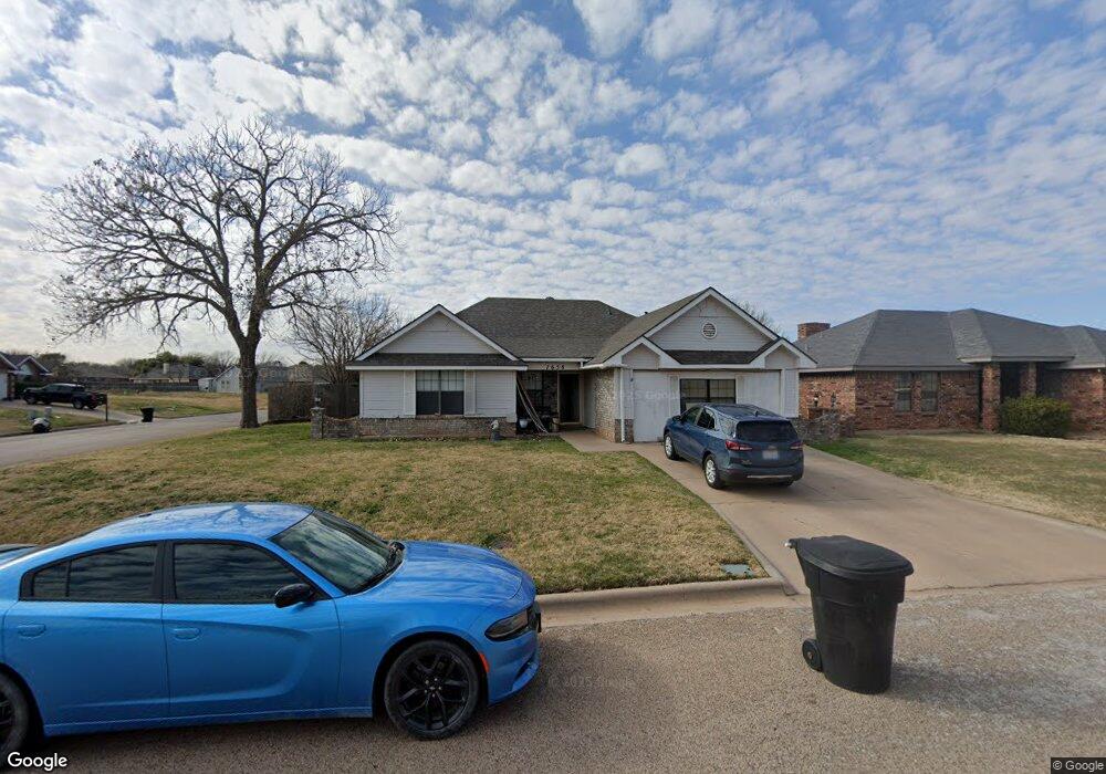
7658 Patricia Ln Abilene, TX 79606
Far Southside NeighborhoodEstimated Value: $229,919 - $257,000
3
Beds
2
Baths
1,697
Sq Ft
$145/Sq Ft
Est. Value
About This Home
This home is located at 7658 Patricia Ln, Abilene, TX 79606 and is currently estimated at $245,980, approximately $144 per square foot. 7658 Patricia Ln is a home located in Taylor County with nearby schools including Wylie West Early Childhood Center, Wylie West Intermediate School, and Wylie West Elementary School.
Ownership History
Date
Name
Owned For
Owner Type
Purchase Details
Closed on
Dec 18, 2023
Sold by
Terbush Leslie Ann
Bought by
Terbush Edwin Leslie
Current Estimated Value
Purchase Details
Closed on
Dec 16, 2014
Sold by
Rowan Justin and Rowan Kara
Bought by
Terbush Edwin and Terbush Leslie Ann
Purchase Details
Closed on
Dec 22, 2011
Sold by
Torres Ricardo and Torres Yesenia
Bought by
Rowan Justin and Rowan Kara
Home Financials for this Owner
Home Financials are based on the most recent Mortgage that was taken out on this home.
Original Mortgage
$112,084
Interest Rate
3.75%
Mortgage Type
FHA
Create a Home Valuation Report for This Property
The Home Valuation Report is an in-depth analysis detailing your home's value as well as a comparison with similar homes in the area
Home Values in the Area
Average Home Value in this Area
Purchase History
| Date | Buyer | Sale Price | Title Company |
|---|---|---|---|
| Terbush Edwin Leslie | -- | None Listed On Document | |
| Terbush Edwin | -- | None Available | |
| Rowan Justin | -- | None Available |
Source: Public Records
Mortgage History
| Date | Status | Borrower | Loan Amount |
|---|---|---|---|
| Previous Owner | Rowan Justin | $112,084 |
Source: Public Records
Tax History Compared to Growth
Tax History
| Year | Tax Paid | Tax Assessment Tax Assessment Total Assessment is a certain percentage of the fair market value that is determined by local assessors to be the total taxable value of land and additions on the property. | Land | Improvement |
|---|---|---|---|---|
| 2025 | $5,271 | $221,948 | $26,989 | $194,959 |
| 2023 | $5,271 | $203,419 | $13,709 | $189,710 |
| 2022 | $4,138 | $175,374 | $13,709 | $161,665 |
| 2021 | $3,900 | $151,407 | $13,709 | $137,698 |
| 2020 | $3,645 | $139,193 | $13,709 | $125,484 |
| 2019 | $3,626 | $134,744 | $11,995 | $122,749 |
| 2018 | $3,344 | $133,586 | $11,995 | $121,591 |
| 2017 | $3,143 | $130,347 | $11,995 | $118,352 |
| 2016 | $2,922 | $121,181 | $11,995 | $109,186 |
| 2015 | $2,329 | $121,123 | $11,995 | $109,128 |
| 2014 | $2,329 | $117,186 | $0 | $0 |
Source: Public Records
Map
Nearby Homes
- 7710 John Carroll Dr
- 3809 Mark Ct
- 7501 White Blvd
- 7967 Bonnie Cir
- 8073 Bonnie Cir
- 7801 Old Forrest Hill Rd
- 4634 Beall Blvd
- 5001 Buffalo Gap Rd
- 6642 Buffalo Gap Rd
- 8201 Cimarron Trail
- 4833 Meadow Dr
- 4410 Sierra Sunset
- 8326 Cimarron Trail
- 3676 Yamini Dr
- 4034 Forrest Hill Rd
- 7717 Vineyard Dr
- 6947 Forrest Meadows Dr
- 7665 Vineyard Dr
- 4658 Vista Del Sol
- 5002 Meadow Dr
- 7650 Patricia Ln
- 7642 Patricia Ln
- 4217 Craig Dr
- 4209 Craig Dr
- 4134 Craig Dr
- 4225 Craig Dr
- 7634 Patricia Ln
- 4201 Craig Dr
- 4133 Chris Dr
- 7625 Thompson Pkwy
- 7633 Thompson Pkwy
- 4133 Craig Dr
- 4126 Craig Dr
- 7626 Patricia Ln
- 7617 Thompson Pkwy
- 4125 Chris Dr
- 4125 Craig Dr
- 4118 Craig Dr
- 7609 Thompson Pw
- 7701 Thompson Pkwy