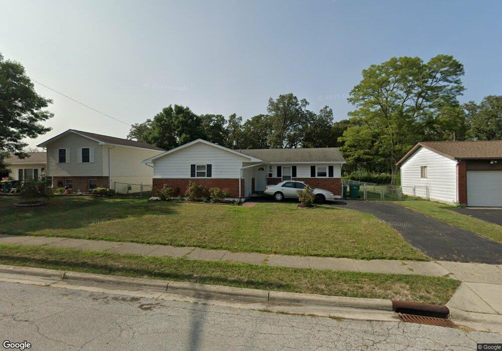
766 Brookdale Dr West Jefferson, OH 43162
Estimated Value: $242,420 - $275,000
3
Beds
2
Baths
1,144
Sq Ft
$226/Sq Ft
Est. Value
About This Home
This home is located at 766 Brookdale Dr, West Jefferson, OH 43162 and is currently estimated at $259,105, approximately $226 per square foot. 766 Brookdale Dr is a home located in Madison County with nearby schools including Norwood Elementary School, West Jefferson Middle School, and West Jefferson High School.
Ownership History
Date
Name
Owned For
Owner Type
Purchase Details
Closed on
Oct 19, 2005
Sold by
Peters Gerald E and Peters Deborah L
Bought by
Bartholomew Allen and Bartholomew Kimberly
Current Estimated Value
Home Financials for this Owner
Home Financials are based on the most recent Mortgage that was taken out on this home.
Original Mortgage
$108,720
Outstanding Balance
$66,614
Interest Rate
8.15%
Mortgage Type
Fannie Mae Freddie Mac
Estimated Equity
$192,491
Purchase Details
Closed on
Apr 26, 2005
Sold by
Schiff Don V and Schiff Carol E
Bought by
Peters Gerald E and Peters Deborah L
Create a Home Valuation Report for This Property
The Home Valuation Report is an in-depth analysis detailing your home's value as well as a comparison with similar homes in the area
Home Values in the Area
Average Home Value in this Area
Purchase History
| Date | Buyer | Sale Price | Title Company |
|---|---|---|---|
| Bartholomew Allen | $135,900 | -- | |
| Peters Gerald E | $78,000 | -- |
Source: Public Records
Mortgage History
| Date | Status | Borrower | Loan Amount |
|---|---|---|---|
| Open | Bartholomew Allen | $108,720 |
Source: Public Records
Tax History Compared to Growth
Tax History
| Year | Tax Paid | Tax Assessment Tax Assessment Total Assessment is a certain percentage of the fair market value that is determined by local assessors to be the total taxable value of land and additions on the property. | Land | Improvement |
|---|---|---|---|---|
| 2024 | $3,211 | $72,620 | $17,340 | $55,280 |
| 2023 | $3,211 | $72,620 | $17,340 | $55,280 |
| 2022 | $2,527 | $53,190 | $12,770 | $40,420 |
| 2021 | $2,537 | $53,190 | $12,770 | $40,420 |
| 2020 | $2,582 | $53,190 | $12,770 | $40,420 |
| 2019 | $2,240 | $45,440 | $11,420 | $34,020 |
| 2018 | $2,083 | $45,440 | $11,420 | $34,020 |
| 2017 | $2,086 | $45,440 | $11,420 | $34,020 |
| 2016 | $1,699 | $36,280 | $11,420 | $24,860 |
| 2015 | $1,772 | $36,280 | $11,420 | $24,860 |
| 2014 | $1,772 | $36,280 | $11,420 | $24,860 |
| 2013 | -- | $41,150 | $11,390 | $29,760 |
Source: Public Records
Map
Nearby Homes
- 908 Kingsdale Ct
- 555 Kirkwood Dr
- 277 Hathaway Rd
- 1000 W Main St Unit Lot 13
- 0 W Jeff Kiousville Rd Unit 225000725
- 304 Middle Dr
- 106 Kings Way Unit 4
- 283 Madison Dr N
- 248 London Rd
- 22 N Franklin St
- 200 Smith St
- 74 S Chester St
- 545 Trillium Dr
- 125 Dogwood Ct
- 312 Larkspur Dr
- 1615 Olmstead Rd
- 430 Trillium Dr
- 270 State Route 142 NE
- 1890 Wilson Rd SE
- 360 State Route 142 NE
- 758 Brookdale Dr
- 774 Brookdale Dr
- 750 Brookdale Dr
- 782 Brookdale Dr
- 765 Brookdale Dr
- 769 Brookdale Dr
- 759 Brookdale Dr
- 744 Brookdale Dr
- 790 Brookdale Dr
- 777 Brookdale Dr
- 751 Brookdale Dr
- 785 Brookdale Dr
- 800 Brookdale Dr
- 730 Brookdale Dr
- 139 Inwood Rd
- 795 Brookdale Dr
- 756 Crescent Dr
- 764 Crescent Dr
- 731 Brookdale Dr
- 750 Crescent Dr