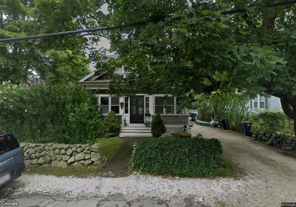
766 Dartmouth St South Dartmouth, MA 02748
Dartmouth Community Park NeighborhoodEstimated Value: $531,000 - $851,000
3
Beds
2
Baths
2,044
Sq Ft
$313/Sq Ft
Est. Value
About This Home
This home is located at 766 Dartmouth St, South Dartmouth, MA 02748 and is currently estimated at $639,595, approximately $312 per square foot. 766 Dartmouth St is a home located in Bristol County with nearby schools including Dartmouth High School and St. Teresa of Calcutta School.
Ownership History
Date
Name
Owned For
Owner Type
Purchase Details
Closed on
Aug 14, 2000
Sold by
Machado Robert A and Machado Jeanne E
Bought by
Miller Mark E and Miller Nancy S
Current Estimated Value
Create a Home Valuation Report for This Property
The Home Valuation Report is an in-depth analysis detailing your home's value as well as a comparison with similar homes in the area
Home Values in the Area
Average Home Value in this Area
Purchase History
| Date | Buyer | Sale Price | Title Company |
|---|---|---|---|
| Miller Mark E | $171,600 | -- |
Source: Public Records
Mortgage History
| Date | Status | Borrower | Loan Amount |
|---|---|---|---|
| Open | Miller Mark E | $83,000 | |
| Closed | Miller Mark E | $76,000 |
Source: Public Records
Tax History Compared to Growth
Tax History
| Year | Tax Paid | Tax Assessment Tax Assessment Total Assessment is a certain percentage of the fair market value that is determined by local assessors to be the total taxable value of land and additions on the property. | Land | Improvement |
|---|---|---|---|---|
| 2025 | $3,882 | $450,900 | $172,900 | $278,000 |
| 2024 | $3,706 | $426,500 | $172,900 | $253,600 |
| 2023 | $3,732 | $407,000 | $172,900 | $234,100 |
| 2022 | $3,449 | $348,400 | $155,000 | $193,400 |
| 2021 | $3,156 | $304,600 | $133,100 | $171,500 |
| 2020 | $3,086 | $297,300 | $133,100 | $164,200 |
| 2019 | $2,997 | $288,200 | $133,100 | $155,100 |
| 2018 | $2,680 | $272,100 | $125,000 | $147,100 |
| 2017 | $2,941 | $293,500 | $144,100 | $149,400 |
| 2016 | $2,562 | $252,200 | $119,000 | $133,200 |
| 2015 | $2,592 | $255,600 | $120,400 | $135,200 |
| 2014 | $2,647 | $259,300 | $126,800 | $132,500 |
Source: Public Records
Map
Nearby Homes
- 768 Dartmouth St
- 764 Dartmouth St
- 7 Clover St
- 110 Rockland St
- 108 Rockland St
- 108 Rockland St Unit 2
- 772 Dartmouth St
- 769 Dartmouth St
- 114 Rockland St
- 771 Dartmouth St
- 111 Rockland St
- 10 Clover St
- 71 Bush St
- 109 Rockland St
- 774 Dartmouth St
- 102 Rockland St
- 773 Dartmouth St
- 67 Bush St
- 100 Rockland St
- 107 Rockland St