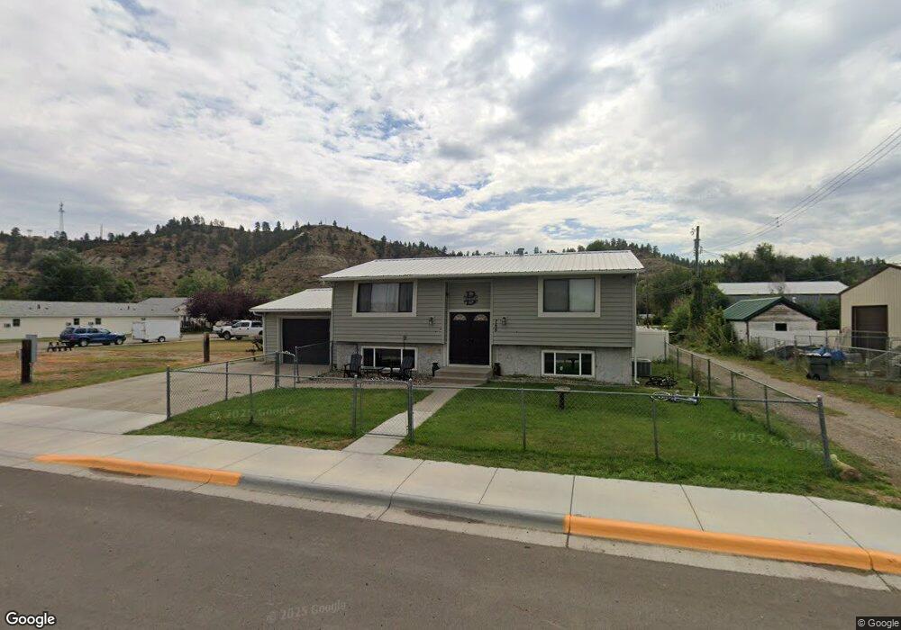
766 Front St Forsyth, MT 59327
Estimated Value: $195,000 - $217,945
About This Home
This home is located at 766 Front St, Forsyth, MT 59327 and is currently estimated at $206,986, approximately $209 per square foot. 766 Front St is a home with nearby schools including Forsyth Elementary School, Forsyth Junior High School, and Forsyth High School.
Ownership History
We collect this data history from publicly available records. To have your information removed, we recommend requesting removal directly through your county’s website.
Purchase Details
Home Financials for this Owner
Home Financials are based on the most recent Mortgage that was taken out on this home.Purchase History
We collect this data history from publicly available records. To have your information removed, we recommend requesting removal directly through your county’s website.
| Date | Buyer | Sale Price | Title Company |
|---|---|---|---|
| -- | First American Title Company | ||
| $123,962 | First American Title |
Mortgage History
We collect this data history from publicly available records. To have your information removed, we recommend requesting removal directly through your county’s website.
| Date | Status | Borrower | Loan Amount |
|---|---|---|---|
| Open | $122,735 |
Tax History
We collect this data history from publicly available records. To have your information removed, we recommend requesting removal directly through your county’s website.
| Year | Tax Paid | Tax Assessment Tax Assessment Total Assessment is a certain percentage of the fair market value that is determined by local assessors to be the total taxable value of land and additions on the property. | Land | Improvement |
|---|---|---|---|---|
| 2025 | $1,514 | $165,900 | $0 | $0 |
| 2024 | $1,912 | $145,200 | $0 | $0 |
| 2023 | $1,682 | $145,200 | $0 | $0 |
| 2022 | $1,756 | $149,425 | $0 | $0 |
| 2021 | $1,679 | $149,425 | $0 | $0 |
| 2020 | $1,378 | $123,800 | $0 | $0 |
| 2019 | $1,339 | $123,800 | $0 | $0 |
| 2018 | $1,357 | $125,000 | $0 | $0 |
| 2017 | $1,318 | $125,000 | $0 | $0 |
| 2016 | $1,276 | $123,600 | $0 | $0 |
| 2015 | $1,124 | $123,600 | $0 | $0 |
| 2014 | $824 | $51,622 | $0 | $0 |
Map
- 971 & 963 Main
- 325 N 7th Ave
- 1290 Front St
- 390 N 8th Ave
- 210 N 3rd Ave
- 214 N 13th Ave
- 258 N 1st Ave
- 255 Smith Creek Rd
- 26 Kalt Ln S
- TBD Vananda
- 0 Nhn Lone Rock Canyon
- Nhn Lone Rock Canyon Lot: Sc-28
- Lone Rock Canyon Ln
- NHN Lone Rock Canyon
- Lone Rock Canyon Ln
- TBD Lone Rock Canyon Ln Unit SC-25
- TBD Lone Rock Canyon Ln Unit SC-28
- Nhn Lone Rock Canyon Ln
- nhn Lone Rock Canyon Ln
- nhn Lone Rock
Ask me questions while you tour the home.