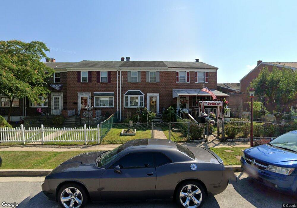
766 Lannerton Rd Middle River, MD 21220
Estimated Value: $196,000 - $221,000
--
Bed
1
Bath
1,080
Sq Ft
$190/Sq Ft
Est. Value
About This Home
This home is located at 766 Lannerton Rd, Middle River, MD 21220 and is currently estimated at $205,164, approximately $189 per square foot. 766 Lannerton Rd is a home located in Baltimore County with nearby schools including Glenmar Elementary School, Middle River Middle School, and Kenwood High.
Ownership History
Date
Name
Owned For
Owner Type
Purchase Details
Closed on
Nov 16, 2007
Sold by
Monnett S Ra K
Bought by
Johnson Sandra K and Johnson Thomas
Current Estimated Value
Purchase Details
Closed on
Jul 20, 2007
Sold by
Monnett S Ra K
Bought by
Johnson Sandra K and Johnson Thomas
Purchase Details
Closed on
Dec 29, 1995
Sold by
Monnett Gerald R
Bought by
Monnett Sandra K
Purchase Details
Closed on
Apr 6, 1988
Sold by
Kurzmiller Kevin
Bought by
Monnett Gerald R
Create a Home Valuation Report for This Property
The Home Valuation Report is an in-depth analysis detailing your home's value as well as a comparison with similar homes in the area
Home Values in the Area
Average Home Value in this Area
Purchase History
| Date | Buyer | Sale Price | Title Company |
|---|---|---|---|
| Johnson Sandra K | -- | -- | |
| Johnson Sandra K | -- | -- | |
| Monnett Sandra K | -- | -- | |
| Monnett Gerald R | $57,000 | -- |
Source: Public Records
Tax History Compared to Growth
Tax History
| Year | Tax Paid | Tax Assessment Tax Assessment Total Assessment is a certain percentage of the fair market value that is determined by local assessors to be the total taxable value of land and additions on the property. | Land | Improvement |
|---|---|---|---|---|
| 2025 | $2,079 | $145,967 | -- | -- |
| 2024 | $2,079 | $131,033 | $0 | $0 |
| 2023 | $1,107 | $116,100 | $39,000 | $77,100 |
| 2022 | $2,064 | $112,467 | $0 | $0 |
| 2021 | $1,811 | $108,833 | $0 | $0 |
| 2020 | $1,811 | $105,200 | $39,000 | $66,200 |
| 2019 | $1,775 | $100,833 | $0 | $0 |
| 2018 | $1,740 | $96,467 | $0 | $0 |
| 2017 | $1,661 | $92,100 | $0 | $0 |
| 2016 | $1,722 | $92,100 | $0 | $0 |
| 2015 | $1,722 | $92,100 | $0 | $0 |
| 2014 | $1,722 | $98,100 | $0 | $0 |
Source: Public Records
Map
Nearby Homes
- 9755 Matzon Rd
- 9899 Decatur Rd
- 9903 Decatur Rd
- 9831 Biggs Rd
- 815 Lowe Rd
- 826 Lowe Rd
- 9703 Biggs Rd
- 719 Macdill Rd
- 54 Chelmsford Ct
- 0 Bird River Rd Unit MDBC2136640
- 71 Chelmsford Ct
- 0 Wampler Rd Unit MDBC2107084
- 561 Compass Rd E
- 9864 Greenbriar Way
- 804 Thimbleberry Rd
- 508 Gloucester Ct
- 9422 Windpine Rd
- 1806 Watermark Way
- 547 Compass Rd E
- 17 Taos Cir
- 764 Lannerton Rd
- 768 Lannerton Rd
- 762 Lannerton Rd
- 760 Lannerton Rd
- 770 Lannerton Rd
- 758 Lannerton Rd
- 772 Lannerton Rd
- 774 Lannerton Rd
- 776 Lannerton Rd
- 778 Lannerton Rd
- 9864 Decatur Rd
- 9866 Decatur Rd
- 9862 Decatur Rd
- 9868 Decatur Rd
- 751 Lannerton Rd
- 9860 Decatur Rd
- 749 Lannerton Rd
- 753 Lannerton Rd
- 747 Lannerton Rd
- 780 Lannerton Rd