Estimated Value: $273,000 - $308,000
3
Beds
2
Baths
1,170
Sq Ft
$241/Sq Ft
Est. Value
About This Home
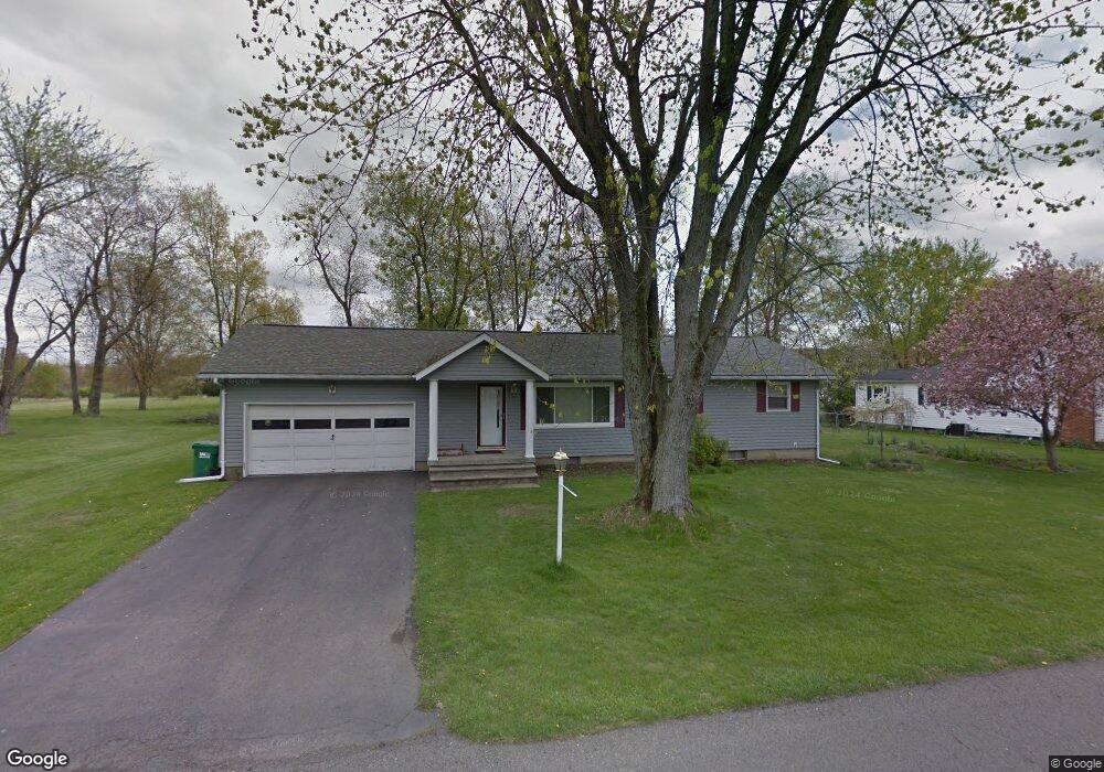
This home is located at 766 Radian Dr, Heath, OH 43056 and is currently estimated at $282,521, approximately $241 per square foot. 766 Radian Dr is a home located in Licking County with nearby schools including Garfield Elementary School, Stevenson Elementary School, and Heath Middle School.
Ownership History
Date
Name
Owned For
Owner Type
Purchase Details
Closed on
Aug 25, 2017
Sold by
Smith Joshua A and Smith Karla A
Bought by
Auflick John and Auflick Victoria
Current Estimated Value
Home Financials for this Owner
Home Financials are based on the most recent Mortgage that was taken out on this home.
Original Mortgage
$154,950
Outstanding Balance
$129,844
Interest Rate
4.03%
Mortgage Type
VA
Estimated Equity
$152,677
Purchase Details
Closed on
Dec 25, 2014
Sold by
Smith Joshua A and Smith Karla A
Bought by
Smith Joshua A and Smith Karla A
Purchase Details
Closed on
Sep 24, 2008
Sold by
Calhoun David E and Calhoun Anna M
Bought by
Smith Joshua A
Home Financials for this Owner
Home Financials are based on the most recent Mortgage that was taken out on this home.
Original Mortgage
$104,000
Interest Rate
6.52%
Mortgage Type
Unknown
Create a Home Valuation Report for This Property
The Home Valuation Report is an in-depth analysis detailing your home's value as well as a comparison with similar homes in the area
Home Values in the Area
Average Home Value in this Area
Purchase History
| Date | Buyer | Sale Price | Title Company |
|---|---|---|---|
| Auflick John | $150,000 | Stewart Title Agency | |
| Smith Joshua A | -- | None Available | |
| Smith Joshua A | $134,000 | Chicago Tit |
Source: Public Records
Mortgage History
| Date | Status | Borrower | Loan Amount |
|---|---|---|---|
| Open | Auflick John | $154,950 | |
| Previous Owner | Smith Joshua A | $104,000 |
Source: Public Records
Tax History Compared to Growth
Tax History
| Year | Tax Paid | Tax Assessment Tax Assessment Total Assessment is a certain percentage of the fair market value that is determined by local assessors to be the total taxable value of land and additions on the property. | Land | Improvement |
|---|---|---|---|---|
| 2024 | $3,147 | $73,150 | $17,640 | $55,510 |
| 2023 | $3,483 | $73,150 | $17,640 | $55,510 |
| 2022 | $2,533 | $46,730 | $12,080 | $34,650 |
| 2021 | $2,585 | $46,730 | $12,080 | $34,650 |
| 2020 | $2,601 | $46,730 | $12,080 | $34,650 |
| 2019 | $2,455 | $44,910 | $13,410 | $31,500 |
| 2018 | $2,482 | $0 | $0 | $0 |
| 2017 | $2,540 | $0 | $0 | $0 |
| 2016 | $2,555 | $0 | $0 | $0 |
| 2015 | $2,598 | $0 | $0 | $0 |
| 2014 | $1,827 | $0 | $0 | $0 |
| 2013 | $2,398 | $0 | $0 | $0 |
Source: Public Records
Map
Nearby Homes
- 878 Oberlin Dr
- 254 Wildwood Ct
- 944 Fieldson Dr
- 243 Fieldpoint Rd
- 875 Terrace Dr
- 101 Fieldpoint Rd
- 91 Fieldpoint Rd
- 536 Partridge Rd
- 224 Walden Rd
- 521 Partridge Rd
- 514 S 30th St
- 381 Laurel Oaks Ln
- 399 Laurel Oaks Ln Unit Lot 131
- 403 Laurel Oaks Ln Unit Lot 132
- 80 Maureen Dr
- 98 Burt Ave
- 79 James Ave
- 229 Heath Rd
- 605 Turning Leaf Ln
- 25 S 24th St