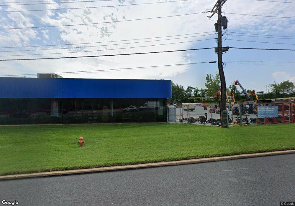
7667 Pulaski Hwy Baltimore, MD 21237
Estimated Value: $4,544,199
--
Bed
--
Bath
20,325
Sq Ft
$224/Sq Ft
Est. Value
About This Home
This home is located at 7667 Pulaski Hwy, Baltimore, MD 21237 and is currently estimated at $4,544,199, approximately $223 per square foot. 7667 Pulaski Hwy is a home located in Baltimore County with nearby schools including Elmwood Elementary School, Golden Ring Middle School, and Overlea High School.
Ownership History
Date
Name
Owned For
Owner Type
Purchase Details
Closed on
May 9, 2022
Sold by
Rosedaleone Llc
Bought by
7667 Pulaski Partners Llc
Current Estimated Value
Purchase Details
Closed on
Apr 26, 2011
Sold by
Moreco Inc
Bought by
Rosedaleone Llc
Purchase Details
Closed on
Apr 7, 2011
Sold by
Moreco Inc
Bought by
Rosedaleone Llc
Purchase Details
Closed on
Sep 16, 1998
Sold by
Wilkie Buick Binmost Corporation
Bought by
Moreco Inc
Purchase Details
Closed on
May 19, 1986
Sold by
General Motors C Orporation
Bought by
Wilkie Buick Binmost Corporation
Create a Home Valuation Report for This Property
The Home Valuation Report is an in-depth analysis detailing your home's value as well as a comparison with similar homes in the area
Home Values in the Area
Average Home Value in this Area
Purchase History
| Date | Buyer | Sale Price | Title Company |
|---|---|---|---|
| 7667 Pulaski Partners Llc | $4,000,000 | Dufour R Alex | |
| Rosedaleone Llc | $1,300,000 | -- | |
| Rosedaleone Llc | $1,300,000 | -- | |
| Moreco Inc | $925,000 | -- | |
| Wilkie Buick Binmost Corporation | $400,000 | -- |
Source: Public Records
Tax History Compared to Growth
Tax History
| Year | Tax Paid | Tax Assessment Tax Assessment Total Assessment is a certain percentage of the fair market value that is determined by local assessors to be the total taxable value of land and additions on the property. | Land | Improvement |
|---|---|---|---|---|
| 2025 | $30,199 | $3,035,967 | -- | -- |
| 2024 | $30,199 | $2,338,533 | $0 | $0 |
| 2023 | $10,935 | $1,641,100 | $954,100 | $687,000 |
| 2022 | $26,534 | $1,620,333 | $0 | $0 |
| 2021 | $20,695 | $1,599,567 | $0 | $0 |
| 2020 | $20,498 | $1,578,800 | $954,100 | $624,700 |
| 2019 | $18,877 | $1,557,533 | $0 | $0 |
| 2018 | $19,511 | $1,536,267 | $0 | $0 |
| 2017 | $20,494 | $1,515,000 | $0 | $0 |
| 2016 | $19,249 | $1,466,733 | $0 | $0 |
| 2015 | $19,249 | $1,418,500 | $0 | $0 |
| 2014 | $19,249 | $1,370,200 | $0 | $0 |
Source: Public Records
Map
Nearby Homes
- 1303 Beatty Ave
- 2000 Longview Ct
- 7932 Philadelphia Rd
- 7848 Oakdale Ave
- 7403 South Rd
- 8020 Old Philadelphia Rd
- 8102 Sumter Ave
- 8003 Woodhaven Rd
- 1217 64th St
- 8100 Old Philadelphia Rd
- 1601 Odell Ave
- 1015 Sumter Ave
- 8029 Duvall Ave
- 0 Sumter Ave
- Lot #133/Lot #134 Sumter Ave
- 8006 Woodhaven Ct
- 2308 Hamiltowne Cir
- 2321 Bluegrass Heights Ct
- 2354 Hamiltowne Cir
- 1535 Rosewick Ave
- 7750 Pulaski Hwy
- 7801 Pulaski Hwy
- 3 Shiphorst Terrace
- 7804 Pulaski Hwy
- 4 Shiphorst Terrace
- 7655 Pulaski Hwy
- 1 Shiphorst Terrace
- 7803 Pulaski Hwy
- 7717 Philadelphia Rd
- 7723 Philadelphia Rd
- 7721 Philadelphia Rd
- 7801 Philadelphia Rd
- 7807 Philadelphia Rd
- 7805 Philadelphia Rd
- 7705 Philadelphia Rd
- 7703 Philadelphia Rd
- 1207 Rosedale Ave
- 7605 Pulaski Hwy
- 7701 Philadelphia Rd