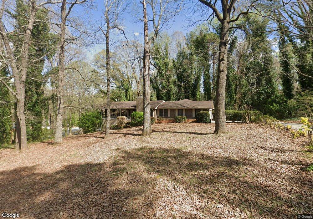
7668 Morant Dr Unit I Jonesboro, GA 30236
Estimated Value: $223,243 - $282,000
3
Beds
3
Baths
1,838
Sq Ft
$140/Sq Ft
Est. Value
About This Home
This home is located at 7668 Morant Dr Unit I, Jonesboro, GA 30236 and is currently estimated at $256,561, approximately $139 per square foot. 7668 Morant Dr Unit I is a home located in Clayton County with nearby schools including James Jackson Elementary School, M. D. Roberts Middle School, and Mount Zion High School.
Ownership History
Date
Name
Owned For
Owner Type
Purchase Details
Closed on
Mar 31, 2000
Sold by
Mcnabb Boyce L and Mcnabb Flora L
Bought by
Way Kenneth L and Way Marilyn C
Current Estimated Value
Home Financials for this Owner
Home Financials are based on the most recent Mortgage that was taken out on this home.
Original Mortgage
$157,900
Outstanding Balance
$52,693
Interest Rate
8.29%
Mortgage Type
VA
Estimated Equity
$203,868
Create a Home Valuation Report for This Property
The Home Valuation Report is an in-depth analysis detailing your home's value as well as a comparison with similar homes in the area
Home Values in the Area
Average Home Value in this Area
Purchase History
| Date | Buyer | Sale Price | Title Company |
|---|---|---|---|
| Way Kenneth L | $157,900 | -- |
Source: Public Records
Mortgage History
| Date | Status | Borrower | Loan Amount |
|---|---|---|---|
| Open | Way Kenneth L | $157,900 |
Source: Public Records
Tax History Compared to Growth
Tax History
| Year | Tax Paid | Tax Assessment Tax Assessment Total Assessment is a certain percentage of the fair market value that is determined by local assessors to be the total taxable value of land and additions on the property. | Land | Improvement |
|---|---|---|---|---|
| 2024 | $3,101 | $88,280 | $9,600 | $78,680 |
| 2023 | $3,231 | $89,480 | $9,600 | $79,880 |
| 2022 | $3,044 | $86,360 | $9,600 | $76,760 |
| 2021 | $2,493 | $71,920 | $9,600 | $62,320 |
| 2020 | $2,276 | $65,720 | $9,600 | $56,120 |
| 2019 | $2,105 | $60,694 | $9,600 | $51,094 |
| 2018 | $2,112 | $60,862 | $9,600 | $51,262 |
| 2017 | $2,008 | $58,181 | $9,600 | $48,581 |
| 2016 | $1,581 | $47,691 | $9,600 | $38,091 |
| 2015 | $1,576 | $0 | $0 | $0 |
| 2014 | $1,528 | $47,210 | $9,600 | $37,610 |
Source: Public Records
Map
Nearby Homes
- 2884 Kevin Ln Unit 2
- 2919 Cushing Ct Unit 2
- 7719 Glen Devon Rd
- 2809 Highway 138 E
- 2846 Highway 138 E
- 7595 Teton Ct
- 277 Epping St
- 277 Epping St Unit 79
- 273 Epping St Unit 80
- 269 Epping St Unit 81
- 269 Epping St
- 253 Epping St
- 253 Epping St Unit 85
- 241 Epping St Unit 88
- 241 Epping St
- 7436 Fielder Rd
- 228 Epping St Unit 8
- 733 Berkeley Dr
- 732 Berkeley Dr
- 717 Berkeley Dr
- 7664 Morant Dr
- 7704 Morant Dr Unit 1
- 7689 Morant Dr
- 7687 Tyra Cove
- 7669 Morant Dr
- 7703 Tyra Cove
- 7716 Morant Dr Unit 1
- 7701 Morant Dr
- 7665 Morant Dr
- 7677 Morant Dr Unit 1
- 7715 Tyra Cove
- 7713 Morant Dr
- 7661 Morant Dr
- 7673 Morant Dr
- 0 Tyra Cove Unit 7121993
- 0 Tyra Cove Unit 8353574
- 0 Tyra Cove Unit 8328743
- 0 Tyra Cove Unit 8035847
- 0 Tyra Cove Unit 3264425
- 7728 Morant Dr