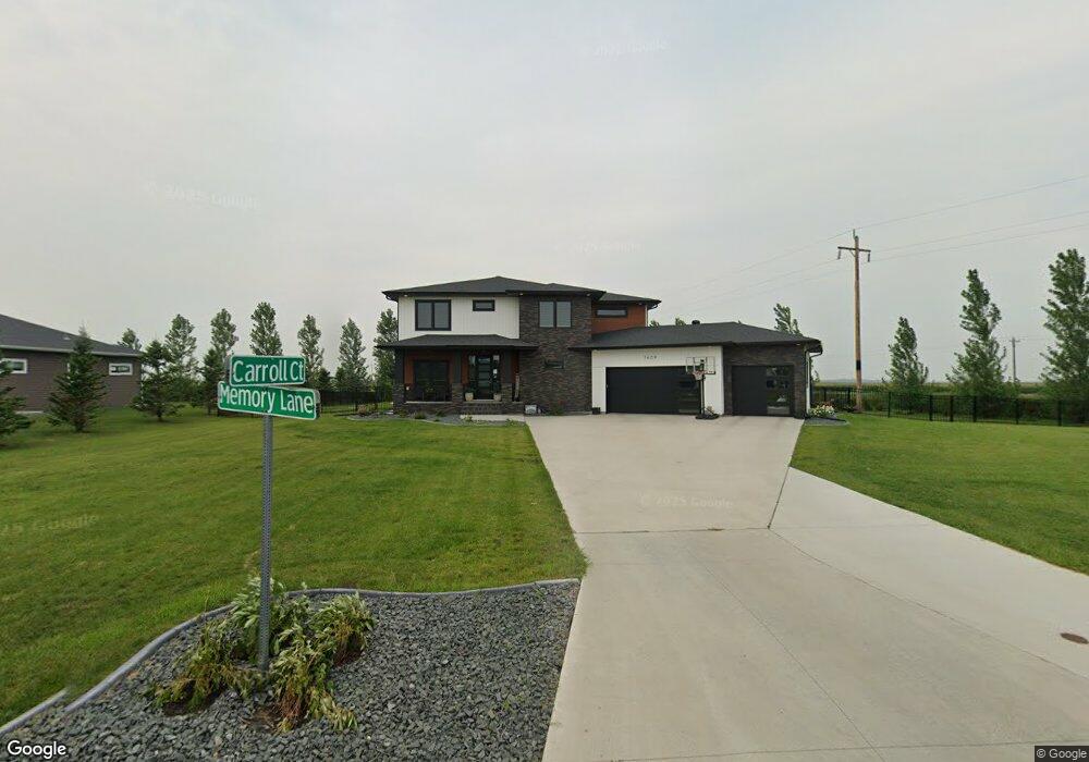
7669 Memory Ln Horace, ND 58047
Estimated Value: $594,000 - $1,025,191
5
Beds
--
Bath
2,765
Sq Ft
$317/Sq Ft
Est. Value
About This Home
This home is located at 7669 Memory Ln, Horace, ND 58047 and is currently estimated at $876,064, approximately $316 per square foot. 7669 Memory Ln is a home located in Cass County with nearby schools including Horace Elementary School, Liberty Middle School, and West Fargo Sheyenne High School.
Ownership History
Date
Name
Owned For
Owner Type
Purchase Details
Closed on
Feb 11, 2022
Sold by
Titan Homes Inc
Bought by
Green Lakin S and Green Bruce V
Current Estimated Value
Home Financials for this Owner
Home Financials are based on the most recent Mortgage that was taken out on this home.
Original Mortgage
$648,000
Outstanding Balance
$597,184
Interest Rate
3.56%
Mortgage Type
New Conventional
Estimated Equity
$278,880
Purchase Details
Closed on
May 1, 2014
Sold by
Hoffman Gary G and Western Trust Co
Bought by
Constellation Development Llc
Create a Home Valuation Report for This Property
The Home Valuation Report is an in-depth analysis detailing your home's value as well as a comparison with similar homes in the area
Home Values in the Area
Average Home Value in this Area
Purchase History
| Date | Buyer | Sale Price | Title Company |
|---|---|---|---|
| Green Lakin S | -- | New Title Company Name | |
| Green Lakin S | $831,690 | New Title Company Name | |
| Constellation Development Llc | -- | Trn Abstract And Title |
Source: Public Records
Mortgage History
| Date | Status | Borrower | Loan Amount |
|---|---|---|---|
| Open | Green Lakin S | $648,000 | |
| Closed | Green Lakin S | $648,000 |
Source: Public Records
Tax History
| Year | Tax Paid | Tax Assessment Tax Assessment Total Assessment is a certain percentage of the fair market value that is determined by local assessors to be the total taxable value of land and additions on the property. | Land | Improvement |
|---|---|---|---|---|
| 2024 | $13,523 | $363,750 | $63,450 | $300,300 |
| 2023 | $13,722 | $354,500 | $63,450 | $291,050 |
| 2022 | $13,580 | $333,600 | $50,600 | $283,000 |
| 2021 | $5,906 | $35,400 | $35,400 | $0 |
| 2020 | $6,253 | $35,400 | $35,400 | $0 |
| 2019 | $5,957 | $38,350 | $38,350 | $0 |
| 2018 | $5,913 | $38,350 | $38,350 | $0 |
| 2017 | $5,121 | $6,300 | $6,300 | $0 |
| 2016 | $5,350 | $6,100 | $6,100 | $0 |
| 2015 | $5,348 | $5,650 | $5,650 | $0 |
| 2014 | $117 | $5,500 | $5,500 | $0 |
Source: Public Records
Map
Nearby Homes
- 7634 Whitman Dr
- 7628 Whitman Dr
- 7640 Whitman Dr
- 7622 Whitman Dr
- 7646 Whitman Dr
- 7616 Whitman Dr
- 7615 Whitman Dr
- 7652 Whitman Dr
- 7610 Whitman Dr
- 7609 Whitman Dr
- 7658 Whitman Dr
- 7621 Whitman Dr
- 7604 Whitman Dr
- 7603 Whitman Dr
- 7664 Whitman Dr
- 7627 Whitman Dr
- 7670 Whitman Dr
- 7633 Whitman Dr
- 7639 Whitman Dr
- 7676 Whitman Dr
- 7613 Memory Ln
- 7616 Carroll Ct
- 7601 Carroll Ct
- 7617 Memory Ln
- 7610 Carroll Ct
- 7603 Carroll Ct
- 7608 Carroll Ct
- 7620 Memory Ln
- 7609 Memory Ln
- 7633 Aquarius Ct
- 7627 Aquarius Ct
- 7624 Memory Ln
- 7637 Aquarius Ct
- 7625 Shadow Ln
- 7621 Shadow Ln
- L6,B1 Shadow Ln
- L7,B1 Shadow Ln
- 7430 Maple Cir
- 7644 Aquarius Ct
- 7628 Memory Ln
Your Personal Tour Guide
Ask me questions while you tour the home.