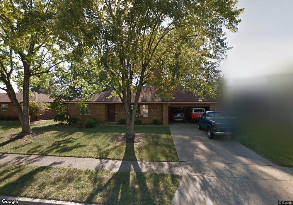
767 Browning Ave Englewood, OH 45322
Estimated Value: $224,000 - $245,000
3
Beds
2
Baths
1,672
Sq Ft
$140/Sq Ft
Est. Value
About This Home
This home is located at 767 Browning Ave, Englewood, OH 45322 and is currently estimated at $233,891, approximately $139 per square foot. 767 Browning Ave is a home located in Montgomery County with nearby schools including Northmont High School, Trotwood Preparatory & Fitness Academy, and Mother Brunner Catholic School.
Ownership History
Date
Name
Owned For
Owner Type
Purchase Details
Closed on
Nov 12, 2020
Sold by
Roll Zachary C and Roll Tami A
Bought by
Smith Kanysha Lynnette
Current Estimated Value
Home Financials for this Owner
Home Financials are based on the most recent Mortgage that was taken out on this home.
Original Mortgage
$141,391
Interest Rate
2.7%
Mortgage Type
FHA
Purchase Details
Closed on
Nov 13, 2009
Sold by
Shellabarger Anna T
Bought by
Roll Zachary C and Klenke Tami A
Home Financials for this Owner
Home Financials are based on the most recent Mortgage that was taken out on this home.
Original Mortgage
$97,650
Interest Rate
4.9%
Mortgage Type
New Conventional
Create a Home Valuation Report for This Property
The Home Valuation Report is an in-depth analysis detailing your home's value as well as a comparison with similar homes in the area
Home Values in the Area
Average Home Value in this Area
Purchase History
| Date | Buyer | Sale Price | Title Company |
|---|---|---|---|
| Smith Kanysha Lynnette | $144,000 | Vantage Land Title | |
| Roll Zachary C | $108,500 | Attorney |
Source: Public Records
Mortgage History
| Date | Status | Borrower | Loan Amount |
|---|---|---|---|
| Previous Owner | Smith Kanysha Lynnette | $141,391 | |
| Previous Owner | Roll Zachary C | $97,650 |
Source: Public Records
Tax History Compared to Growth
Tax History
| Year | Tax Paid | Tax Assessment Tax Assessment Total Assessment is a certain percentage of the fair market value that is determined by local assessors to be the total taxable value of land and additions on the property. | Land | Improvement |
|---|---|---|---|---|
| 2024 | $3,725 | $65,340 | $9,580 | $55,760 |
| 2023 | $3,725 | $65,340 | $9,580 | $55,760 |
| 2022 | $3,403 | $45,940 | $6,740 | $39,200 |
| 2021 | $3,413 | $45,940 | $6,740 | $39,200 |
| 2020 | $3,349 | $45,940 | $6,740 | $39,200 |
| 2019 | $2,946 | $36,190 | $7,760 | $28,430 |
| 2018 | $2,892 | $36,190 | $7,760 | $28,430 |
| 2017 | $2,872 | $36,190 | $7,760 | $28,430 |
| 2016 | $2,767 | $34,250 | $6,740 | $27,510 |
| 2015 | $2,530 | $34,250 | $6,740 | $27,510 |
| 2014 | $2,530 | $34,250 | $6,740 | $27,510 |
| 2012 | -- | $38,370 | $7,440 | $30,930 |
Source: Public Records
Map
Nearby Homes
- 534 Unger Ave
- 108 Denwood Trail
- 510 Rohr Ln
- 306 Pauly Dr
- 206 Lodestone Dr
- 830 W Wenger Rd
- 206 Gardengrove Way
- 803 Albert St
- 4245 W Wenger Rd
- 109 Silverstone Dr
- 104 Silverstone Dr
- 510 Lambert Ln
- 900 Moonlight Dr
- 800 Sipos Cir
- 607 Albert St
- 505 Durst Dr
- 108 Tate Ave
- 208 S Walnut St
- 250 Winter Creek Ct
- 881 Sunset Dr
- 765 Browning Ave
- 769 Browning Ave
- 763 Browning Ave
- 766 Browning Ave
- 768 Browning Ave
- 771 Browning Ave
- 764 Browning Ave
- 770 Browning Ave
- 761 Browning Ave
- 762 Browning Ave
- 548 Unger Ave
- 546 Unger Ave
- 550 Unger Ave
- 772 Browning Ave
- 773 Browning Ave
- 544 Unger Ave
- 444 Nies Ave
- 759 Browning Ave
- 552 Unger Ave
- 600 Union Blvd