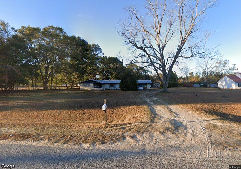
767 Clyo Shawnee Rd Springfield, GA 31329
Estimated Value: $223,866 - $316,000
--
Bed
1
Bath
1,767
Sq Ft
$142/Sq Ft
Est. Value
About This Home
This home is located at 767 Clyo Shawnee Rd, Springfield, GA 31329 and is currently estimated at $251,467, approximately $142 per square foot. 767 Clyo Shawnee Rd is a home located in Effingham County with nearby schools including Springfield Elementary School, Effingham County Middle School, and Effingham County High School.
Ownership History
Date
Name
Owned For
Owner Type
Purchase Details
Closed on
Jun 30, 2006
Sold by
Burns Terry L
Bought by
Mcloud Douglas G
Current Estimated Value
Home Financials for this Owner
Home Financials are based on the most recent Mortgage that was taken out on this home.
Original Mortgage
$155,000
Outstanding Balance
$91,765
Interest Rate
6.6%
Mortgage Type
New Conventional
Estimated Equity
$159,702
Create a Home Valuation Report for This Property
The Home Valuation Report is an in-depth analysis detailing your home's value as well as a comparison with similar homes in the area
Home Values in the Area
Average Home Value in this Area
Purchase History
| Date | Buyer | Sale Price | Title Company |
|---|---|---|---|
| Mcloud Douglas G | $155,000 | -- |
Source: Public Records
Mortgage History
| Date | Status | Borrower | Loan Amount |
|---|---|---|---|
| Open | Mcloud Douglas G | $155,000 |
Source: Public Records
Tax History Compared to Growth
Tax History
| Year | Tax Paid | Tax Assessment Tax Assessment Total Assessment is a certain percentage of the fair market value that is determined by local assessors to be the total taxable value of land and additions on the property. | Land | Improvement |
|---|---|---|---|---|
| 2024 | $1,949 | $63,543 | $20,507 | $43,036 |
| 2023 | $1,153 | $61,525 | $20,507 | $41,018 |
| 2022 | $1,621 | $51,917 | $10,899 | $41,018 |
| 2021 | $1,498 | $42,768 | $7,924 | $34,844 |
| 2020 | $1,450 | $42,054 | $7,769 | $34,285 |
| 2019 | $1,370 | $39,125 | $4,840 | $34,285 |
| 2018 | $1,533 | $44,374 | $12,497 | $31,877 |
| 2017 | $1,493 | $42,766 | $8,748 | $34,018 |
| 2016 | $1,417 | $42,228 | $8,748 | $33,480 |
| 2015 | -- | $42,228 | $8,748 | $33,480 |
| 2014 | -- | $42,228 | $8,748 | $33,480 |
| 2013 | -- | $42,228 | $8,748 | $33,480 |
Source: Public Records
Map
Nearby Homes
- 3790 Old Dixie Hwy S
- 101 Rebel Estates Dr
- 1091 Green Morgan School Rd
- 0 Clyo Shawnee Rd Unit 10637729
- 0 Clyo Shawnee Rd Unit SA342552
- 257 Greenwood Rd
- 501 W First Street Extension
- 0 Chester Thomas Rd Unit SA338840
- 0 Hwy 21 & Elbert Arnsdorff Rd Unit 326489
- 0 Morgan Cemetery Rd Unit 10393176
- 0 Reidsville Rd Unit 10397939
- 0 Morgan Cemetery Rd Unit 21693641
- 0 Sister's Ferry Rd Unit SA341732
- 0 Sister's Ferry Rd Unit SA341735
- 506 Dewitt Rd
- 137 Bird Rd
- 263 Dewitt Rd
- 1258 Clyo Kildare Rd
- 0 Reedsville Rd Unit SA333786
- 0 Reedsville Rd Unit SA336727
- 789 Clyo Shawnee Rd
- 784 Clyo Shawnee Rd
- 731 Clyo Shawnee Rd
- 809 Clyo Shawnee Rd
- 760 Clyo Shawnee Rd
- 738 Clyo Shawnee Rd
- 968 Silver Hill Church Rd
- 711 Clyo Shawnee Rd
- 880 Silver Hill Church Rd
- 835 Clyo Shawnee Rd
- 701 Clyo Shawnee Rd
- 1466 Clyo Shawnee Rd
- 836 Clyo Shawnee Rd
- 1017 Silver Hill Church Rd
- 870 Silver Hill Church Rd
- 909 Silver Hill Church Rd
- 876 Silver Hill Church Rd
- 1029 Silver Hill Church Rd
- 1054 Silver Hill Church Rd
- 879 Silver Hill Church Rd