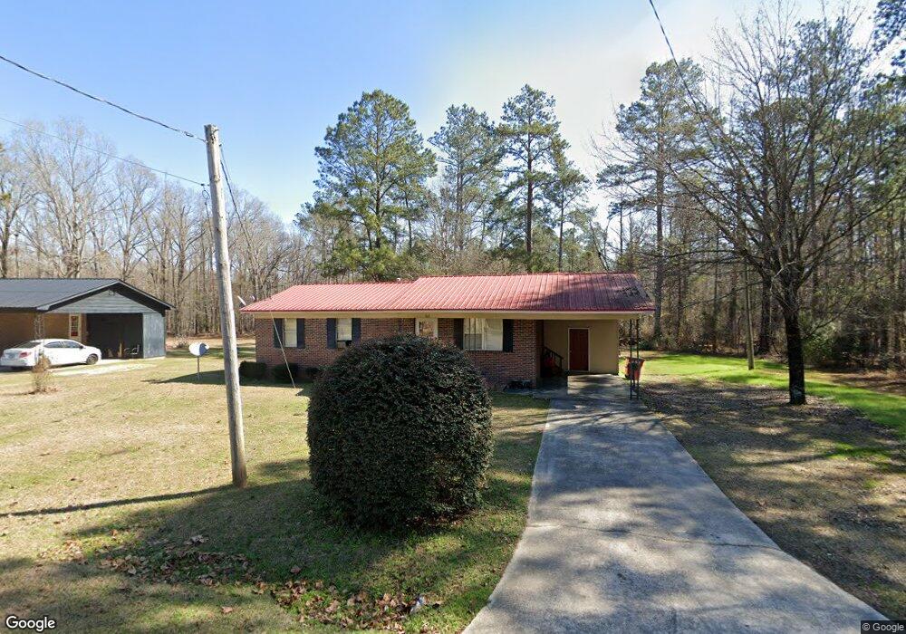
767 McElrath St Sandersville, GA 31082
Estimated Value: $61,000 - $87,112
--
Bed
--
Bath
1,025
Sq Ft
$75/Sq Ft
Est. Value
About This Home
This home is located at 767 McElrath St, Sandersville, GA 31082 and is currently estimated at $77,028, approximately $75 per square foot. 767 McElrath St is a home located in Washington County with nearby schools including Ridge Road Primary School, Ridge Road Elementary School, and T.J. Elder Middle School.
Ownership History
Date
Name
Owned For
Owner Type
Purchase Details
Closed on
Jun 1, 2009
Sold by
Wilson Romulus M
Bought by
Drw Investment Group Inc
Current Estimated Value
Purchase Details
Closed on
Dec 4, 1985
Sold by
United States Trhough Fha
Bought by
Wilson Romulus M
Purchase Details
Closed on
Oct 7, 1985
Sold by
Reeves Lofton J
Bought by
United States Through Fha
Purchase Details
Closed on
May 21, 1982
Create a Home Valuation Report for This Property
The Home Valuation Report is an in-depth analysis detailing your home's value as well as a comparison with similar homes in the area
Home Values in the Area
Average Home Value in this Area
Purchase History
| Date | Buyer | Sale Price | Title Company |
|---|---|---|---|
| Drw Investment Group Inc | -- | -- | |
| Wilson Romulus M | $29,500 | -- | |
| United States Through Fha | -- | -- | |
| -- | $32,900 | -- |
Source: Public Records
Tax History Compared to Growth
Tax History
| Year | Tax Paid | Tax Assessment Tax Assessment Total Assessment is a certain percentage of the fair market value that is determined by local assessors to be the total taxable value of land and additions on the property. | Land | Improvement |
|---|---|---|---|---|
| 2024 | $1,082 | $30,280 | $4,320 | $25,960 |
| 2023 | $737 | $25,280 | $4,320 | $20,960 |
| 2022 | $737 | $25,280 | $4,320 | $20,960 |
| 2021 | $758 | $25,280 | $4,320 | $20,960 |
| 2020 | $764 | $25,280 | $4,320 | $20,960 |
| 2019 | $762 | $25,280 | $4,320 | $20,960 |
| 2018 | $763 | $25,280 | $4,320 | $20,960 |
| 2017 | $759 | $24,714 | $3,770 | $20,944 |
| 2016 | $750 | $24,714 | $3,770 | $20,944 |
| 2015 | $612 | $806 | $3,770 | $20,944 |
| 2014 | $612 | $24,436 | $3,770 | $20,667 |
| 2013 | $612 | $24,436 | $3,769 | $20,666 |
Source: Public Records
Map
Nearby Homes
- 766 McElrath St
- 516 Sunhill Rd
- 0 Franklin Haynes Dr
- 518 Cooley Dr
- 525 E Church St
- 520 E Church St
- 530 E Church St
- 407 Riddleville Rd
- 408 Moye Dr
- 415 Riddleville Rd
- 908 E Mccarty St
- 849 E Mccarty St
- 821 E Mccarty St
- 1282 E Mccarty St
- 219 Cypress St
- 210 E Church St
- 406 S Smith St
- 47 Anderson Ln
- 164 Anderson Ln
- 324 Railroad Ave
- 765 McElrath St
- 761 McElrath St
- 762 McElrath St
- 758 McElrath St
- 757 McElrath St
- 735 Alfred C Carson Dr
- 752 McElrath St
- 753 McElrath St
- 731 Alfred C Carson Dr
- 104 Pierce St
- 740 McElrath St
- 725 Alfred C Carson Cir
- 723 Alfred C Carson Cir
- 749 McElrath St
- 728 Alfred C Carson Dr
- 734 McElrath St
- 727 Alfred C Carson Dr
- 741 McElrath St
- 747 McElrath St
- 721 Alfred C Carson Cir