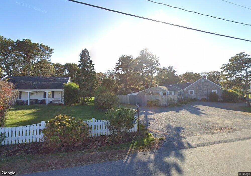
767 Route 28 Unit 5 Harwich Port, MA 02646
Harwich Port NeighborhoodEstimated Value: $331,246 - $581,000
2
Beds
1
Bath
480
Sq Ft
$849/Sq Ft
Est. Value
About This Home
This home is located at 767 Route 28 Unit 5, Harwich Port, MA 02646 and is currently estimated at $407,312, approximately $848 per square foot. 767 Route 28 Unit 5 is a home located in Barnstable County with nearby schools including Harwich Elementary School, Chatham Elementary School, and Monomoy Regional Middle School.
Ownership History
Date
Name
Owned For
Owner Type
Purchase Details
Closed on
Dec 18, 2015
Sold by
Guodace Kimberly A
Bought by
Meehan Lane C
Current Estimated Value
Purchase Details
Closed on
Aug 1, 2011
Sold by
Lowe Debra A and Cannato Edith A
Bought by
Guodace Kimberly A
Home Financials for this Owner
Home Financials are based on the most recent Mortgage that was taken out on this home.
Original Mortgage
$126,000
Interest Rate
3%
Mortgage Type
Adjustable Rate Mortgage/ARM
Purchase Details
Closed on
Apr 5, 2005
Sold by
Rl Ballantine Wychmere
Bought by
Mele Debra A and Cannato Edith A
Home Financials for this Owner
Home Financials are based on the most recent Mortgage that was taken out on this home.
Original Mortgage
$178,000
Interest Rate
5.61%
Create a Home Valuation Report for This Property
The Home Valuation Report is an in-depth analysis detailing your home's value as well as a comparison with similar homes in the area
Home Values in the Area
Average Home Value in this Area
Purchase History
| Date | Buyer | Sale Price | Title Company |
|---|---|---|---|
| Meehan Lane C | $186,000 | -- | |
| Guodace Kimberly A | $168,000 | -- | |
| Mele Debra A | $198,000 | -- | |
| Mele Debra A | $198,000 | -- |
Source: Public Records
Mortgage History
| Date | Status | Borrower | Loan Amount |
|---|---|---|---|
| Previous Owner | Guodace Kimberly A | $126,000 | |
| Previous Owner | Mele Debra A | $178,000 |
Source: Public Records
Tax History Compared to Growth
Tax History
| Year | Tax Paid | Tax Assessment Tax Assessment Total Assessment is a certain percentage of the fair market value that is determined by local assessors to be the total taxable value of land and additions on the property. | Land | Improvement |
|---|---|---|---|---|
| 2025 | $1,281 | $216,800 | $0 | $216,800 |
| 2024 | $1,283 | $212,700 | $0 | $212,700 |
| 2023 | $1,434 | $216,000 | $0 | $216,000 |
| 2022 | $1,768 | $218,000 | $0 | $218,000 |
| 2021 | $1,752 | $203,700 | $0 | $203,700 |
| 2020 | $1,729 | $198,000 | $0 | $198,000 |
| 2019 | $1,643 | $189,500 | $0 | $189,500 |
| 2018 | $1,616 | $183,600 | $0 | $183,600 |
| 2017 | $1,524 | $169,900 | $0 | $169,900 |
| 2016 | $1,305 | $143,900 | $0 | $143,900 |
| 2015 | $1,266 | $141,100 | $0 | $141,100 |
| 2014 | $1,329 | $151,500 | $0 | $151,500 |
Source: Public Records
Map
Nearby Homes
- 27 Saquatucket Bluffs Rd
- 820 Massachusetts 28
- 8 Old Wharf Rd
- 29 Windward Walk
- 53 Freeman St
- 252 Chatham Rd
- 9 Jason Ln
- 27 Quaker Ln
- 15 Shannon Rd
- 28 Dale Rd
- 106 Chatham Rd
- 15 Pleasant St Unit W24
- 21 Princes St
- 515 Massachusetts 28
- 515 Route 28
- 42 Marthas Ln
- 303 Bank St
- 1011 Massachusetts 28 Unit C-6
- 44 Beriah Brooks Rd
- 1011 Route 28 Unit 6
- 767 Route 28 Unit 15
- 767 Route 28 Unit 14
- 767 Route 28 Unit 12
- 767 Route 28 Unit 11
- 767 Route 28 Unit 10
- 767 Route 28 Unit 9
- 767 Route 28 Unit 8
- 767 Route 28 Unit 7
- 767 Route 28 Unit 6
- 767 Route 28 Unit 4
- 767 Route 28 Unit 3
- 767 Route 28 Unit 2
- 767 Route 28 Unit 1
- 767 Route 28 Unit 9
- 767 Route 28
- 767 Route 28 Unit 5
- 767 Route 28 Unit 3
- 767 Route 28 Unit 12
- 767 Route 28 Unit 8
- 767 Main St