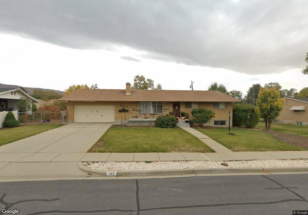
767 W 1900 S Woods Cross, UT 84087
Estimated Value: $495,000 - $563,526
4
Beds
3
Baths
2,700
Sq Ft
$192/Sq Ft
Est. Value
About This Home
This home is located at 767 W 1900 S, Woods Cross, UT 84087 and is currently estimated at $518,382, approximately $191 per square foot. 767 W 1900 S is a home located in Davis County with nearby schools including Woods Cross Elementary School, South Davis Junior High School, and Woods Cross High School.
Ownership History
Date
Name
Owned For
Owner Type
Purchase Details
Closed on
Oct 26, 2021
Sold by
Parkin Veneice B
Bought by
Meyer Austin and Meyer Marissa
Current Estimated Value
Purchase Details
Closed on
Apr 29, 2020
Sold by
Parkin Veneice
Bought by
Meyer Austin and Meyer Marissa
Home Financials for this Owner
Home Financials are based on the most recent Mortgage that was taken out on this home.
Original Mortgage
$264,000
Interest Rate
3.6%
Mortgage Type
New Conventional
Create a Home Valuation Report for This Property
The Home Valuation Report is an in-depth analysis detailing your home's value as well as a comparison with similar homes in the area
Home Values in the Area
Average Home Value in this Area
Purchase History
| Date | Buyer | Sale Price | Title Company |
|---|---|---|---|
| Meyer Austin | -- | North American Title | |
| Meyer Austin | -- | North American Title |
Source: Public Records
Mortgage History
| Date | Status | Borrower | Loan Amount |
|---|---|---|---|
| Previous Owner | Meyer Austin | $264,000 |
Source: Public Records
Tax History Compared to Growth
Tax History
| Year | Tax Paid | Tax Assessment Tax Assessment Total Assessment is a certain percentage of the fair market value that is determined by local assessors to be the total taxable value of land and additions on the property. | Land | Improvement |
|---|---|---|---|---|
| 2025 | $3,295 | $284,350 | $119,524 | $164,826 |
| 2024 | $3,190 | $282,700 | $129,082 | $153,618 |
| 2023 | $3,036 | $501,000 | $172,447 | $328,553 |
| 2022 | $3,110 | $285,450 | $74,860 | $210,590 |
| 2021 | $2,764 | $403,000 | $110,489 | $292,511 |
| 2020 | $2,278 | $326,000 | $105,360 | $220,640 |
| 2019 | $2,296 | $324,000 | $97,585 | $226,415 |
| 2018 | $2,097 | $293,000 | $95,813 | $197,187 |
| 2016 | $1,779 | $135,630 | $42,865 | $92,765 |
| 2015 | $1,670 | $123,090 | $42,865 | $80,225 |
| 2014 | $1,430 | $108,195 | $42,865 | $65,330 |
| 2013 | -- | $107,132 | $25,254 | $81,878 |
Source: Public Records
Map
Nearby Homes