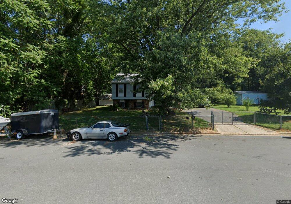
7675 2nd St Pasadena, MD 21122
Green Haven NeighborhoodEstimated Value: $391,000 - $451,966
Studio
1
Bath
1,092
Sq Ft
$389/Sq Ft
Est. Value
About This Home
This home is located at 7675 2nd St, Pasadena, MD 21122 and is currently estimated at $424,742, approximately $388 per square foot. 7675 2nd St is a home located in Anne Arundel County with nearby schools including High Point Elementary School, Northeast Middle School, and Northeast High School.
Ownership History
Date
Name
Owned For
Owner Type
Purchase Details
Closed on
Jun 8, 2005
Sold by
Mafc Residential In
Bought by
Maryland Mary T
Current Estimated Value
Home Financials for this Owner
Home Financials are based on the most recent Mortgage that was taken out on this home.
Original Mortgage
$205,785
Outstanding Balance
$107,570
Interest Rate
5.78%
Mortgage Type
Purchase Money Mortgage
Estimated Equity
$317,172
Purchase Details
Closed on
Mar 21, 2005
Sold by
Owens Edward G
Bought by
Mafc Residential In
Purchase Details
Closed on
Sep 15, 1997
Sold by
Donahue Timothy R
Bought by
Owens Edward G and Owens Kristina A
Create a Home Valuation Report for This Property
The Home Valuation Report is an in-depth analysis detailing your home's value as well as a comparison with similar homes in the area
Home Values in the Area
Average Home Value in this Area
Purchase History
| Date | Buyer | Sale Price | Title Company |
|---|---|---|---|
| Maryland Mary T | $269,900 | -- | |
| Mafc Residential In | $216,575 | -- | |
| Owens Edward G | $114,900 | -- |
Source: Public Records
Mortgage History
| Date | Status | Borrower | Loan Amount |
|---|---|---|---|
| Open | Maryland Mary T | $205,785 | |
| Closed | Owens Edward G | -- |
Source: Public Records
Tax History
| Year | Tax Paid | Tax Assessment Tax Assessment Total Assessment is a certain percentage of the fair market value that is determined by local assessors to be the total taxable value of land and additions on the property. | Land | Improvement |
|---|---|---|---|---|
| 2025 | $4,060 | $329,567 | -- | -- |
| 2024 | $4,060 | $324,900 | $188,900 | $136,000 |
| 2023 | $3,919 | $315,467 | $0 | $0 |
| 2022 | $3,628 | $306,033 | $0 | $0 |
| 2020 | $3,259 | $274,567 | $0 | $0 |
| 2019 | $3,031 | $252,533 | $0 | $0 |
| 2018 | $2,337 | $230,500 | $124,700 | $105,800 |
| 2017 | $2,657 | $223,167 | $0 | $0 |
| 2016 | -- | $215,833 | $0 | $0 |
| 2015 | -- | $208,500 | $0 | $0 |
| 2014 | -- | $208,500 | $0 | $0 |
Source: Public Records
Map
Nearby Homes
- 7662 Pine Haven Dr
- 7722 Vena Ct
- 7665 Cedar Dr
- 8700 Scorton Harbour
- 7686 Briar Ln
- 7715 Woodlawn Ave
- 7713 Woodlawn Ave
- 1186 Annis Squam Harbour
- 1056 Saybrook Harbour
- 969 10th St
- 961 Mount Desert Harbour
- 941 8th St
- 1217 Valley Rd
- 7707 Lake Cir
- 1215 Markham Ln
- 7759 Glen Ave
- 1202 Hillcreek Rd
- 7913 Kings Bench Place
- 7616 Turnbrook Dr
- 813 201st St
- 7673 2nd St
- 1118 Holmespun Dr
- 7654 Sherlock Ct
- 7656 Sherlock Ct
- 7652 Sherlock Ct
- 7658 Sherlock Ct
- 7660 Sherlock Ct
- 7662 Sherlock Ct
- 1102 Holmespun Dr
- 7664 Sherlock Ct
- 7674 2nd St
- 7672 2nd St
- 1100 Holmespun Dr
- 1198 Holmespun Dr
- 1159 Wharf Dr
- 7670 2nd St
- 1119 Holmespun Dr
- 1153 Wharf Dr
- 1115 Holmespun Dr
- 1123 Holmespun Dr
Your Personal Tour Guide
Ask me questions while you tour the home.