Estimated Value: $76,000 - $159,000
3
Beds
1
Bath
960
Sq Ft
$127/Sq Ft
Est. Value
About This Home
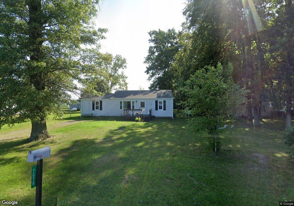
This home is located at 7676 Ramsey Rd, Lima, OH 45807 and is currently estimated at $122,067, approximately $127 per square foot. 7676 Ramsey Rd is a home located in Allen County with nearby schools including Bath Elementary School, Bath Middle School, and Bath High School.
Ownership History
Date
Name
Owned For
Owner Type
Purchase Details
Closed on
May 2, 2005
Sold by
Sherard Ronald E and Sherard Lisa J
Bought by
Lunz Kristin
Current Estimated Value
Purchase Details
Closed on
Dec 14, 2001
Sold by
Sherard Richard L
Bought by
Sherard Ronald E
Home Financials for this Owner
Home Financials are based on the most recent Mortgage that was taken out on this home.
Original Mortgage
$44,745
Interest Rate
6.6%
Mortgage Type
New Conventional
Purchase Details
Closed on
Sep 28, 2001
Sold by
Sherard Richard Lee and Sherard Linda K
Bought by
Sherard Ronald E
Purchase Details
Closed on
Jan 1, 1990
Bought by
Sherard Richard Lee
Create a Home Valuation Report for This Property
The Home Valuation Report is an in-depth analysis detailing your home's value as well as a comparison with similar homes in the area
Purchase History
| Date | Buyer | Sale Price | Title Company |
|---|---|---|---|
| Lunz Kristin | $44,000 | None Available | |
| Sherard Ronald E | $47,100 | -- | |
| Sherard Ronald E | $47,100 | Ati Title Agency Of Ohio Inc | |
| Sherard Richard Lee | -- | -- |
Source: Public Records
Mortgage History
| Date | Status | Borrower | Loan Amount |
|---|---|---|---|
| Previous Owner | Sherard Ronald E | $44,745 |
Source: Public Records
Tax History
| Year | Tax Paid | Tax Assessment Tax Assessment Total Assessment is a certain percentage of the fair market value that is determined by local assessors to be the total taxable value of land and additions on the property. | Land | Improvement |
|---|---|---|---|---|
| 2024 | $1,135 | $28,570 | $6,200 | $22,370 |
| 2023 | $1,036 | $23,420 | $5,080 | $18,340 |
| 2022 | $1,019 | $23,420 | $5,080 | $18,340 |
| 2021 | $1,030 | $23,420 | $5,080 | $18,340 |
| 2020 | $887 | $18,450 | $4,620 | $13,830 |
| 2019 | $887 | $18,450 | $4,620 | $13,830 |
| 2018 | $881 | $18,450 | $4,620 | $13,830 |
| 2017 | $813 | $17,190 | $4,620 | $12,570 |
| 2016 | $809 | $17,190 | $4,620 | $12,570 |
| 2015 | $805 | $17,190 | $4,620 | $12,570 |
| 2014 | $952 | $19,810 | $4,620 | $15,190 |
| 2013 | $953 | $19,810 | $4,620 | $15,190 |
Source: Public Records
Map
Nearby Homes
- 634 W Main St
- 513 W Main St
- 102 W Main St
- 201 Wall St
- 13347 Ohio 12
- 3270 Bonnieview Dr
- 11059 Ottawa Rd
- 0 Fraunfelter Unit 307817
- 0 N Eastown Rd Unit 1034495
- 108 Highland Lakes Dr
- 3137 Thorndyke Dr
- 3263 Shiloh Dr
- 603 S Main St
- 4150 W Lincoln Hwy
- 5635 Port St
- 204 S Broadway St
- 215 West St
- 520 Kenmore St
- 475 Kenmore St
- 2878 Autumn Lake Dr