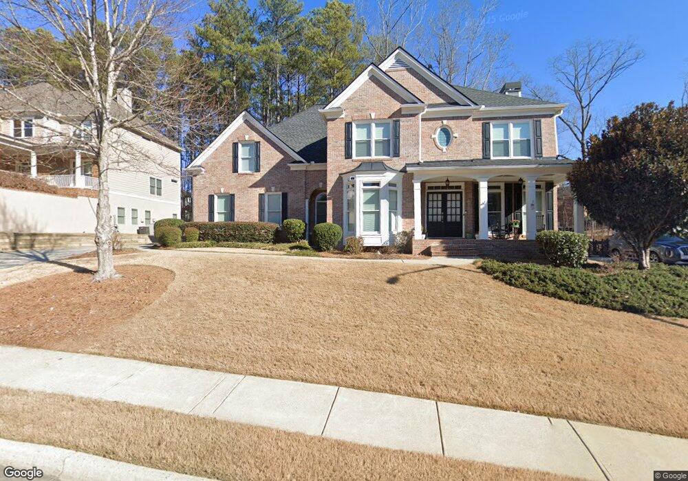
768 Highcrest Dr Acworth, GA 30101
Cedarcrest NeighborhoodEstimated Value: $547,438 - $634,000
4
Beds
4
Baths
2,835
Sq Ft
$210/Sq Ft
Est. Value
About This Home
This home is located at 768 Highcrest Dr, Acworth, GA 30101 and is currently estimated at $596,110, approximately $210 per square foot. 768 Highcrest Dr is a home located in Paulding County with nearby schools including Floyd L. Shelton Elementary School at Crossroad, Sammy Mcclure Sr. Middle School, and North Paulding High School.
Ownership History
Date
Name
Owned For
Owner Type
Purchase Details
Closed on
Feb 19, 2014
Sold by
Grostick Matthew Carl
Bought by
Grostick Matthew Carl and Grostick Christa Jeaneen
Current Estimated Value
Purchase Details
Closed on
Jan 26, 2011
Sold by
Grostick Carmen L
Bought by
Grostick Matthew C
Purchase Details
Closed on
Nov 30, 2004
Sold by
Sharp Residential Builders & Dev
Bought by
Grostick Matthew C and Grostick Carmen
Home Financials for this Owner
Home Financials are based on the most recent Mortgage that was taken out on this home.
Original Mortgage
$32,000
Interest Rate
5.67%
Mortgage Type
New Conventional
Purchase Details
Closed on
Jun 24, 2004
Sold by
Temco Associates
Create a Home Valuation Report for This Property
The Home Valuation Report is an in-depth analysis detailing your home's value as well as a comparison with similar homes in the area
Home Values in the Area
Average Home Value in this Area
Purchase History
| Date | Buyer | Sale Price | Title Company |
|---|---|---|---|
| Grostick Matthew Carl | -- | -- | |
| Grostick Matthew Carl | -- | -- | |
| Grostick Matthew C | -- | -- | |
| Grostick Matthew C | $320,000 | -- | |
| -- | $320,000 | -- | |
| -- | $64,100 | -- |
Source: Public Records
Mortgage History
| Date | Status | Borrower | Loan Amount |
|---|---|---|---|
| Previous Owner | -- | $32,000 | |
| Previous Owner | -- | $255,950 |
Source: Public Records
Tax History
| Year | Tax Paid | Tax Assessment Tax Assessment Total Assessment is a certain percentage of the fair market value that is determined by local assessors to be the total taxable value of land and additions on the property. | Land | Improvement |
|---|---|---|---|---|
| 2025 | $5,770 | $247,532 | $26,000 | $221,532 |
| 2024 | $4,892 | $199,920 | $26,000 | $173,920 |
| 2023 | $5,287 | $205,332 | $26,000 | $179,332 |
| 2022 | $4,708 | $182,468 | $26,000 | $156,468 |
| 2021 | $4,475 | $155,848 | $26,000 | $129,848 |
| 2020 | $4,243 | $144,704 | $26,000 | $118,704 |
| 2019 | $4,061 | $136,640 | $26,000 | $110,640 |
| 2018 | $4,229 | $140,360 | $26,000 | $114,360 |
| 2017 | $4,061 | $134,800 | $34,000 | $100,800 |
Source: Public Records
Map
Nearby Homes
- 788 Highcrest Dr
- 341 Carl Sanders Dr
- 123 Candler Loop
- 1022 Carl Sanders Dr
- 260 Carl Sanders Dr
- 300 Carl Sanders Dr
- 954 Carl Sanders Dr
- 1276 Rutledge Rd
- 6335 Howell Cobb Ct
- 4559 Oglethorpe Loop NW
- 28 Vandiver Ct
- 138 Highcrest Dr
- 1128L Rutledge Rd
- 331 Brisbane Dr
- 254 Broadstone Blvd
- 39 Telfair Ct
- 6225 Arnall Ct NW
- 202 Vandiver Ct
- 6186 Talmadge Run NW
- 6218 Zell Miller Path NW
- 758 Highcrest Dr
- 11 Manorside Way
- 729 Highcrest Dr
- 736 Highcrest Dr
- 816 Highcrest Dr
- 31 Manorside Way
- 817 Highcrest Dr
- 722 Highcrest Dr
- 828 Highcrest Dr
- 438 Carl Sanders Dr
- 80 Gilmer Way
- 30 Gilmer Way
- 711 Highcrest Dr
- 41 Manorside Way
- 28 Manorside Way
- 704 Highcrest Dr
- 831 Highcrest Dr
- 416 Carl Sanders Dr
- 34 Manorside Way
- 693 Highcrest Dr