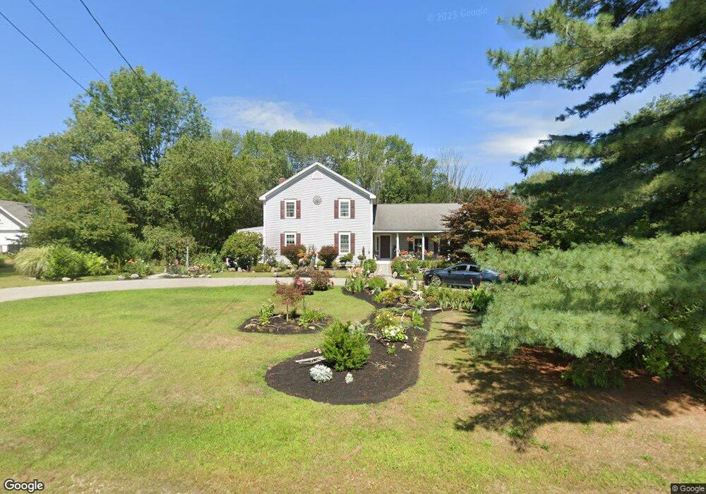
768 Main St Eliot, ME 03903
South Eliot NeighborhoodEstimated Value: $730,000 - $982,000
3
Beds
3
Baths
2,548
Sq Ft
$332/Sq Ft
Est. Value
About This Home
This home is located at 768 Main St, Eliot, ME 03903 and is currently estimated at $844,747, approximately $331 per square foot. 768 Main St is a home located in York County with nearby schools including Marshwood High School and Seacoast Waldorf School.
Create a Home Valuation Report for This Property
The Home Valuation Report is an in-depth analysis detailing your home's value as well as a comparison with similar homes in the area
Home Values in the Area
Average Home Value in this Area
Tax History Compared to Growth
Tax History
| Year | Tax Paid | Tax Assessment Tax Assessment Total Assessment is a certain percentage of the fair market value that is determined by local assessors to be the total taxable value of land and additions on the property. | Land | Improvement |
|---|---|---|---|---|
| 2024 | $6,585 | $555,700 | $140,500 | $415,200 |
| 2023 | $6,395 | $522,000 | $134,100 | $387,900 |
| 2022 | $6,091 | $503,400 | $134,100 | $369,300 |
| 2021 | $5,960 | $441,500 | $123,400 | $318,100 |
| 2020 | $5,917 | $402,500 | $118,100 | $284,400 |
| 2019 | $5,917 | $402,500 | $118,100 | $284,400 |
| 2018 | $5,917 | $402,500 | $118,100 | $284,400 |
| 2017 | $5,756 | $402,500 | $118,100 | $284,400 |
| 2016 | $5,655 | $402,500 | $118,100 | $284,400 |
| 2015 | $5,635 | $402,500 | $118,100 | $284,400 |
| 2014 | $5,555 | $402,500 | $118,100 | $284,400 |
| 2013 | $5,301 | $402,500 | $118,100 | $284,400 |
Source: Public Records
Map
Nearby Homes
- 18 Shipping Ln
- 850 Main St
- 956 Main St
- 493 Main St
- 35 Leach Rd
- 8 Caslyn Dr
- 0 Franks Fort Island Unit 1631886
- 124 Spinnaker Way
- 5 Spinney Way Unit 9
- 7 Fernald Rd
- 19 Shearwater Dr Unit 1903
- 15 Shearwater Dr Unit 1902
- 37 Shearwater Dr Unit 1906
- 3 Shearwater Dr Unit 1900
- 201 Kearsarge Way
- 25 Mangrove St
- 1338 Woodbury Ave Unit 10
- 14 Birch St
- 25 Oak Terrace
- 171 Echo Ave