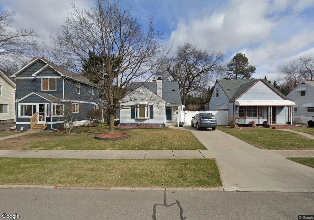
768 W Maplehurst St Ferndale, MI 48220
Estimated Value: $307,000 - $327,000
About This Home
This home is located at 768 W Maplehurst St, Ferndale, MI 48220 and is currently estimated at $317,838, approximately $273 per square foot. 768 W Maplehurst St is a home located in Oakland County with nearby schools including Ferndale Lower Elementary Campus, Ferndale Upper Elementary Campus, and Ferndale Middle School.
Ownership History
We collect this data history from publicly available records. To have your information removed, we recommend requesting removal directly through your county’s website.
Purchase Details
Purchase Details
Home Values in the Area
Average Home Value in this Area
Purchase History
We collect this data history from publicly available records. To have your information removed, we recommend requesting removal directly through your county’s website.
| Date | Buyer | Sale Price | Title Company |
|---|---|---|---|
| -- | None Available | ||
| -- | None Available |
Tax History
We collect this data history from publicly available records. To have your information removed, we recommend requesting removal directly through your county’s website.
| Year | Tax Paid | Tax Assessment Tax Assessment Total Assessment is a certain percentage of the fair market value that is determined by local assessors to be the total taxable value of land and additions on the property. | Land | Improvement |
|---|---|---|---|---|
| 2025 | $3,919 | $162,700 | $0 | $0 |
| 2024 | $3,868 | $160,340 | $0 | $0 |
| 2023 | $3,759 | $150,850 | $0 | $0 |
| 2022 | $3,780 | $137,370 | $0 | $0 |
| 2021 | $3,803 | $134,160 | $0 | $0 |
| 2020 | $3,603 | $134,030 | $0 | $0 |
| 2019 | $3,662 | $124,620 | $0 | $0 |
| 2018 | $3,676 | $109,120 | $0 | $0 |
| 2017 | $3,629 | $106,690 | $0 | $0 |
| 2016 | $3,586 | $93,080 | $0 | $0 |
| 2015 | -- | $76,830 | $0 | $0 |
| 2014 | -- | $69,540 | $0 | $0 |
| 2011 | -- | $63,420 | $0 | $0 |
Map
- 642 W Maplehurst St
- 910 W Maplehurst St
- 920 W Maplehurst St
- 928 W Maplehurst Ave
- 629 W Lewiston Ave
- 580 W Lewiston Ave
- 831 W Breckenridge St
- 1924 Pinecrest Dr
- 429 W Drayton St
- 1178 Withington St
- 2019 Hyland St
- 23240 Forest St
- 23200 Forest St
- 23110 Forest St
- 1316 W Troy St
- 250 W Drayton St
- 108 Maplefield Rd
- 24 Ridge Rd
- 23045 Sherman St
- 1281 W Saratoga St
- 2305 Pinecrest Dr
- 740 W Maplehurst St
- 2315 Pinecrest Dr
- 750 W Maplehurst St
- 2325 Pinecrest Dr
- 2281 Pinecrest Dr
- 758 W Maplehurst St
- 755 W Maplehurst St
- 2271 Pinecrest Dr
- 2335 Pinecrest Dr
- 747 W Maplehurst St
- 2261 Pinecrest Dr
- 2345 Pinecrest Dr
- 763 W Maplehurst St
- 774 W Maplehurst St
- 2249 Pinecrest Dr
- 769 W Maplehurst St
- 671 W Woodland St
- 800 W Maplehurst St
- 775 W Maplehurst St
Ask me questions while you tour the home.