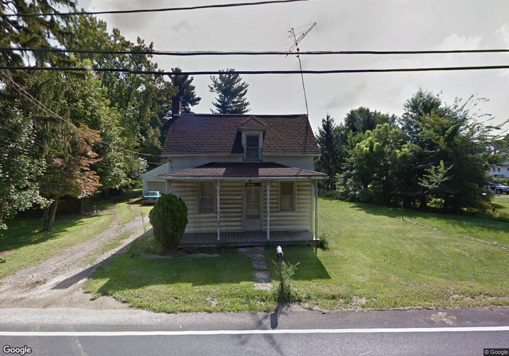
7680 Anthony Hwy Waynesboro, PA 17268
Estimated Value: $89,853 - $288,000
--
Bed
--
Bath
1,500
Sq Ft
$144/Sq Ft
Est. Value
About This Home
This home is located at 7680 Anthony Hwy, Waynesboro, PA 17268 and is currently estimated at $215,713, approximately $143 per square foot. 7680 Anthony Hwy is a home located in Franklin County with nearby schools including Waynesboro Area Senior High School, St. Andrew Catholic School, and Providence School - Pigeon Hill Building.
Ownership History
Date
Name
Owned For
Owner Type
Purchase Details
Closed on
Apr 4, 2018
Sold by
Carson Matthew L
Bought by
Hollar David A
Current Estimated Value
Purchase Details
Closed on
Nov 1, 2016
Sold by
Carson Matthew L and Estate Of Ronald Lee Carson
Bought by
Carson Matthew L
Purchase Details
Closed on
Apr 5, 2005
Sold by
Carson Ronald L
Bought by
Department Of Transportation
Create a Home Valuation Report for This Property
The Home Valuation Report is an in-depth analysis detailing your home's value as well as a comparison with similar homes in the area
Home Values in the Area
Average Home Value in this Area
Purchase History
| Date | Buyer | Sale Price | Title Company |
|---|---|---|---|
| Hollar David A | $50,000 | None Available | |
| Carson Matthew L | -- | None Available | |
| Department Of Transportation | -- | None Available |
Source: Public Records
Tax History Compared to Growth
Tax History
| Year | Tax Paid | Tax Assessment Tax Assessment Total Assessment is a certain percentage of the fair market value that is determined by local assessors to be the total taxable value of land and additions on the property. | Land | Improvement |
|---|---|---|---|---|
| 2025 | $2,307 | $15,810 | $1,100 | $14,710 |
| 2024 | $2,236 | $15,810 | $1,100 | $14,710 |
| 2023 | $2,174 | $15,810 | $1,100 | $14,710 |
| 2022 | $2,111 | $15,810 | $1,100 | $14,710 |
| 2021 | $2,048 | $15,810 | $1,100 | $14,710 |
| 2020 | $2,048 | $15,810 | $1,100 | $14,710 |
| 2019 | $2,000 | $15,810 | $1,100 | $14,710 |
| 2018 | $1,367 | $11,180 | $1,100 | $10,080 |
| 2017 | $1,336 | $11,180 | $1,100 | $10,080 |
| 2016 | $320 | $11,180 | $1,100 | $10,080 |
| 2015 | $299 | $11,180 | $1,100 | $10,080 |
| 2014 | $299 | $11,180 | $1,100 | $10,080 |
Source: Public Records
Map
Nearby Homes
- 7468 Anthony Hwy
- 5434 Manheim Rd
- 6159 Orphanage Rd
- 8620 Monns Gap Rd
- 8652 Mormon Church Rd
- 286 Verdier St
- 207 University Dr
- 111 Poplar St
- 6 S Main St
- 8655 Wayne Hwy
- 6456 Wayne Hwy
- 7205 Fairway Dr S
- 6158 Merion Dr
- 7130 St Annes Dr
- 7059 Duck Hook Ln
- 7136 Sandwich Ln
- 7060 Duck Hook Ln
- 7121 Sandwich Ln
- 6337 Medina Ridge Dr
- 0 Unit PAFL2024598
- 7670 Anthony Hwy
- 7700 Anthony Hwy
- 7662 Anthony Hwy
- 7710 Anthony Hwy
- 7705 Anthony Hwy
- 7640 Anthony Hwy
- 7720 Anthony Hwy
- 7721 Anthony Hwy
- 7628 Anthony Hwy
- 7836 Tomstown Rd
- 7652 Anthony Hwy
- 7747 Anthony Hwy
- 7756 Anthony Hwy
- 7866 Tomstown Rd
- 7851 Tomstown Rd
- 7835 Tomstown Rd
- 7876 Tomstown Rd
- 7626 Anthony Hwy
- 7772 Anthony Hwy
- 7803 Tomstown Rd