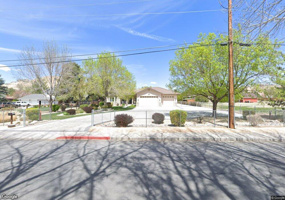
7685 Shadow Ln Sparks, NV 89434
Reed NeighborhoodEstimated Value: $822,000 - $1,063,000
3
Beds
3
Baths
2,681
Sq Ft
$341/Sq Ft
Est. Value
About This Home
This home is located at 7685 Shadow Ln, Sparks, NV 89434 and is currently estimated at $914,219, approximately $340 per square foot. 7685 Shadow Ln is a home located in Washoe County with nearby schools including Jerry Whitehead Elementary School, Lou Mendive Middle School, and Edward C Reed High School.
Ownership History
Date
Name
Owned For
Owner Type
Purchase Details
Closed on
Dec 28, 2015
Sold by
Dicus Gregg and Dicus Taryn
Bought by
Dicus Living Trust
Current Estimated Value
Purchase Details
Closed on
Dec 20, 2000
Sold by
Johnson Michael James
Bought by
Dicus Gregg A and Dicus Taryn L
Purchase Details
Closed on
Dec 21, 1999
Sold by
Sandoval Gloria T
Bought by
Johnson Michael James
Home Financials for this Owner
Home Financials are based on the most recent Mortgage that was taken out on this home.
Original Mortgage
$57,000
Interest Rate
7.69%
Purchase Details
Closed on
Dec 27, 1993
Sold by
Sandoval Ronald L and Sandoval Gloria T
Bought by
Sandoval Gloria T
Create a Home Valuation Report for This Property
The Home Valuation Report is an in-depth analysis detailing your home's value as well as a comparison with similar homes in the area
Home Values in the Area
Average Home Value in this Area
Purchase History
| Date | Buyer | Sale Price | Title Company |
|---|---|---|---|
| Dicus Living Trust | -- | None Available | |
| Dicus Gregg A | $71,000 | First Centennial Title Co | |
| Johnson Michael James | $64,000 | First Centennial Title Co | |
| Sandoval Gloria T | -- | -- |
Source: Public Records
Mortgage History
| Date | Status | Borrower | Loan Amount |
|---|---|---|---|
| Previous Owner | Johnson Michael James | $57,000 |
Source: Public Records
Tax History
| Year | Tax Paid | Tax Assessment Tax Assessment Total Assessment is a certain percentage of the fair market value that is determined by local assessors to be the total taxable value of land and additions on the property. | Land | Improvement |
|---|---|---|---|---|
| 2026 | -- | $208,210 | $56,000 | $152,210 |
| 2024 | $4,926 | $208,229 | $53,288 | $154,942 |
| 2023 | $4,784 | $196,318 | $49,613 | $146,706 |
| 2022 | $4,646 | $171,947 | $49,613 | $122,334 |
| 2021 | $4,511 | $150,780 | $29,327 | $121,453 |
| 2020 | $4,378 | $149,622 | $27,930 | $121,692 |
| 2019 | $4,250 | $144,195 | $27,930 | $116,265 |
| 2018 | $4,127 | $134,802 | $20,948 | $113,854 |
| 2017 | $4,007 | $134,895 | $20,948 | $113,947 |
| 2016 | $3,905 | $137,040 | $20,948 | $116,092 |
| 2015 | $3,899 | $132,832 | $17,162 | $115,670 |
| 2014 | $3,787 | $116,484 | $11,209 | $105,275 |
| 2013 | -- | $114,962 | $12,091 | $102,871 |
Source: Public Records
Map
Nearby Homes
- 1381 Laser Ct
- 1522 Satellite Dr
- 3592 Oakridge Dr
- 3602 Oakridge Dr
- 3142 Jarbidge Way
- 1069 Palmwood Dr
- 1472 Giannotti Dr
- 3988 Ella Jayne Ct Unit Lot 6
- 1041 Baywood Dr Unit D
- 1029 Baywood Dr Unit D
- 930 Spanish Springs Rd
- 2627 Sunny Slope Dr Unit 5
- 2625 Sunny Slope Dr
- 2625 Sunny Slope Dr Unit 2
- 2659 Sycamore Glen Dr Unit 5
- 2624 Sunny Slope Dr Unit 10
- 2679 Sycamore Glen Dr Unit 4
- 2507 Sycamore Glen Dr Unit 5
- 2688 Laguna Way
- 2407 Sunny Slope Dr Unit 1
- 7655 Shadow Ln
- 7695 Shadow Ln
- 7645 Country Cir
- 7645 Country Creek Rd
- 2200 Shadow Ln
- 3498 Shadow Ranch Dr
- 3482 Shadow Ranch Dr
- 3483 Shadow Ranch Dr
- 3607 Willowdale Dr
- 3495 Shadow Cast Ct
- 2300 Shadow Ln
- 3617 Willowdale Dr
- 3587 Willowdale Dr
- 3496 Shadow Cast Ct
- 3479 Shadow Cast Ct
- 3455 Shadow Ranch Dr
- 2295 Country Cir
- 1356 Spade Bit Dr
- 3577 Willowdale Dr
Your Personal Tour Guide
Ask me questions while you tour the home.