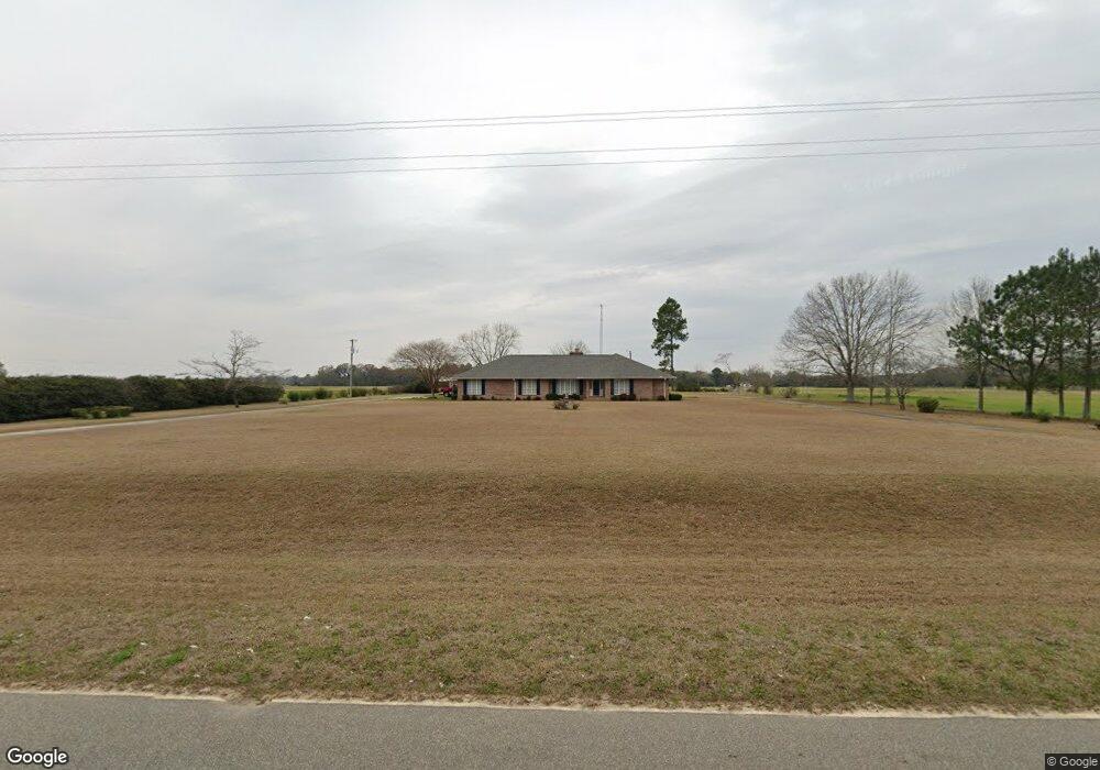
769 Enterprise Rd Colquitt, GA 39837
Estimated Value: $271,000 - $337,062
3
Beds
2
Baths
2,854
Sq Ft
$104/Sq Ft
Est. Value
About This Home
This home is located at 769 Enterprise Rd, Colquitt, GA 39837 and is currently estimated at $297,354, approximately $104 per square foot. 769 Enterprise Rd is a home located in Miller County with nearby schools including Miller County Elementary School, Miller County Middle School, and Miller County High School.
Ownership History
Date
Name
Owned For
Owner Type
Purchase Details
Closed on
Apr 30, 2004
Sold by
Kelley Carlton E
Bought by
Powell William R and Powell Judy
Current Estimated Value
Purchase Details
Closed on
Oct 4, 1999
Sold by
Kelley Ouida G
Bought by
Kelley Carlton E
Create a Home Valuation Report for This Property
The Home Valuation Report is an in-depth analysis detailing your home's value as well as a comparison with similar homes in the area
Home Values in the Area
Average Home Value in this Area
Purchase History
| Date | Buyer | Sale Price | Title Company |
|---|---|---|---|
| Powell William R | $183,500 | -- | |
| Kelley Carlton E | -- | -- |
Source: Public Records
Tax History Compared to Growth
Tax History
| Year | Tax Paid | Tax Assessment Tax Assessment Total Assessment is a certain percentage of the fair market value that is determined by local assessors to be the total taxable value of land and additions on the property. | Land | Improvement |
|---|---|---|---|---|
| 2024 | $3,979 | $120,337 | $19,500 | $100,837 |
| 2023 | $3,232 | $92,721 | $19,500 | $73,221 |
| 2022 | $2,724 | $73,172 | $19,500 | $53,672 |
| 2021 | $2,653 | $72,054 | $19,500 | $52,554 |
| 2020 | $2,653 | $72,054 | $19,500 | $52,554 |
| 2019 | $2,661 | $72,054 | $19,500 | $52,554 |
| 2018 | $2,657 | $72,054 | $19,500 | $52,554 |
| 2017 | $2,657 | $72,054 | $19,500 | $52,554 |
| 2016 | $2,849 | $79,222 | $19,500 | $59,722 |
| 2015 | -- | $71,905 | $10,880 | $61,025 |
| 2014 | -- | $71,905 | $10,880 | $61,025 |
| 2013 | -- | $71,905 | $10,880 | $61,025 |
Source: Public Records
Map
Nearby Homes
- 1645 Georgia 91
- 755 Mayhaw Rd
- 394 Bush Dairy Rd
- Grady Cobb Rd
- 994 Hornsby Rd
- 1068 Georgia 39
- US 27 Us Highway 27
- 102 Bremond St
- 2835 Georgia 91
- 308 E Carr St
- 157 E Pine St
- 210 N First St
- lot 564 Martin Dr
- lot 565 Martin Dr
- 356 E Main St
- 210 W Crawford St
- 300 N First St
- 570 E Pine St
- 708 E Crawford St
- 816 E 6th St
- 0 Enterprise
- 0 Enterprise
- 157 Bush Rd
- 715 Enterprise Rd
- 1718 Ga Highway 91 S
- 1667 Ga Highway 91 S
- 1141 Grimsley Bridge Rd
- 1645 Ga Highway 91 S
- 160 Bush Rd
- 698 Enterprise Rd
- 698 Enterprise Rd
- 845 Enterprise Rd
- 1604 Ga Highway 91 S
- 855 Enterprise Rd
- 1749 Ga Highway 91 S
- 1142 Grimsley Bridge Rd
- 1132 Grimsley Bridge Rd
- 995 Grimsley Bridge Rd
- 1566 Ga Highway 91 S
- 1530 Ga Highway 91 S