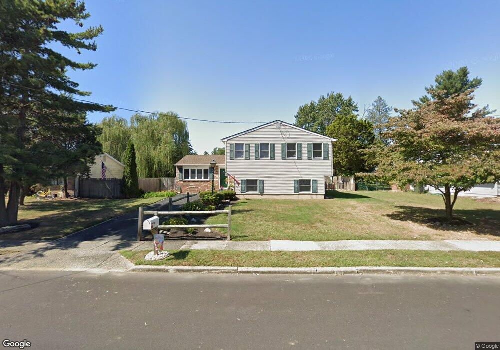
769 Lancing Rd West Deptford, NJ 08096
West Deptford Township NeighborhoodEstimated Value: $342,058 - $468,000
--
Bed
--
Bath
2,298
Sq Ft
$179/Sq Ft
Est. Value
About This Home
This home is located at 769 Lancing Rd, West Deptford, NJ 08096 and is currently estimated at $411,765, approximately $179 per square foot. 769 Lancing Rd is a home located in Gloucester County with nearby schools including Oakview Elementary School, Red Bank Elementary School, and Green-Fields Elementary School.
Ownership History
Date
Name
Owned For
Owner Type
Purchase Details
Closed on
Sep 26, 1997
Sold by
Davis Robert W and Davis Bella Jane
Bought by
Mcshane Charles J and Mcshane Donna Marie
Current Estimated Value
Home Financials for this Owner
Home Financials are based on the most recent Mortgage that was taken out on this home.
Original Mortgage
$72,100
Outstanding Balance
$11,543
Interest Rate
7.41%
Estimated Equity
$400,222
Create a Home Valuation Report for This Property
The Home Valuation Report is an in-depth analysis detailing your home's value as well as a comparison with similar homes in the area
Home Values in the Area
Average Home Value in this Area
Purchase History
| Date | Buyer | Sale Price | Title Company |
|---|---|---|---|
| Mcshane Charles J | $115,000 | Peoples Title Agency Inc |
Source: Public Records
Mortgage History
| Date | Status | Borrower | Loan Amount |
|---|---|---|---|
| Open | Mcshane Charles J | $72,100 |
Source: Public Records
Tax History Compared to Growth
Tax History
| Year | Tax Paid | Tax Assessment Tax Assessment Total Assessment is a certain percentage of the fair market value that is determined by local assessors to be the total taxable value of land and additions on the property. | Land | Improvement |
|---|---|---|---|---|
| 2025 | $7,396 | $211,800 | $54,100 | $157,700 |
| 2024 | $7,301 | $211,800 | $54,100 | $157,700 |
| 2023 | $7,301 | $211,800 | $54,100 | $157,700 |
| 2022 | $7,267 | $211,800 | $54,100 | $157,700 |
| 2021 | $7,241 | $211,800 | $54,100 | $157,700 |
| 2020 | $7,225 | $211,800 | $54,100 | $157,700 |
| 2019 | $7,023 | $211,800 | $54,100 | $157,700 |
| 2018 | $6,833 | $211,800 | $54,100 | $157,700 |
| 2017 | $6,674 | $211,800 | $54,100 | $157,700 |
| 2016 | $6,487 | $211,800 | $54,100 | $157,700 |
| 2015 | $6,268 | $214,800 | $57,100 | $157,700 |
| 2014 | $5,956 | $214,800 | $57,100 | $157,700 |
Source: Public Records
Map
Nearby Homes
- 2 Victorian Way
- 3 Victorian Way
- 7 Victorian Way
- 83 Lynn Dr
- 112 N Drexel St
- 46 Lynn Dr
- 302 W Red Bank Ave
- 815 Harker Ave
- 210 Lawnton Ave
- 21 S Columbia St
- 193 Dubois Ave
- 654 Frances Ave
- 1448 Victory Ave
- 1156 Hessian Ave
- 195 Delaware St
- 1009 Hessian Ave
- 266 Passaic Ave
- 1678 Miller Ave
- 1676 Miller Ave
- 34 S Jackson St
- 775 Lancing Rd
- 763 Lancing Rd
- 760 Sterling Rd
- 752 Sterling Rd
- 781 Lancing Rd
- 768 Sterling Rd
- 757 Lancing Rd
- 766 Lancing Rd
- 772 Lancing Rd
- 762 Lancing Rd
- 746 Sterling Rd
- 774 Sterling Rd
- 787 Lancing Rd
- 778 Lancing Rd
- 751 Lancing Rd
- 758 Lancing Rd
- 742 Sterling Rd
- 782 Lancing Rd
- 793 Lancing Rd
- 752 Lancing Rd