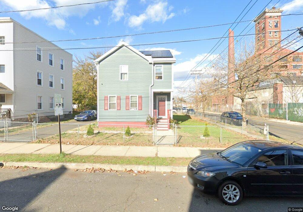
769 Maple St Bridgeport, CT 06608
East Side Bridgeport NeighborhoodEstimated Value: $276,000 - $331,000
4
Beds
2
Baths
1,396
Sq Ft
$216/Sq Ft
Est. Value
About This Home
This home is located at 769 Maple St, Bridgeport, CT 06608 and is currently estimated at $302,122, approximately $216 per square foot. 769 Maple St is a home located in Fairfield County with nearby schools including Waltersville School, Harding High School, and Achievement First Bridgeport Academy Elementary School.
Ownership History
Date
Name
Owned For
Owner Type
Purchase Details
Closed on
Nov 29, 2016
Sold by
Ayala Linda
Bought by
Habitat For Humanity
Current Estimated Value
Purchase Details
Closed on
Nov 17, 2000
Sold by
Habitat For Humanity
Bought by
Limi-Ayala Linda
Home Financials for this Owner
Home Financials are based on the most recent Mortgage that was taken out on this home.
Original Mortgage
$83,832
Interest Rate
7.78%
Create a Home Valuation Report for This Property
The Home Valuation Report is an in-depth analysis detailing your home's value as well as a comparison with similar homes in the area
Home Values in the Area
Average Home Value in this Area
Purchase History
| Date | Buyer | Sale Price | Title Company |
|---|---|---|---|
| Habitat For Humanity | -- | -- | |
| Habitat For Humanity | -- | -- | |
| Limi-Ayala Linda | $83,832 | -- | |
| Limi-Ayala Linda | $83,832 | -- |
Source: Public Records
Mortgage History
| Date | Status | Borrower | Loan Amount |
|---|---|---|---|
| Previous Owner | Limi-Ayala Linda | $83,832 |
Source: Public Records
Tax History
| Year | Tax Paid | Tax Assessment Tax Assessment Total Assessment is a certain percentage of the fair market value that is determined by local assessors to be the total taxable value of land and additions on the property. | Land | Improvement |
|---|---|---|---|---|
| 2025 | $3,346 | $77,000 | $42,200 | $34,800 |
| 2024 | $3,346 | $77,000 | $42,200 | $34,800 |
| 2023 | $3,346 | $77,000 | $42,200 | $34,800 |
| 2022 | $3,346 | $77,000 | $42,200 | $34,800 |
| 2021 | $3,346 | $77,000 | $42,200 | $34,800 |
| 2020 | $4,955 | $91,770 | $19,980 | $71,790 |
| 2019 | $4,955 | $91,770 | $19,980 | $71,790 |
| 2018 | $4,990 | $91,770 | $19,980 | $71,790 |
| 2017 | $4,990 | $91,770 | $19,980 | $71,790 |
| 2016 | $4,990 | $91,770 | $19,980 | $71,790 |
| 2015 | $2,476 | $58,680 | $38,680 | $20,000 |
| 2014 | $2,476 | $58,680 | $38,680 | $20,000 |
Source: Public Records
Map
Nearby Homes
- 746 Maple St
- 277 Helen St
- 695 Shelton St
- 1220 Pembroke St
- 1248 Pembroke St
- 1943 Seaview Ave
- 236 Brooks St
- 751 E Main St
- 691 E Main St
- 1365 E Main St
- 274 Park St
- 60 Gilmore St Unit 21
- 619 Brooks St Unit 621
- 188 Holly St
- 369 Park St
- 502 Berkshire Ave
- 252 Shelton St
- 40 Jane St
- 39 Jane St
- 509 Pembroke St
- 767 Maple St
- 767 Maple St Unit 1
- 767 Maple St Unit 2
- 767 Maple St Unit 3
- 761 Maple St Unit 763
- 107 Helen St
- 145 Helen St
- 105 Helen St
- 157 Helen St Unit 159
- 157 Helen St Unit 2
- 147 Helen St Unit 149
- 147 Helen St Unit 3
- 147 Helen St Unit 2
- 103 Helen St
- 770 Maple St
- 768 Maple St
- 97 Helen St
- 758 Maple St
- 95 Helen St
- 756 Maple St
Your Personal Tour Guide
Ask me questions while you tour the home.