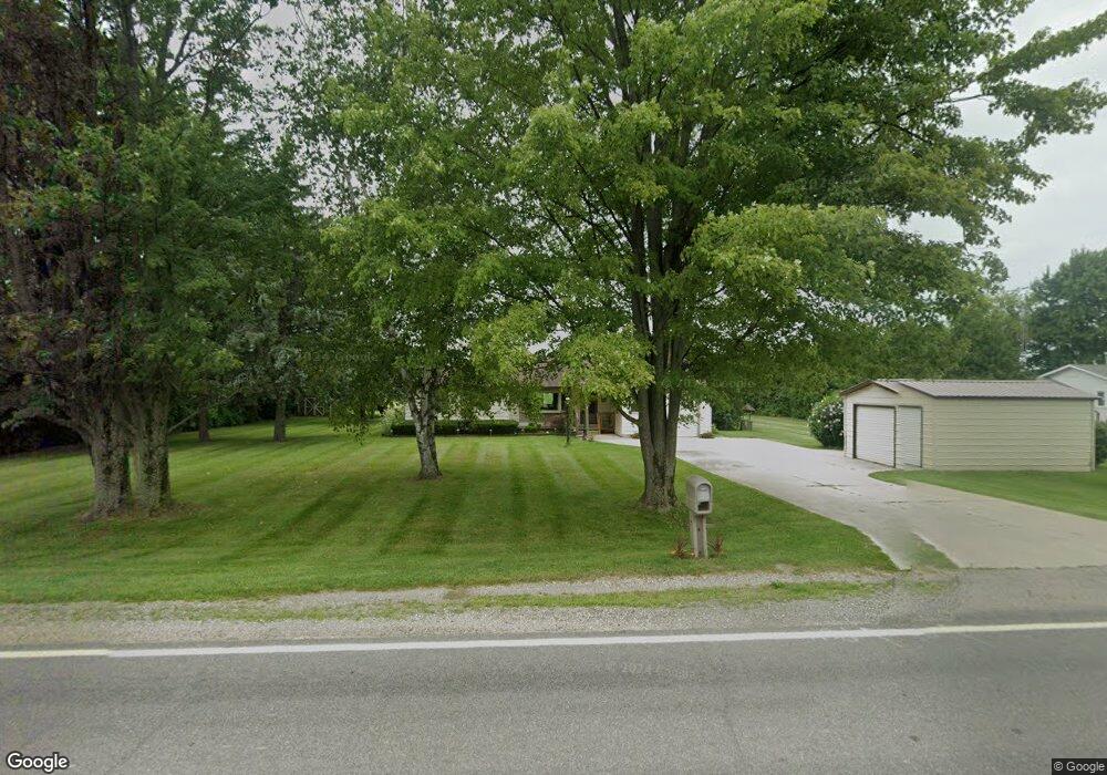
769 N Sandusky Rd Sandusky, MI 48471
Estimated Value: $146,236 - $282,000
--
Bed
--
Bath
--
Sq Ft
0.84
Acres
About This Home
This home is located at 769 N Sandusky Rd, Sandusky, MI 48471 and is currently estimated at $208,809. 769 N Sandusky Rd is a home with nearby schools including Sandusky Elementary School, Sandusky Junior/Senior High School, and Sandusky Christian School.
Ownership History
Date
Name
Owned For
Owner Type
Purchase Details
Closed on
Aug 24, 2023
Sold by
Cole Anne M
Bought by
Cole Anne M
Current Estimated Value
Purchase Details
Closed on
Dec 23, 2020
Sold by
Ford Lisa
Bought by
Cole Anne M
Home Financials for this Owner
Home Financials are based on the most recent Mortgage that was taken out on this home.
Original Mortgage
$141,195
Interest Rate
2.8%
Mortgage Type
New Conventional
Purchase Details
Closed on
Jun 12, 2006
Sold by
Lamm Paul A and Jennings Jessica
Bought by
Mcnew Doris M
Purchase Details
Closed on
May 22, 2003
Sold by
Ross Norman and Ross Margaret
Bought by
Lamm Paul
Create a Home Valuation Report for This Property
The Home Valuation Report is an in-depth analysis detailing your home's value as well as a comparison with similar homes in the area
Home Values in the Area
Average Home Value in this Area
Purchase History
| Date | Buyer | Sale Price | Title Company |
|---|---|---|---|
| Cole Anne M | -- | None Listed On Document | |
| Cole Anne M | $137,790 | -- | |
| Mcnew Doris M | $128,000 | -- | |
| Lamm Paul | $110,000 | -- |
Source: Public Records
Mortgage History
| Date | Status | Borrower | Loan Amount |
|---|---|---|---|
| Previous Owner | Cole Anne M | $141,195 |
Source: Public Records
Tax History Compared to Growth
Tax History
| Year | Tax Paid | Tax Assessment Tax Assessment Total Assessment is a certain percentage of the fair market value that is determined by local assessors to be the total taxable value of land and additions on the property. | Land | Improvement |
|---|---|---|---|---|
| 2025 | $1,517 | $68,900 | $0 | $0 |
| 2024 | $593 | $73,000 | $0 | $0 |
| 2023 | $565 | $58,000 | $0 | $0 |
| 2022 | $1,231 | $47,900 | $0 | $0 |
| 2021 | $1,185 | $45,300 | $0 | $0 |
| 2020 | $1,076 | $41,400 | $0 | $0 |
| 2019 | $406 | $40,500 | $0 | $0 |
| 2018 | $1,033 | $44,800 | $0 | $0 |
| 2017 | $388 | $43,600 | $0 | $0 |
| 2016 | $385 | $38,700 | $0 | $0 |
| 2015 | -- | $37,800 | $0 | $0 |
| 2014 | -- | $41,100 | $0 | $0 |
Source: Public Records
Map
Nearby Homes
- 627 N Sandusky Rd
- 186 N Flynn St
- 180 W Marion St
- 580 Sanilac Rd
- 600 Sanilac Rd
- 620 Sanilac Rd
- 134 N Gates Rd
- 50 Austin St
- 126 S Jackson St
- 155 Worth St
- 206 Jefferson St
- 00 Bridgehampton Rd
- 144 Truman St
- 1421 Berkshire Rd
- 0000 Freiburger Rd
- 2255 Sanilac Rd
- 775 N Church Rd
- 00 Isles Rd
- 1195 French Line Rd
- 2950 Hyde Rd
- 779 N Sandusky Rd
- 809 N Sandusky Rd
- 770 N Sandusky Rd
- 35 W Custer Rd
- 565 N Sandusky Rd
- 59 W Custer Rd
- 75 W Custer Rd
- 66 E Custer Rd
- 00 W Custer Rd
- 85 W Custer Rd
- 95 W Custer Rd
- 125 W Custer Rd
- 1011 N Sandusky Rd
- 62 W Custer Rd
- 90 W Custer Rd
- 180 E Custer Rd
- 47 W Eddy Rd
- 495 N Sandusky Rd
- 490 N Sandusky Rd
- 1055 N Sandusky Rd